
Whistler-Blackcomb: A Huge Ski Resort
Here are some things I did at Whistler that I’d never done before:
- Skied a glacier. Unless I did that in Switzerland and just couldn’t see it well enough to recognize that it happened.
- Rode a T-bar.
- Hiked up a hill to get to a put-in spot.
- Skied in Canada.
All these posts are magnum opuses until I start typing.
Skied there January 9th and 10th. The majority of people with whom I rode up chairs were Australian. It was unsettling. The first time in my life I ever encountered Australians was on a ferry between Brindisi, Italy and somewhere in Greece back in 1990. Around 2 o’clock in the morning, having loudly chatted up every college girl on the ferry (the Australians were a bunch of guys), they drunkenly ascended the ferry’s mast until the boat’s crew started yelling at them, possibly threatening to shoot them if they didn’t come down. That remains my enduring image of Australians. Apologies to the decent Australians of whom there are likely several.
What else?
Blackcomb was way better than Whistler. At Blackcomb it was pretty easy to scout out where you were going before you went there, whereas at Whistler I never seemed able to get to the runs I wanted. Despite this, every lift dropped me off at the same dumb place. Except for the one lift that went up to the peak. Plus Whistler had more wind, seemed more crowded, and had a huge lineup for getting onto the gondola.
Magnum opus.
The first day I was there I skied Blackcomb. They didn’t open the Alpine areas until about an hour after the lower lifts started turning. Then I had one interesting run on the Glacier chair, replete with about six inches of new snow and a bunch of exposed boulders. After that, I went back up and then rode the T-bar up to the glacier, except that it doesn’t actually take you to the glacier, you still have to hike some to get to the glacier despite the fact that the glacier is in-bounds and somewhat popular.
Fortunately, walking through Grindelwald in Switzerland had taught me that it’s possible to walk up to a mile in ski boots without dying. Without dying immediately, I mean. Now having walked a mile in ski boots, I will eventually and certainly, though perhaps not imminently, die. It’s the imminence that’s salient here as well as the non-causal nature of the correlation.
I’ve also learned that wherever I ski this year, the conditions will be imperfect. At WB, the snow was pretty good, the coverage was not great, and the visibility was fine for the first hour on Thursday and parts of the afternoon at Blackcomb on Friday, but otherwise pretty bad. Skiing down Blackcomb Glacier, for instance, was probably an amazing experience, I just couldn’t see it to know for sure. I think this, though, has been stated by all people who have ever skied at WB: the terrain is awesome, the snow is pretty good, and the weather is kind of terrible. It wasn’t rainy-terrible, just flat light-terrible. Rainy-terrible might have been better.
Also, the place is huge, so while there may have been locations that were not flat light-terrible, learning of them was problematic and, even had I learned of them, they may have taken an hour and a half to reach. Asking the Australians on the lifts whether they knew of any such locations was unproductive.
Super-tall ski hill, though. The resort claims 5,280 feet from lodge to peak, which is kind of crazy. The cool thing is that this means there’s potential for some long runs. One downside is that it takes a real long time to get from the lodge to the peak — at Blackcomb, this required taking the one gondola (which is at the parking lot that’s above the lodge, actually, so this is sort of cheating) up to the Excelsior lift, taking the Excelsior lift up to the Glacier lift, taking the Glacier lift up to the T-bar, then taking the T-bar up to the place where you have to hike to get to the top of the glacier.
You have to hold on tightly, it turns out, and things get steep at the end. On the T-Bar, I mean. What a weird conveyance: I can see why they’re not allowed south of the border. God bless America!
Also, the way Australians pronounce “glacier” is wholly unacceptable. And the arrogance with which they do it!
Even the beginner chairs here are long, though. The Wizard chair at the true base of Blackcomb rises like 2,400 feet — basically two Blue Knobs high. Seven Springs only claims 900′ elevation (and I kind of think they’re stretching the truth a lot to get there).
WB has the friendliest, most helpful ski resort employees I’ve ever encountered. On the one hand, for the C$109 a day it costs to ski there, they ought to. On the other: well, yeah, but they actually are that good. A lot of them were also Australian, but apparently culled from the more polite part of the country.
The second day there I started at Whistler, but I eventually got tired of its confusingness and bad visibility (though the conversation with the lift stranger who sold his entertainment software company to Disney was the best I had at the resort). I went to the bottom for lunch and got cheap by-the-slice pizza in the village. Apparently food in the village can be considerably cheaper than on the slopes. Then I went back to Blackcomb since it was better.
Here, then, are a bunch of photos from the two days:
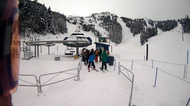
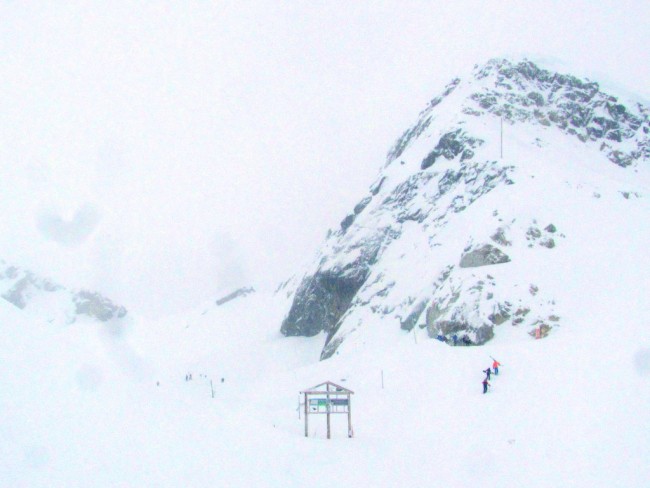
Lineup for the Glacier Lift at Blackcomb.
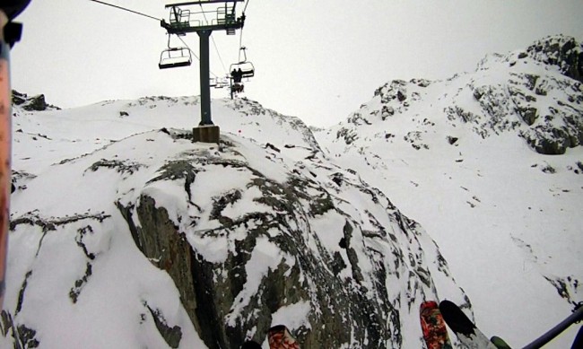
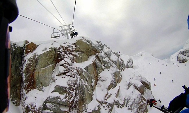
Lift view of THE ALPINE.
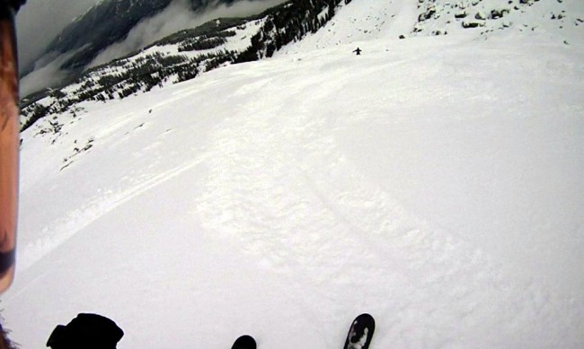
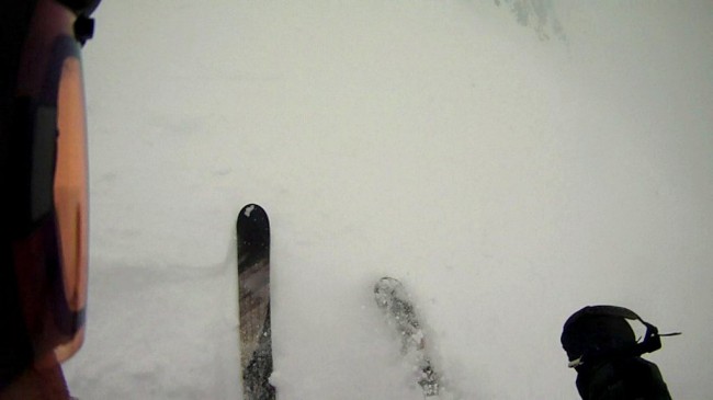
Some fresh snow, with rocks.
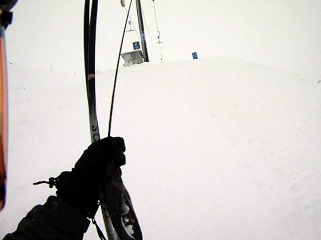
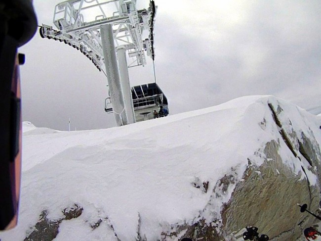
Nearing the end of my historic T-bar ride.
Hiking from the T-Bar to the glacier.
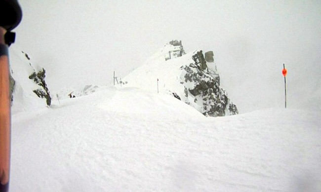
View of some rock from the cat track above Blackcomb Glacier.
Apparently the snow on top of the glacier looked like this.
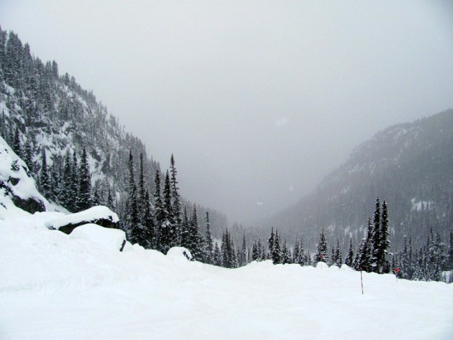
Exiting Blackcomb Glacier
I couldn’t see during the whole Blackcomb Glacier situation, but it was still pretty cool. At the end, you hit the tree line and things flatten out. You can expect to have to pole your way through the last bit. Still, pretty cool.
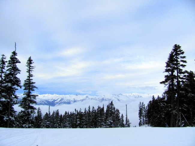
Somewhere at Whistler, a horizon.
Heading up the Peak Express lift at Whistler.
Just that seems like the chair might not clear the rock here is all.
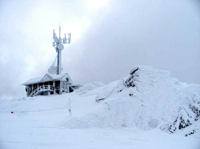
The top of Whistler Peak looks like this.
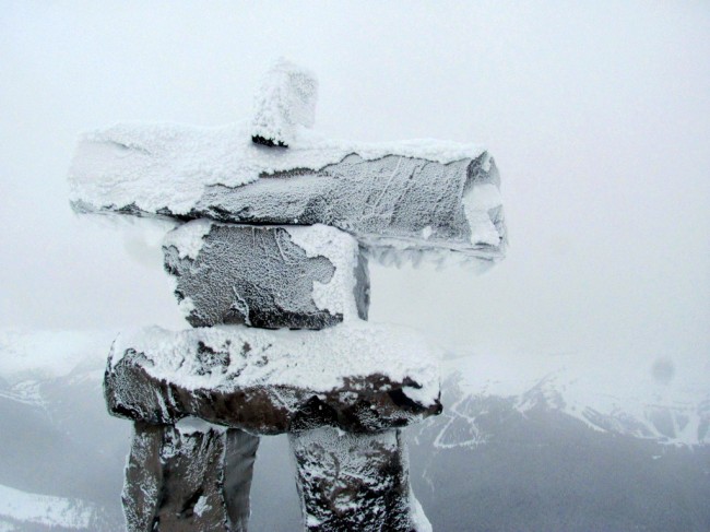
The this thing at the top of 7th Heaven Express.
Sometimes I wonder at the wisdom of visiting different ski resorts every time I go skiing. I mean, probably part of the reason the Whistler side seemed bad was that I’d spent the entire previous day getting to know Blackcomb and it seemed unfair to again have no idea where I was or where I was supposed to go. I’m looking forward to skiing the same ski hill twice some time this year. I’m not sure when, but it should probably happen.
Also: the drive up there was sort of interesting. I stayed at a cheap hotel in Squamish, which is about half-way between Vancouver and Whistler (about 50 minutes from each). The road from Vancouver to Squamish is very twisty, is always either going up or down, and seems frequently beset with fog and hard rain. It was dark the first time I drove the road and, having already been driving for four hours from Tacoma by the time I got there, the twists, hills, and fog made it an irritating drive. The way back was in the light, though, and it’s an amazingly pretty stretch. Shannon Falls coming down right next to the highway is stunning. No photos though. Sorry. Was trying to get down to Vancouver before rush hour got bad. Just meaning to indicate that it’s worth trying to avoid driving that highway at night.
So — yeah. BTW, Whistler was my first stop using my Mountain Collective ski pass. The pass cost $379 and gets me two days skiing at each of WB, Mammoth, Squaw Valley/Alpine Meadows, Alta/Snowbird, Jackson Hole, and Aspen. IOW, regular blog readers may have to endure further such reports. Or just not read them I guess. You’ll survive either way — for a time.
bkd


")


")


