Tag : mountains

post image

Three Nights in the Beartooths: Sort of Near Martin Lake Eventually

I don’t even know how to refer to this one. It happened in August though.

The Beartooths (in Montana) are good. My friend Dave texted me a few months ago and told me this was the year for him to go there with me. So we sort of planned a trip on the Beaten Path trail over the top of them, then we eventually punted on that one and decided to do an in-and-out to the Martin Lake Basin, and then, because of reasons, we didn’t make it that far the first day and ended up camping somewhere with no apparent name (we eventually named the nearby lake after my dog) and then did a day-hike in to Lake Martin later, except we didn’t actually go to Lake Martin, but instead just pulled up at Wright Lake, which is right next to Lake Martin.

It’s still pretty there. One day, I’ll do that Beaten Path hike. One day.

Here are a bunch of photos.

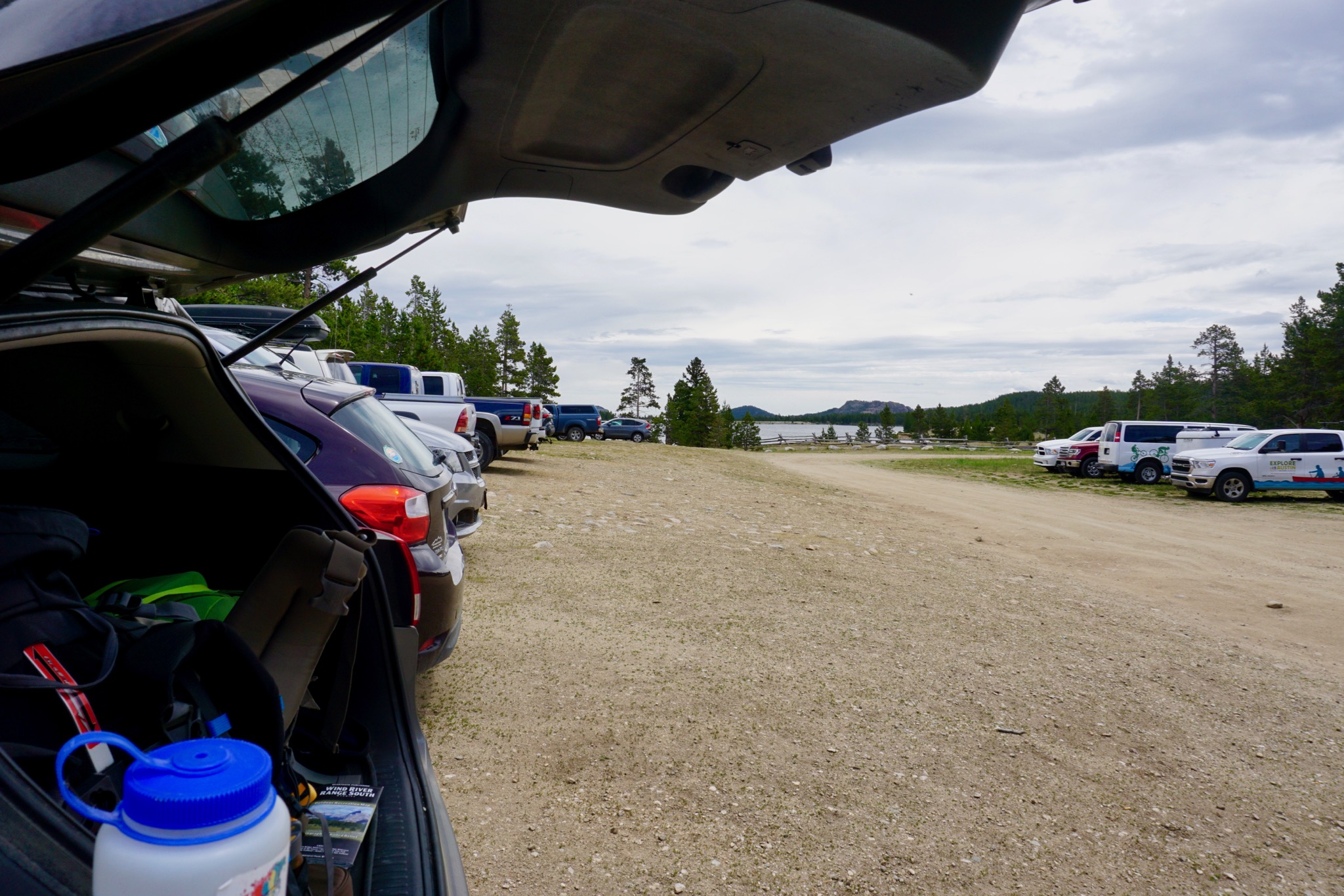
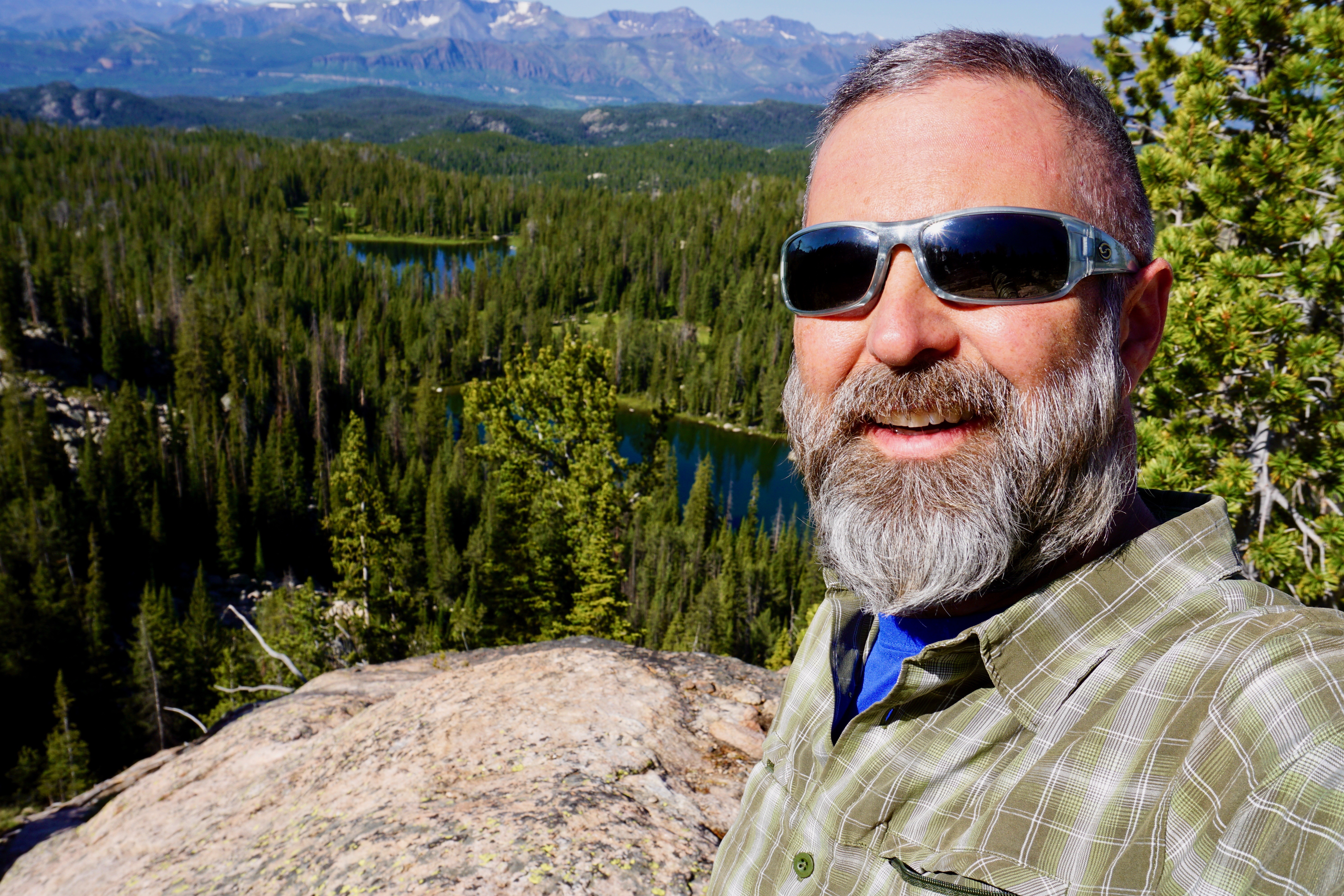
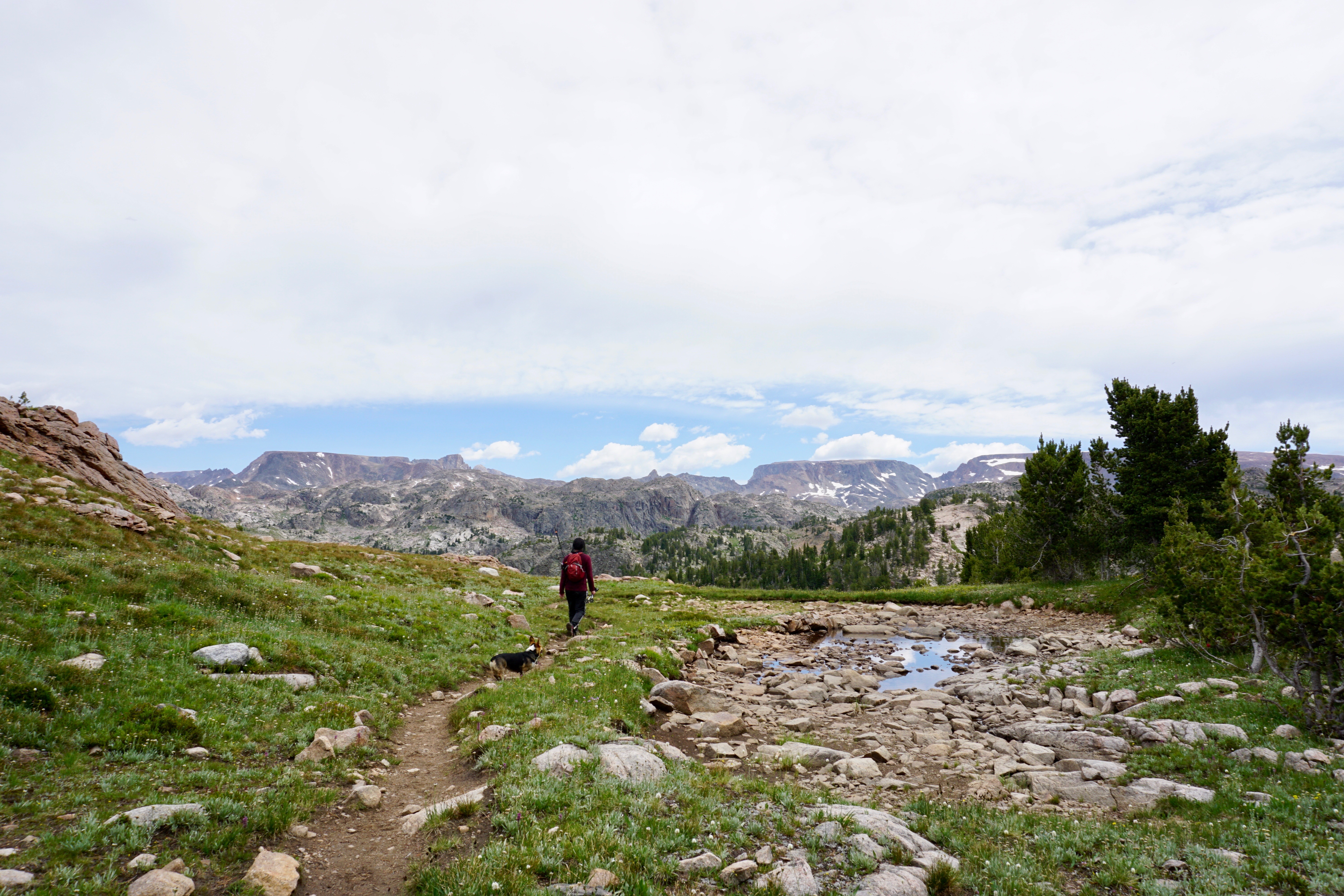
Me at the trailhead with my shirt straining against various straps:

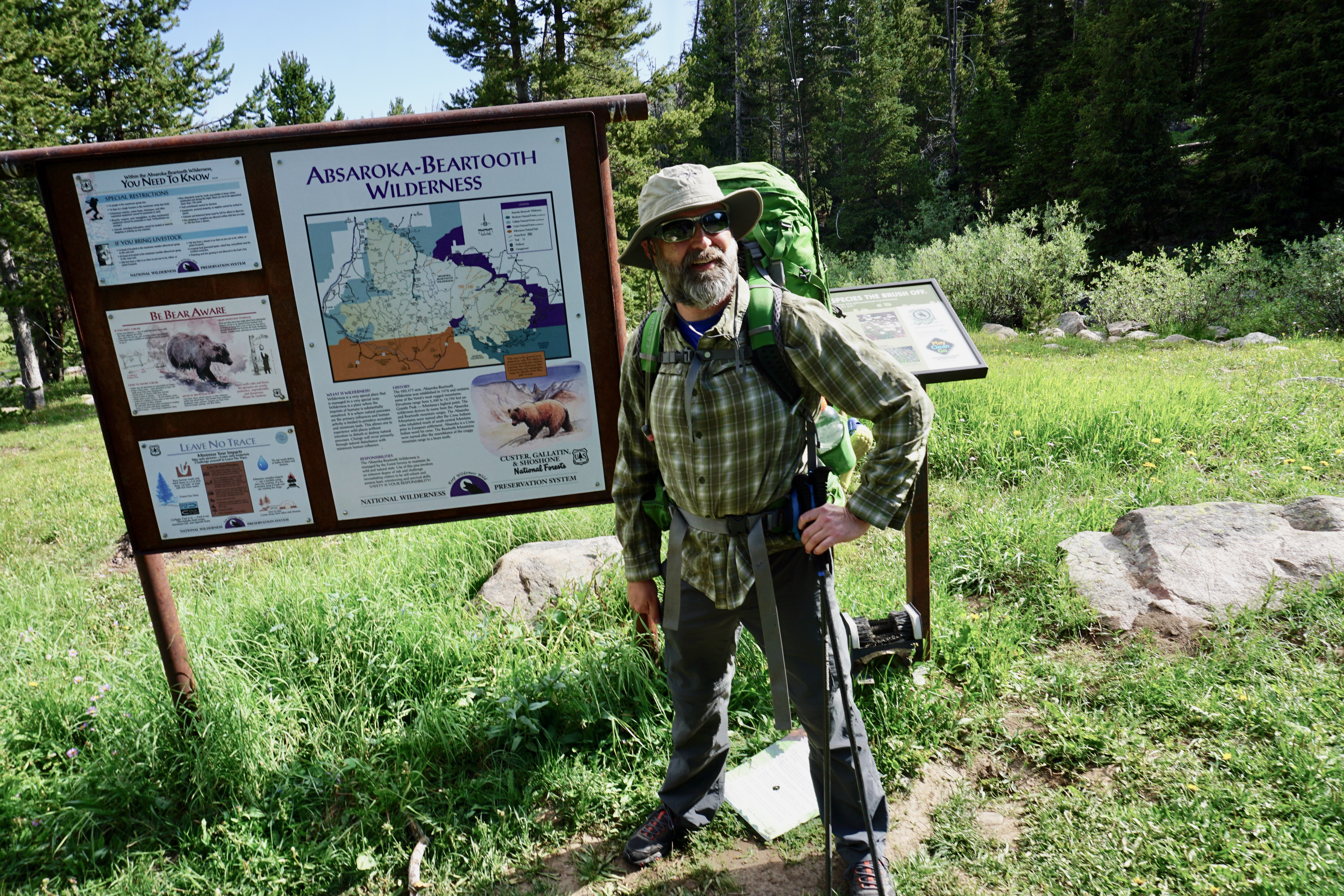
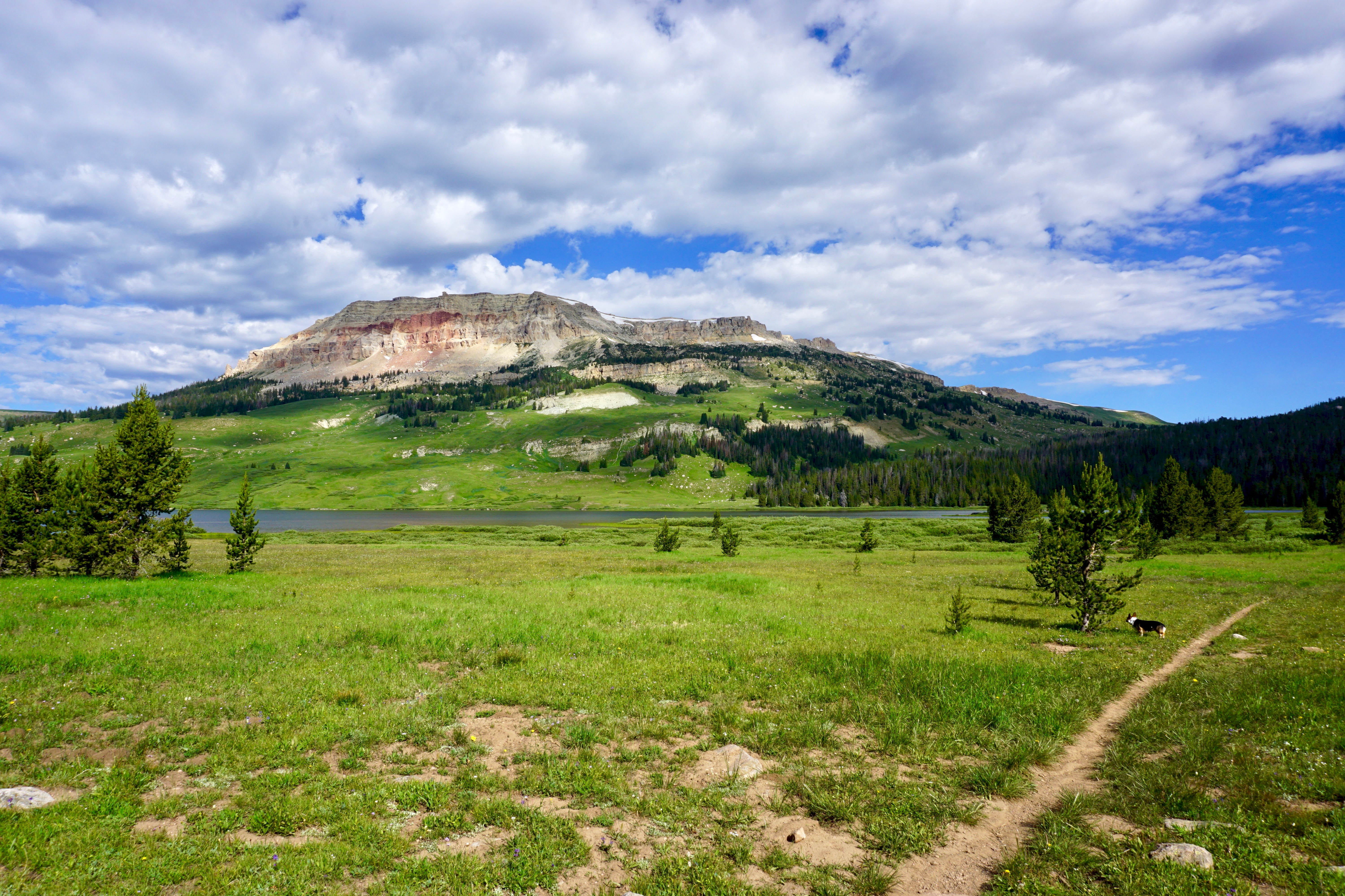
On this hike, we started at the Beartooth Lake trailhead.

OTOH, this is Clay Butte, the butte after which the trailhead we meant to start at but didn’t because the road was closed was named after:

Clay Butte from Beartooth Lake

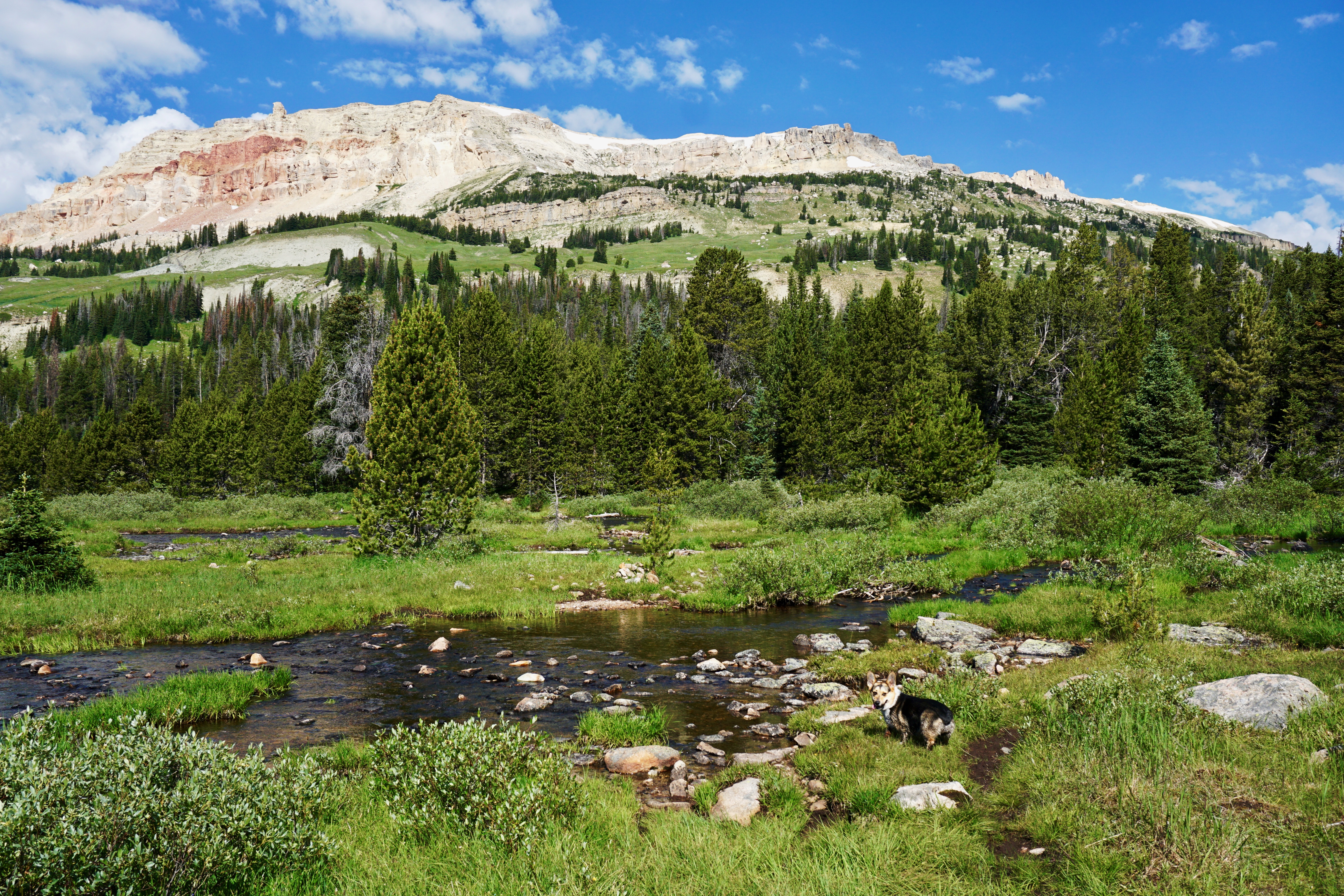
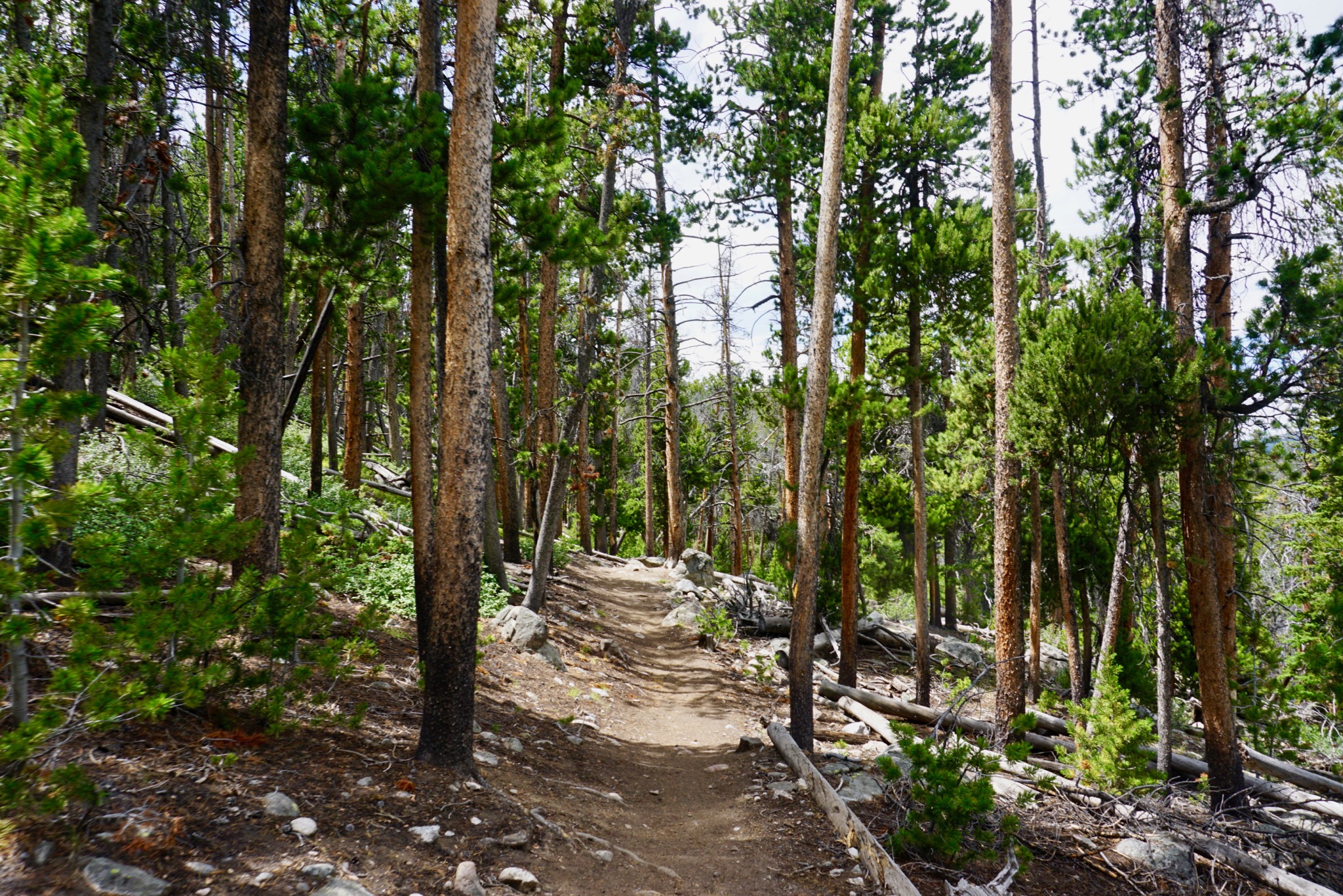
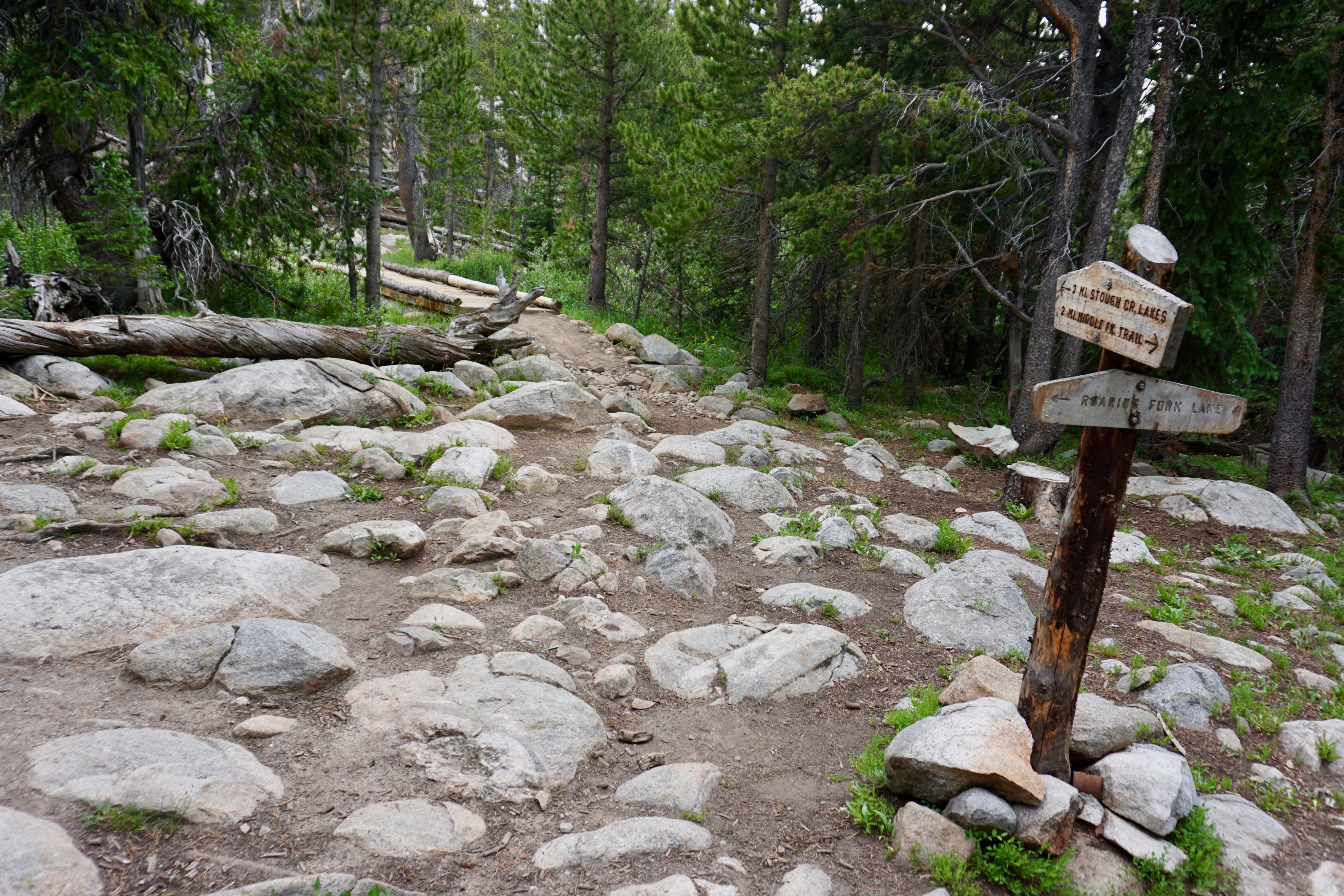
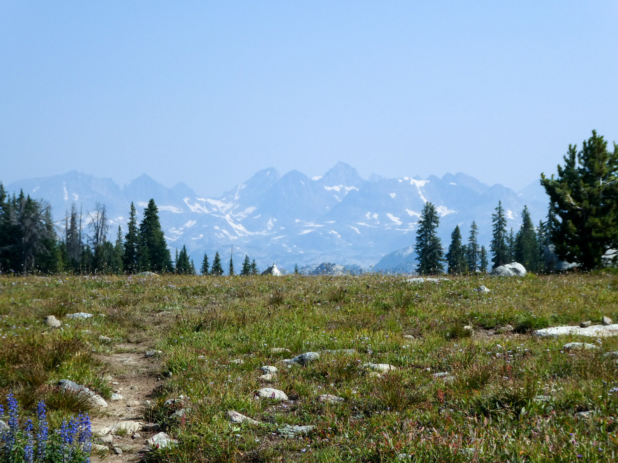
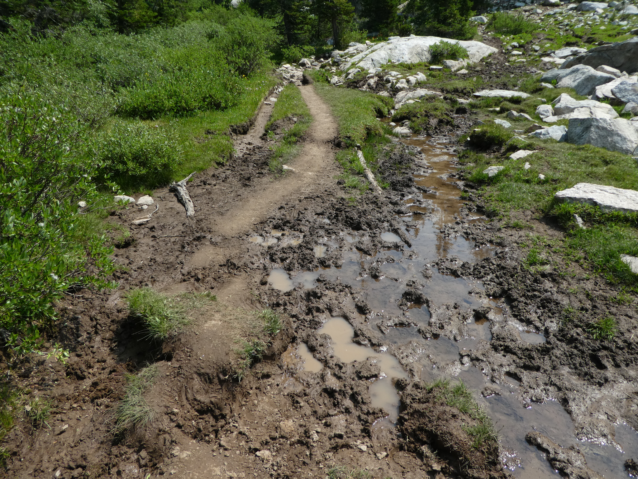
There was some consternation as to what trail was the one we wanted to go on once we reached all these creeks — mostly due to the fact that I didn’t want to look at the map. There are so many trails of use in the Beartooths, though, it’s easy to be deceived by what appears to obviously be The Main Trail, but which is not actually the trail you want to be on.

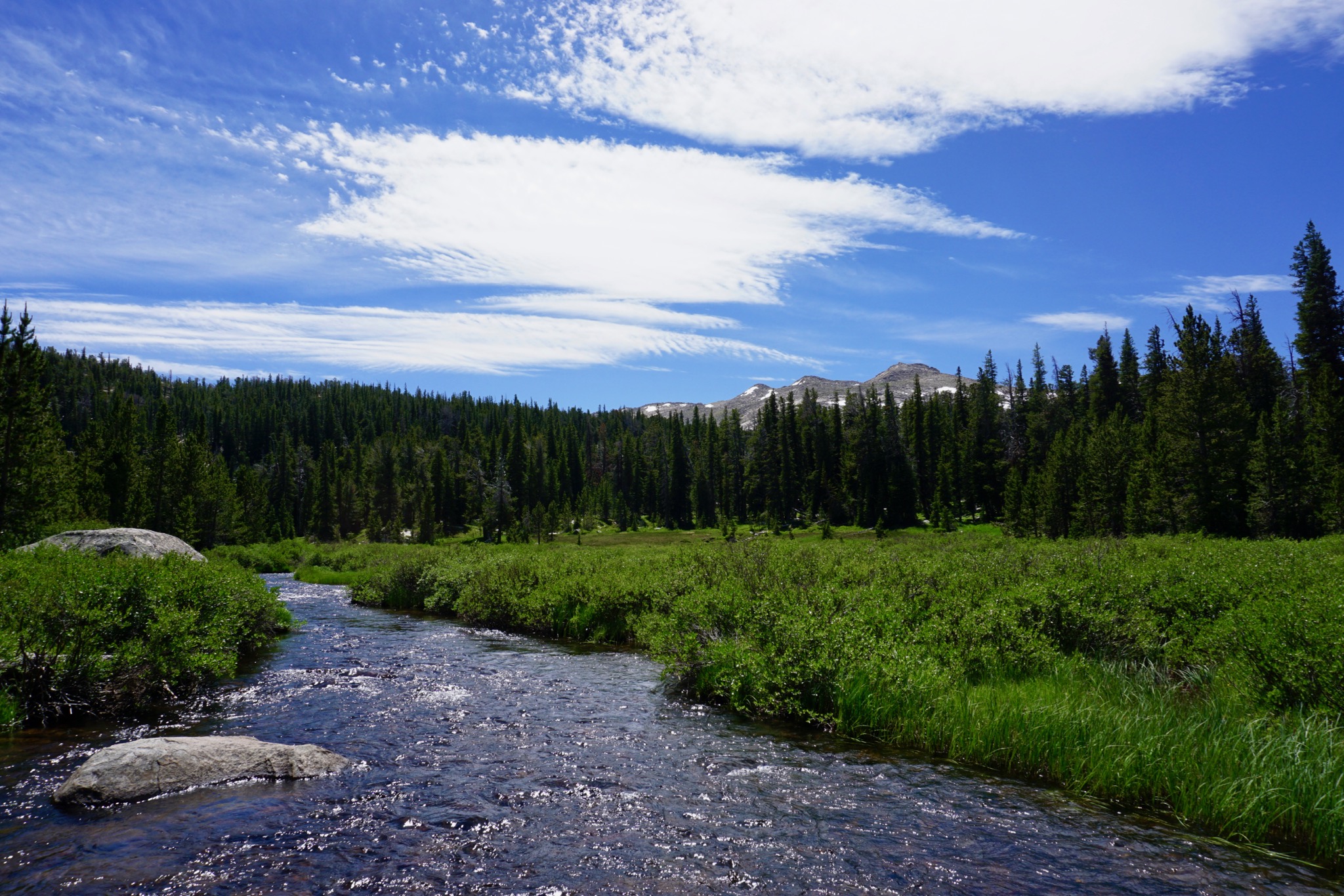
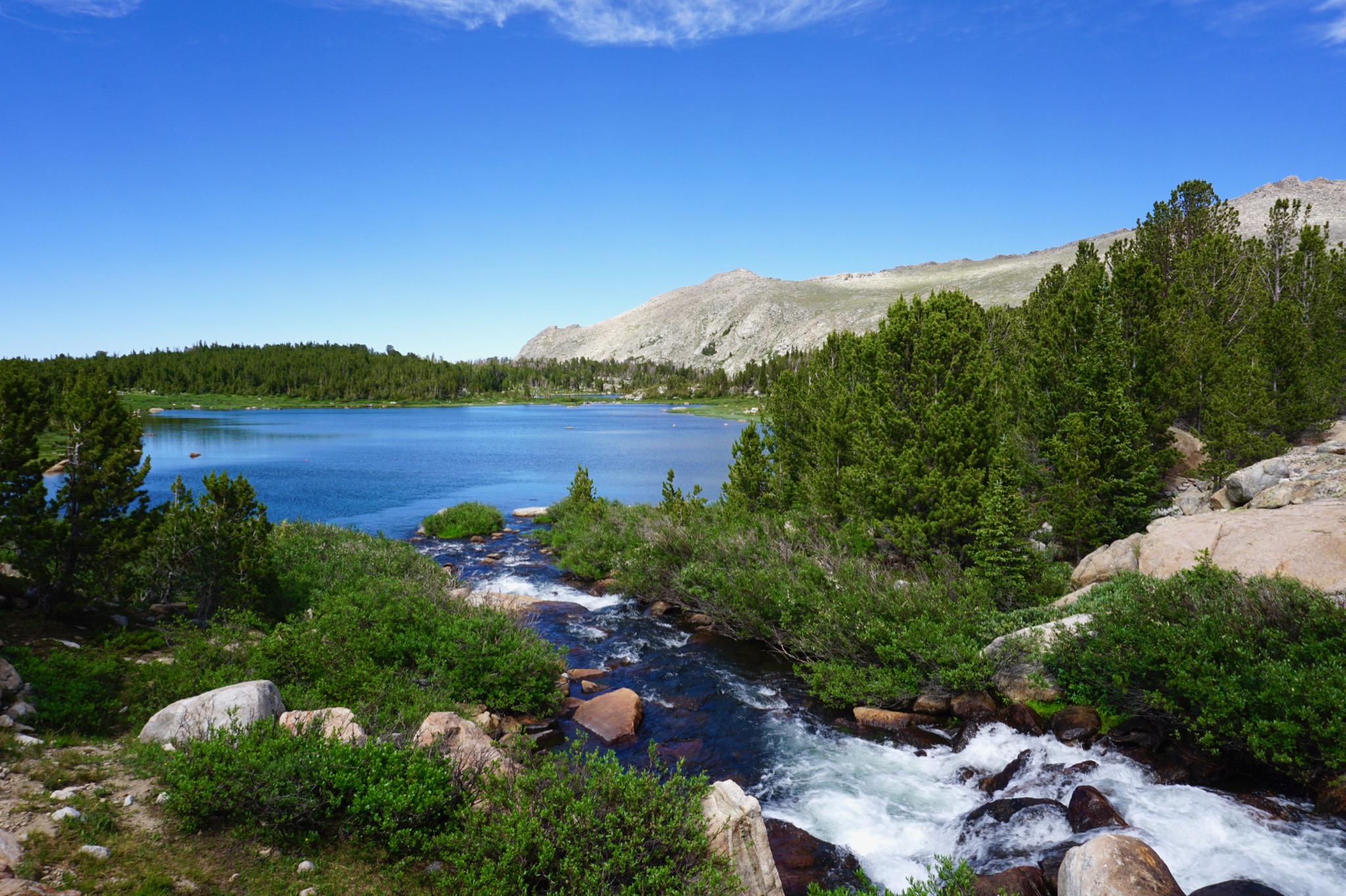
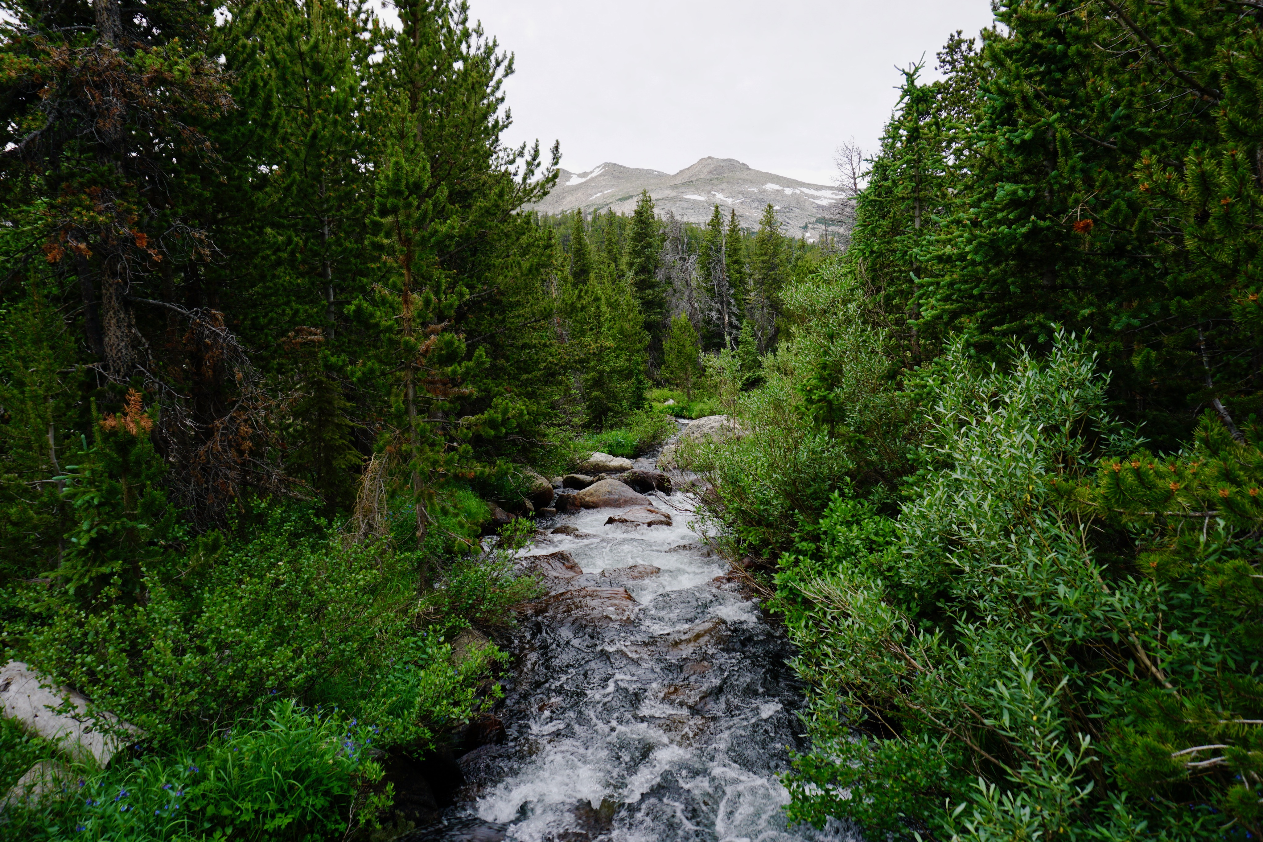
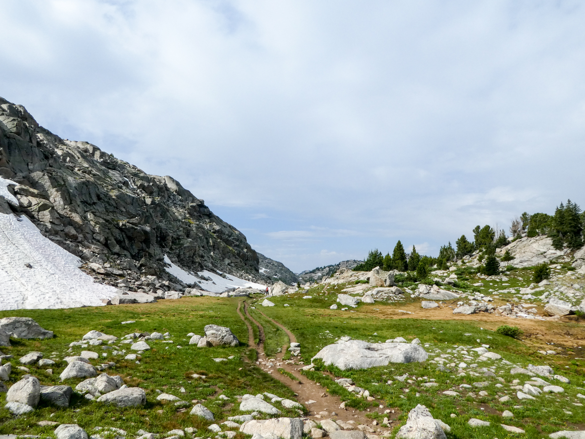
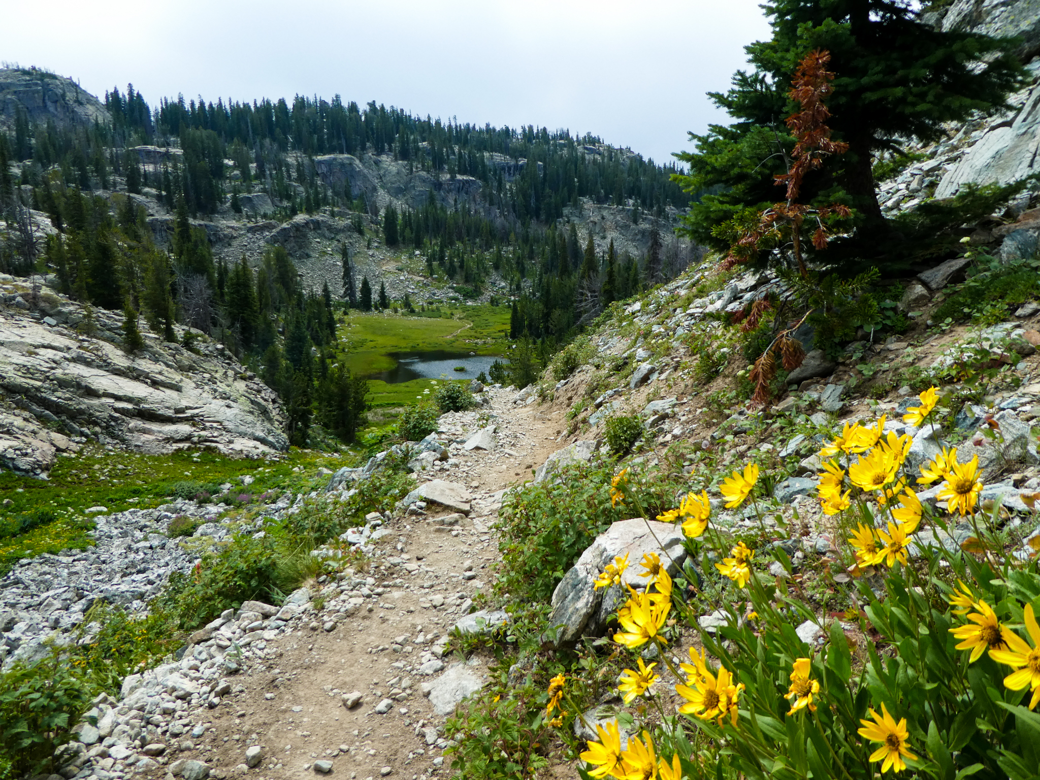
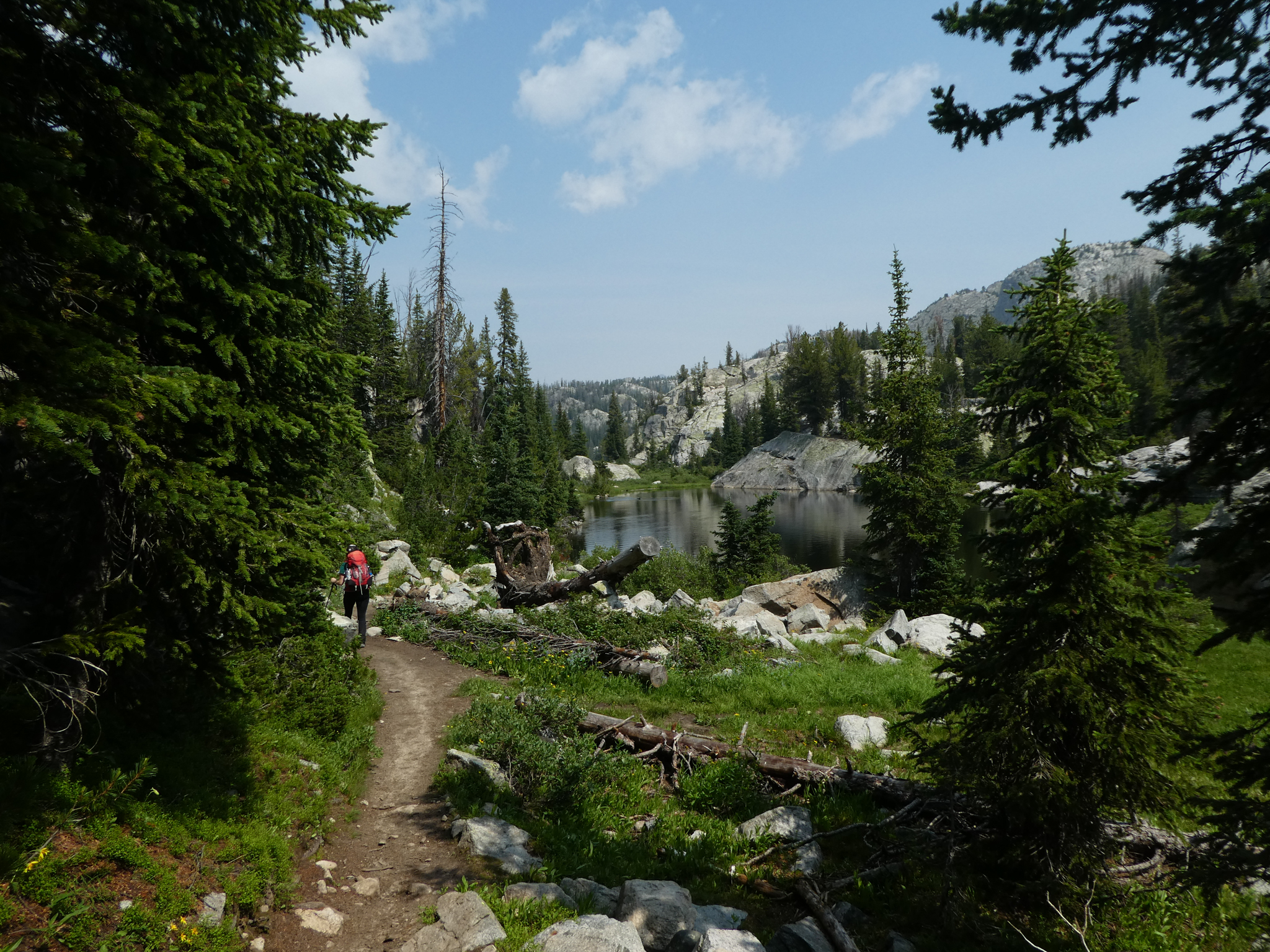
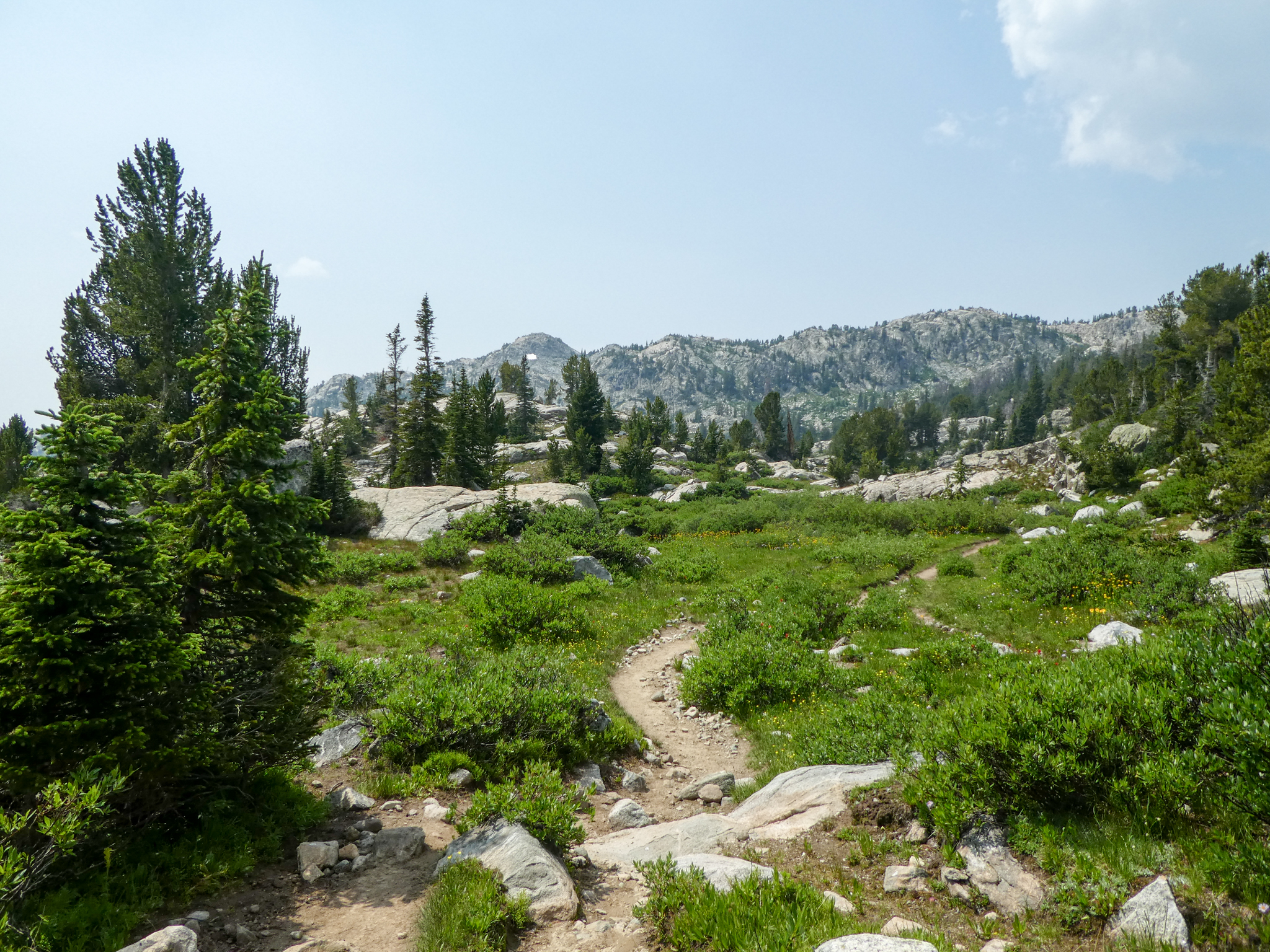
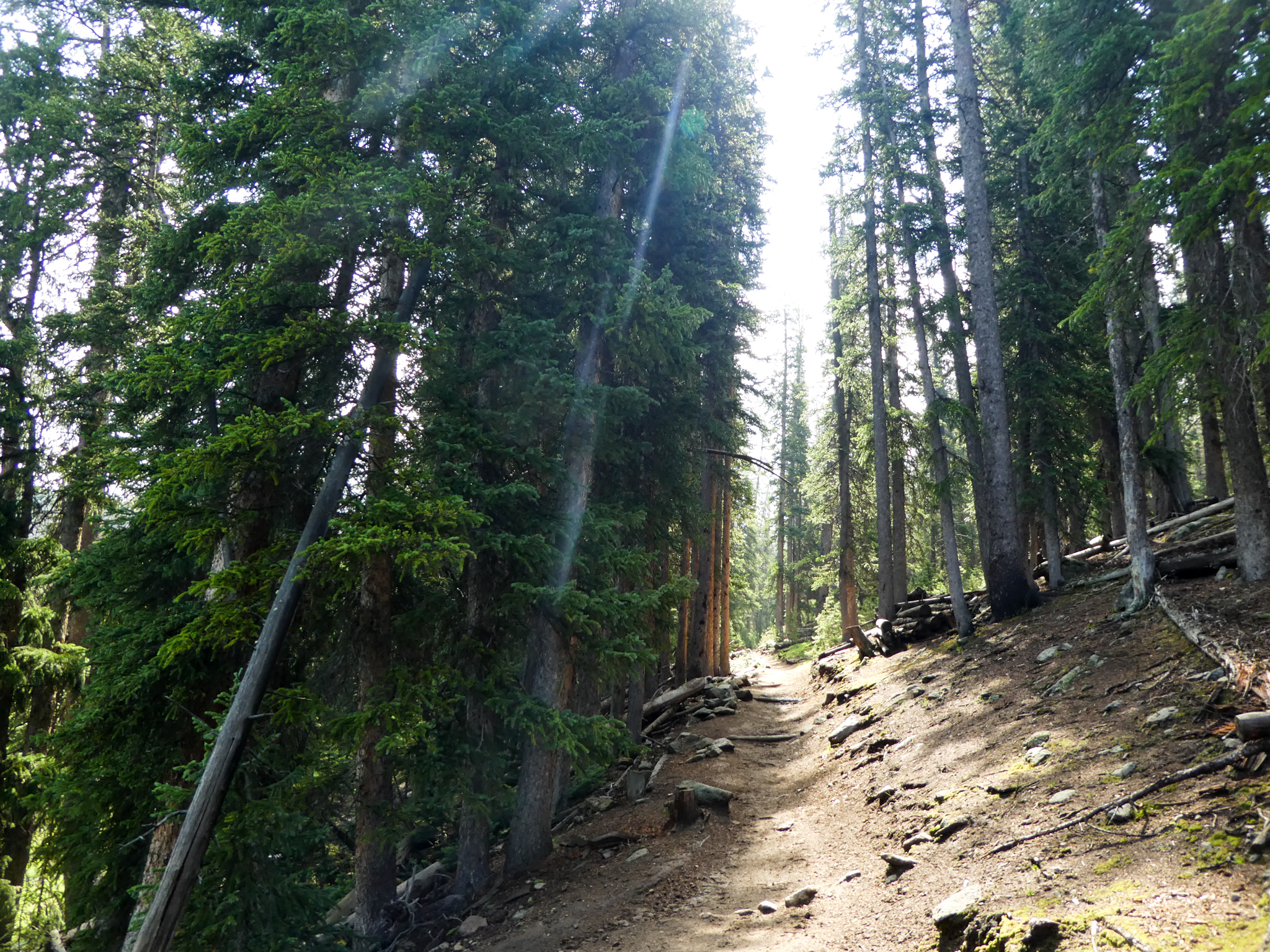
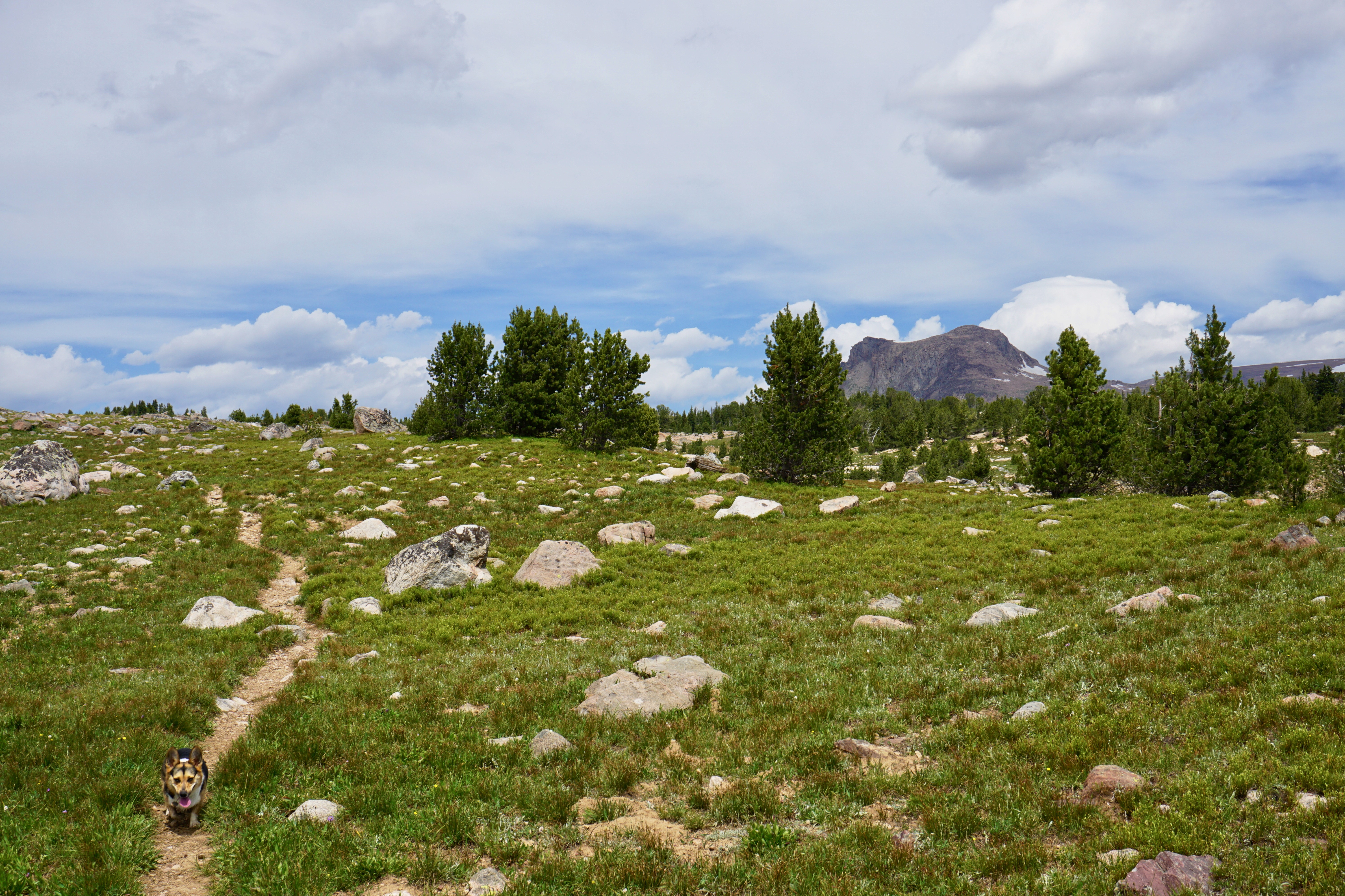
Anyway, the trail we wanted to be on looked like this:

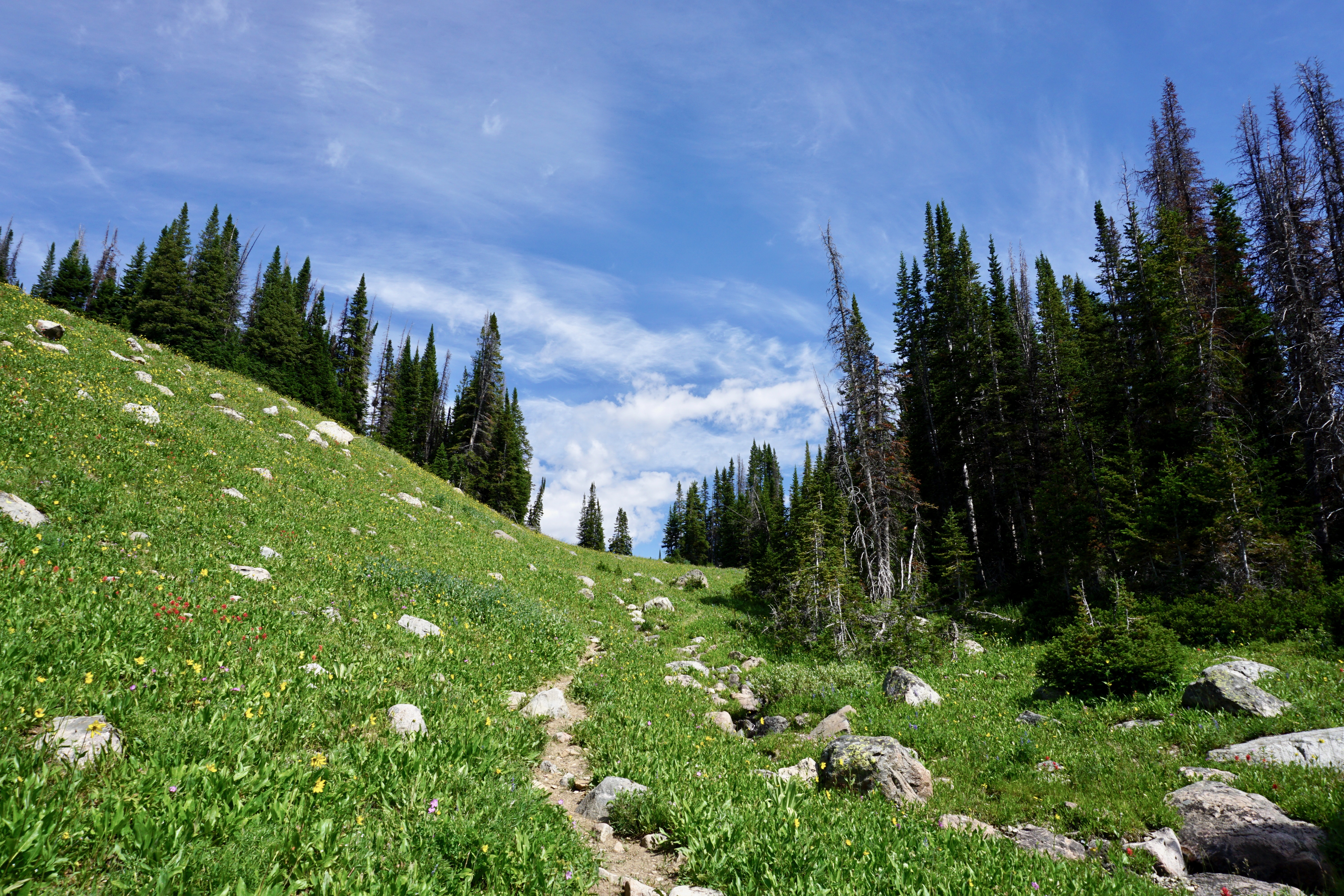
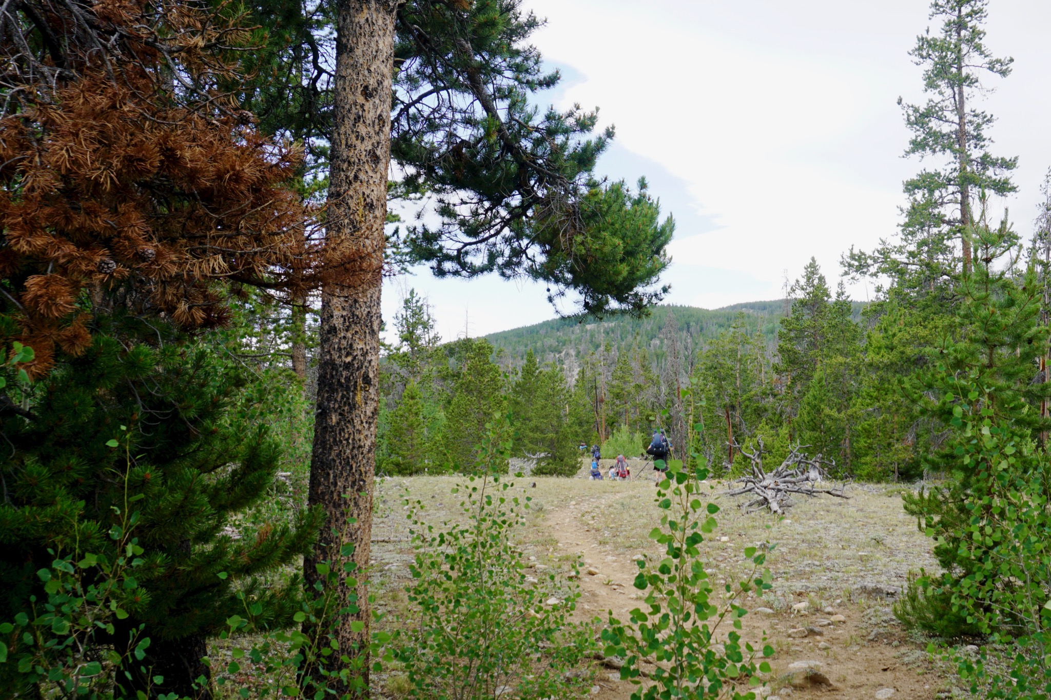
It was pretty much uphill for the first three miles. We met a couple of backpackers on their way out, who noted that all the trails were pretty clearly marked except for a “human-made trail” near Native Lake.

Turns out the human-made trail issue was more a problem on the way back than on the way in.

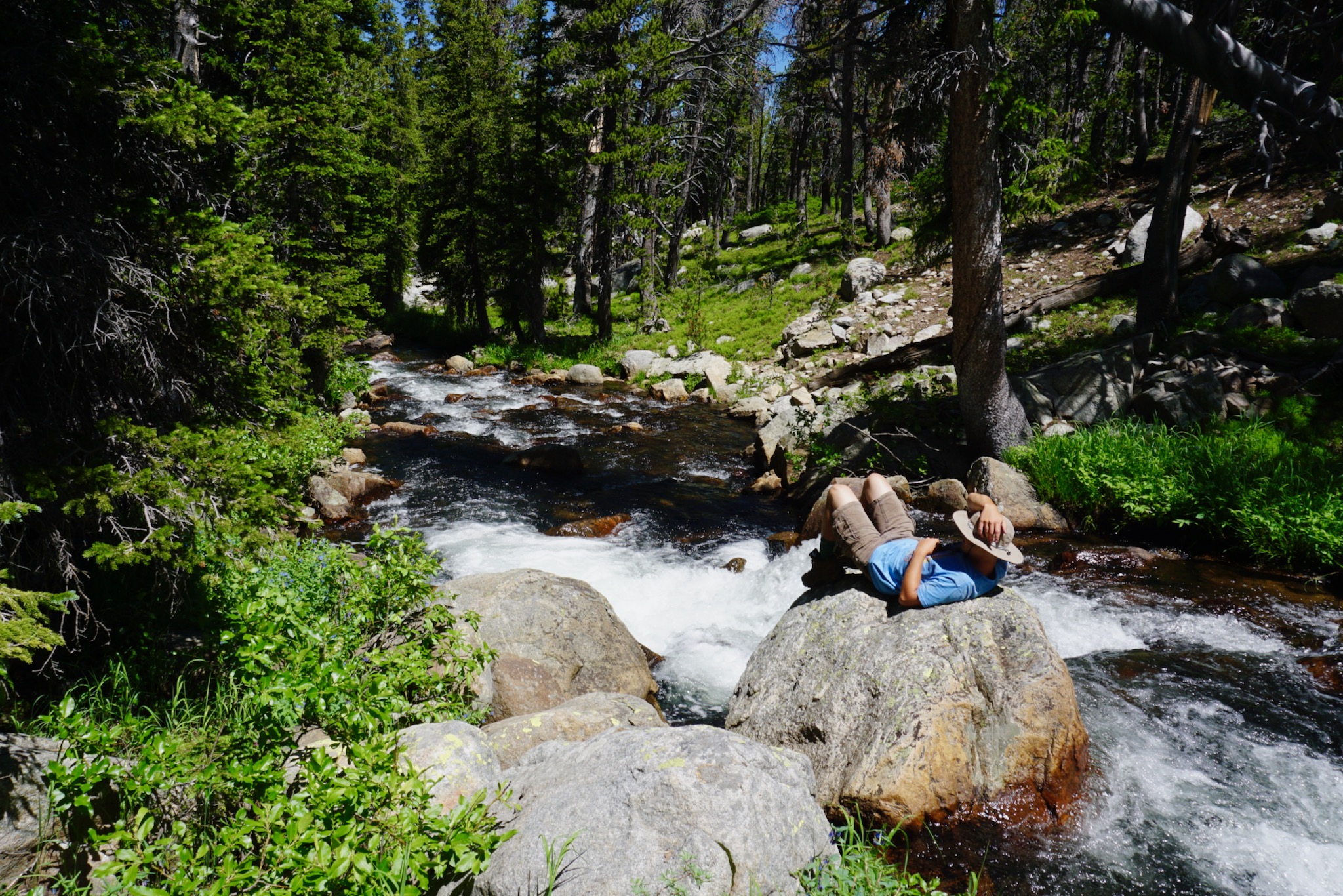
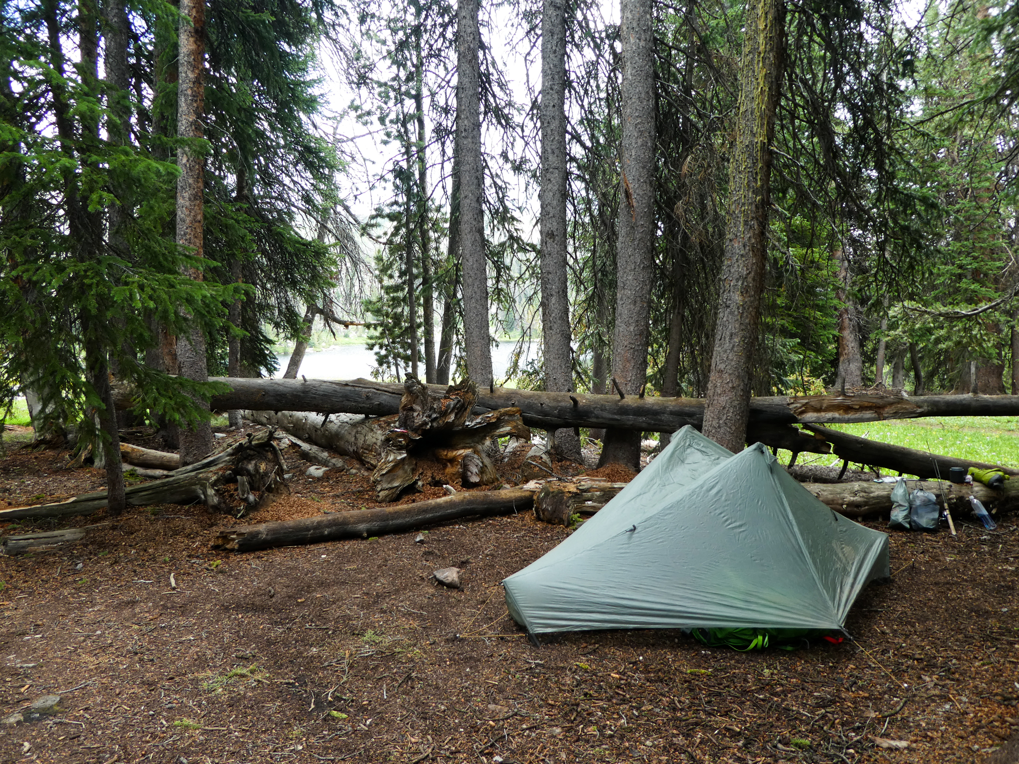
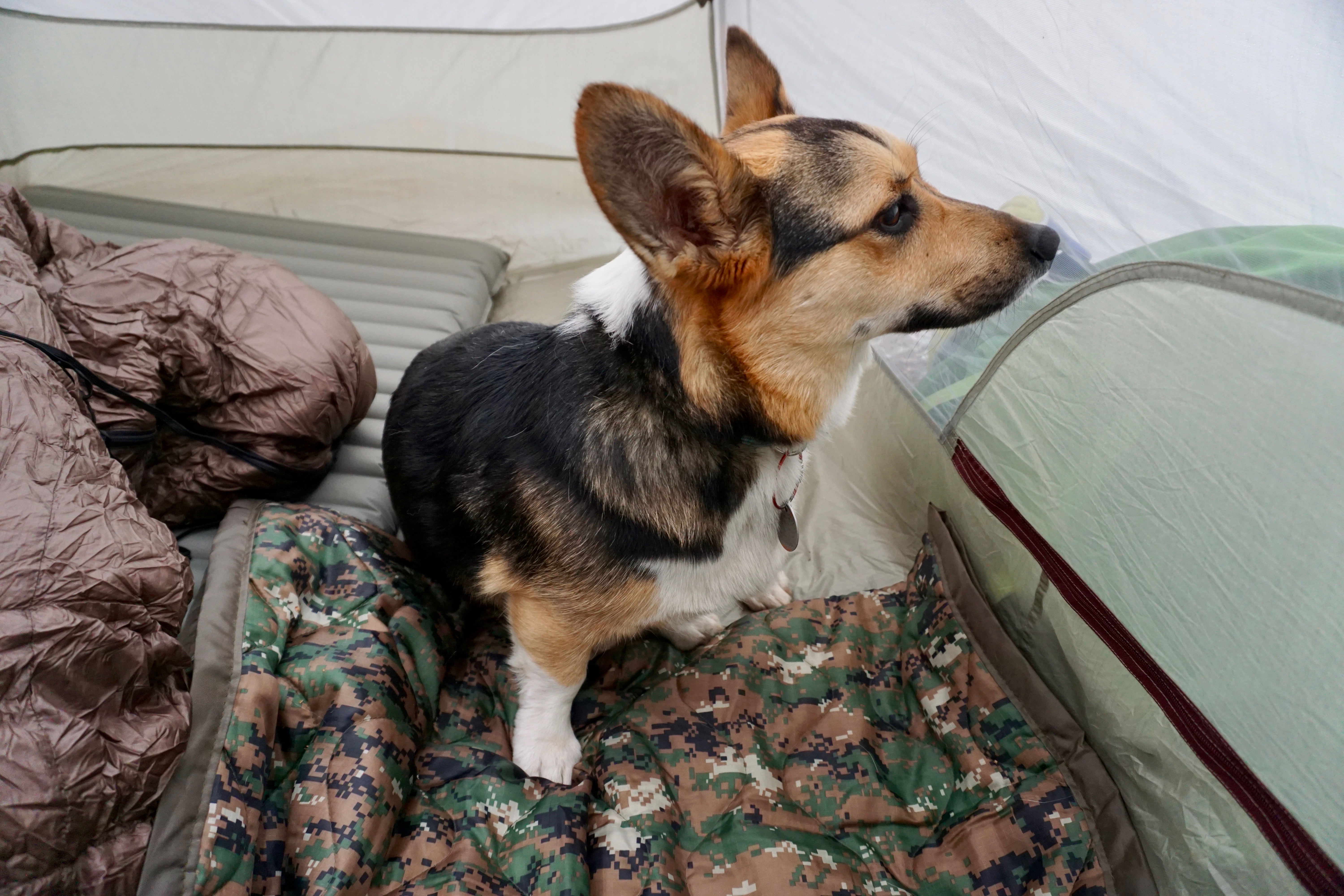
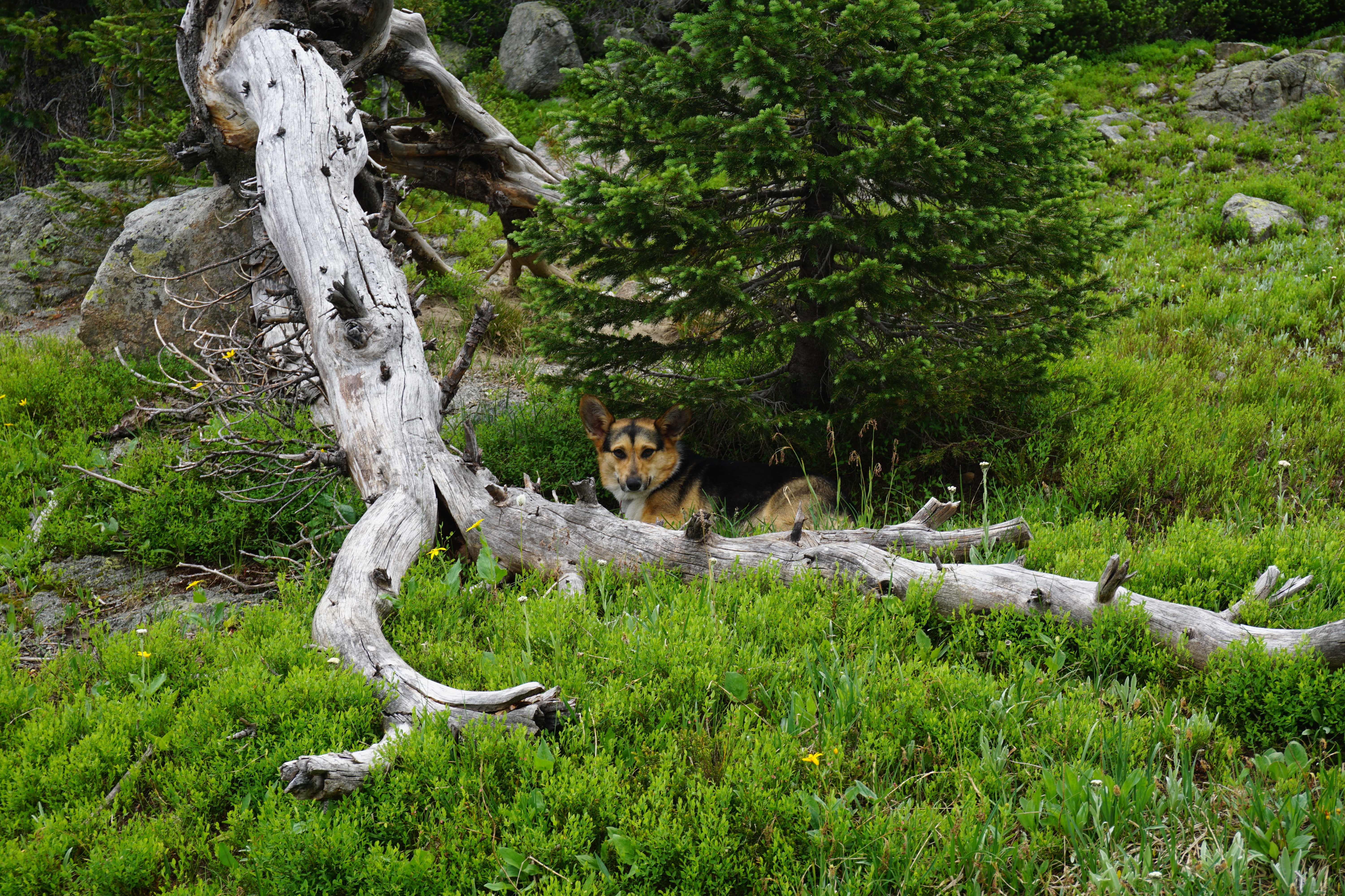
Here’s Aela waiting out the late-afternoon rainstorm from inside the tent that eventually got set up.

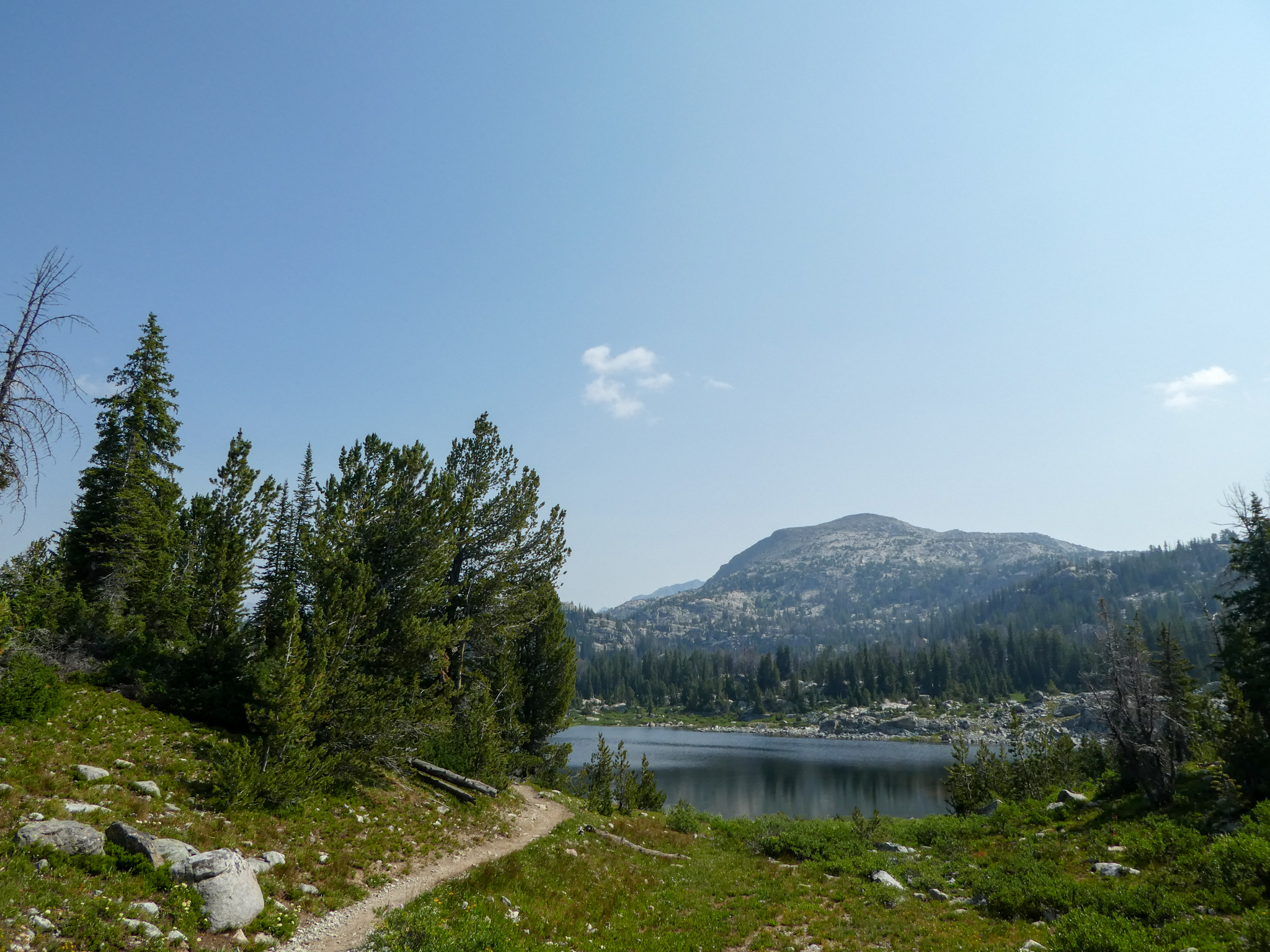
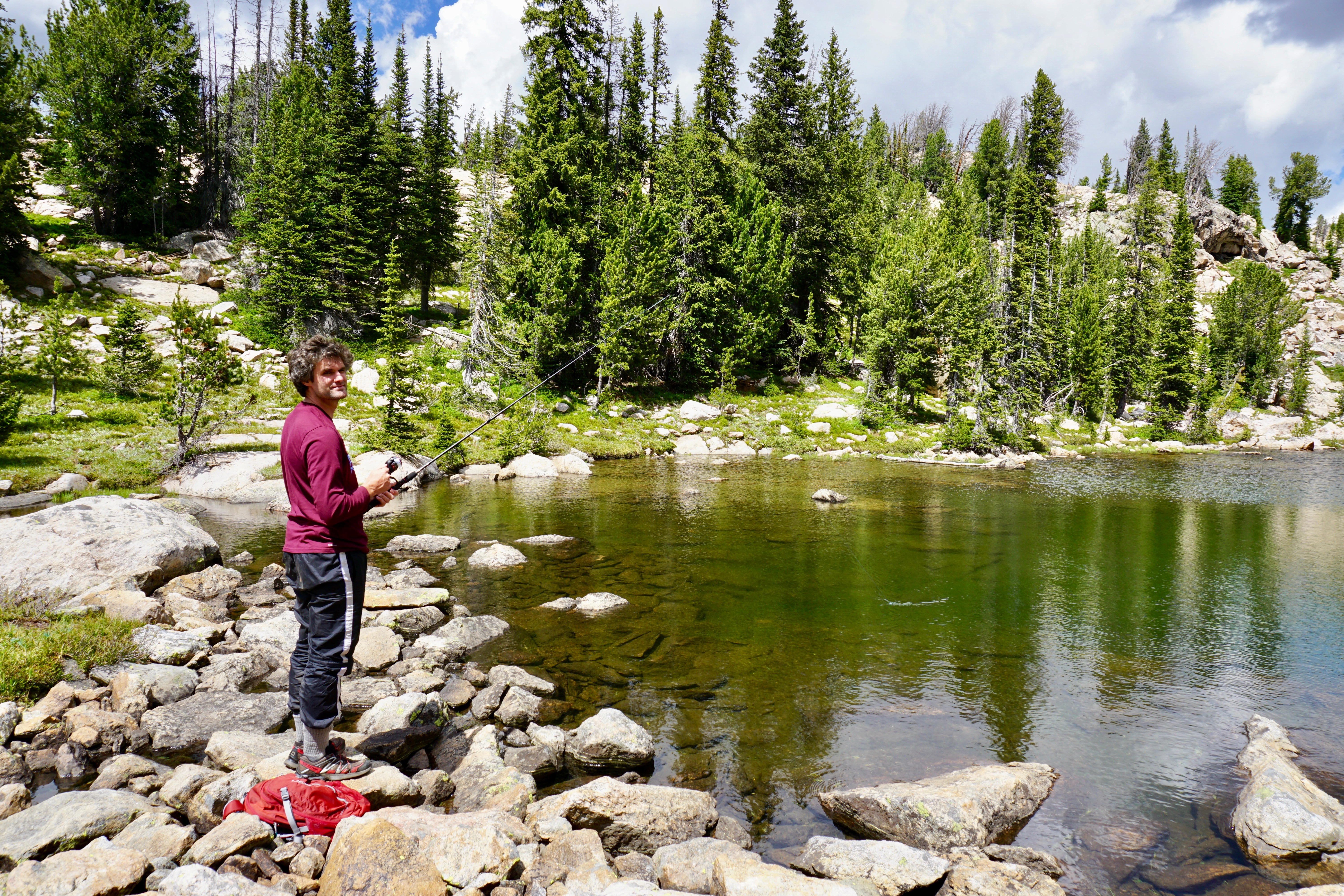
And Dave had pretty good success fishing Aela Lake.

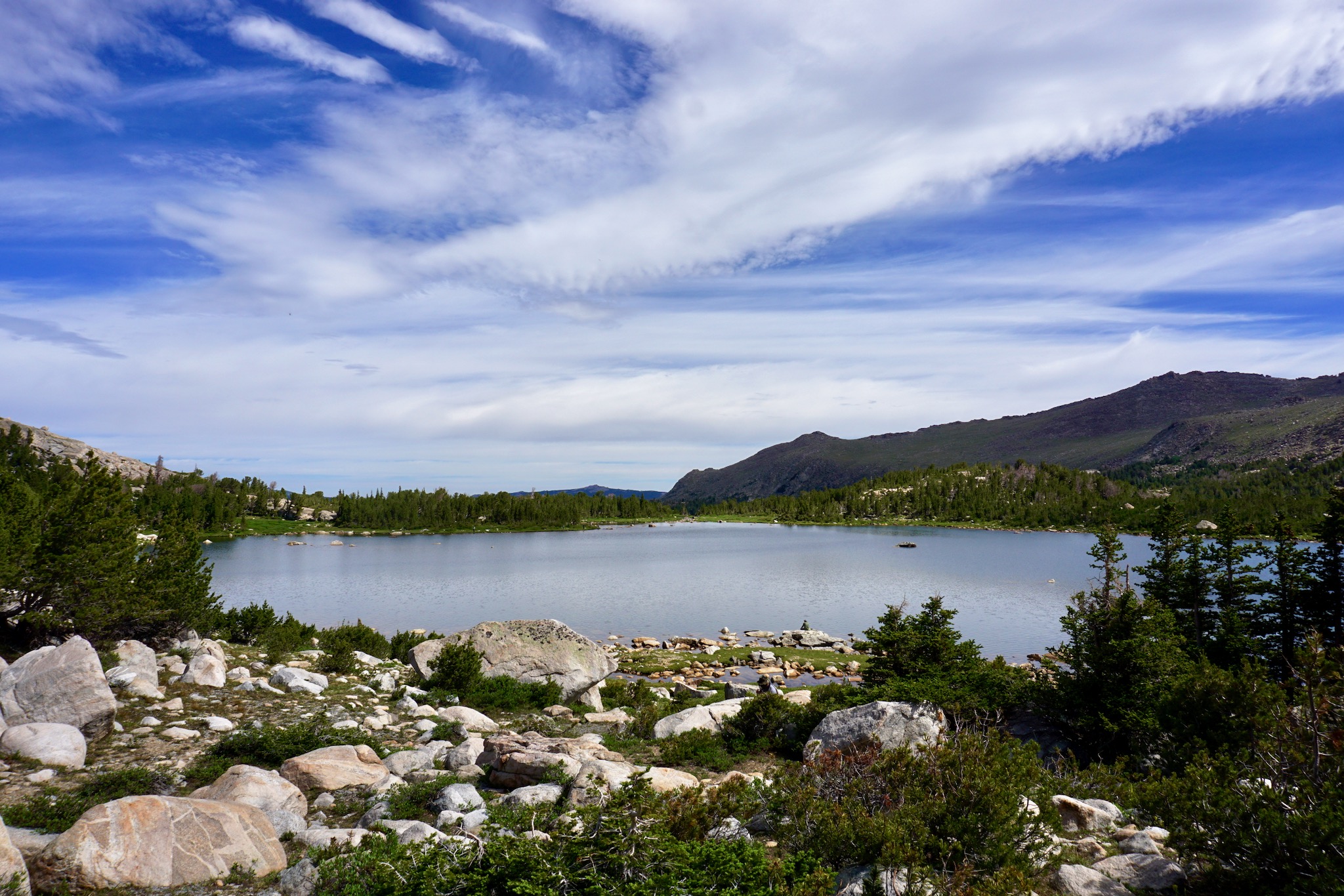
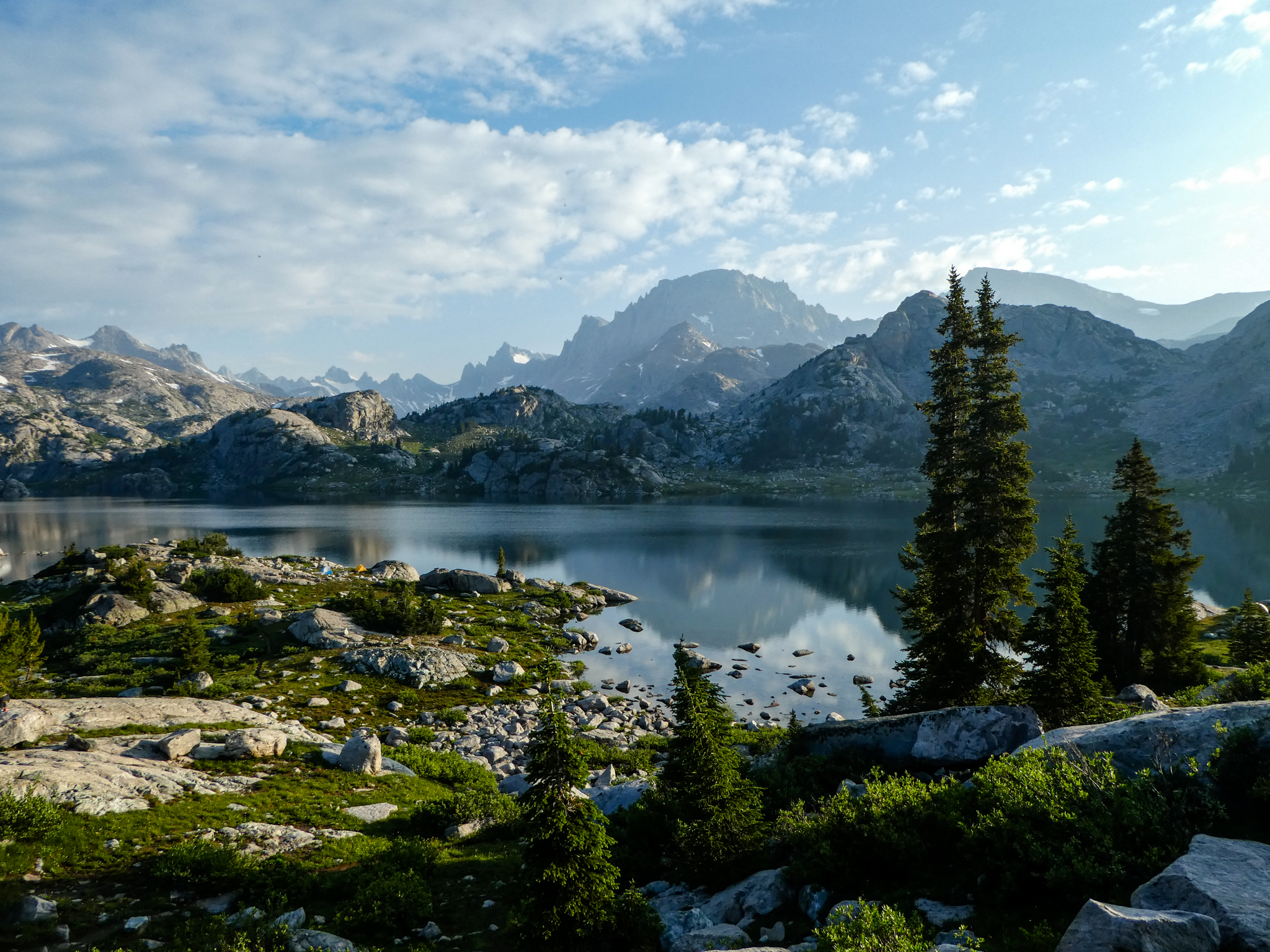
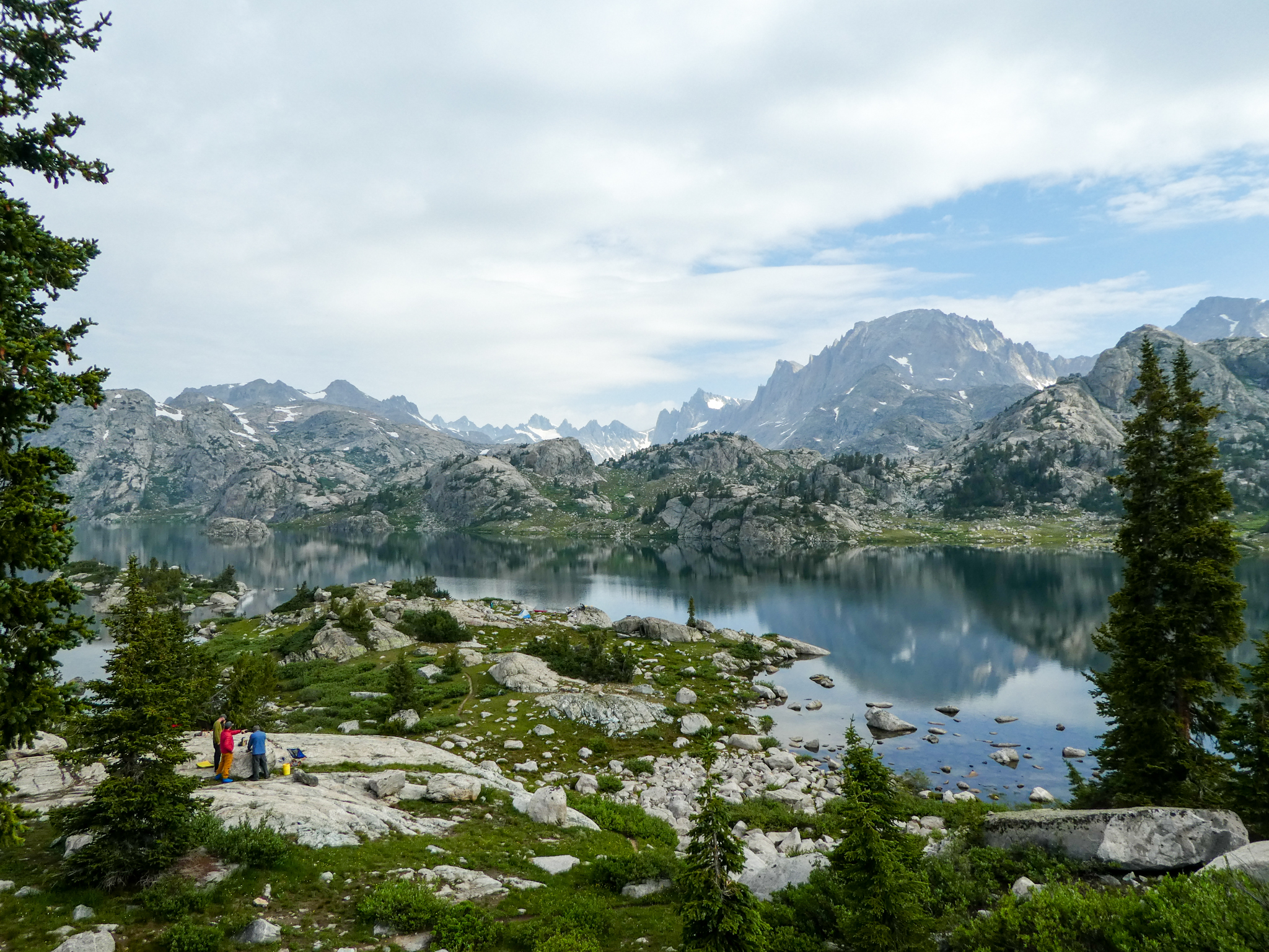
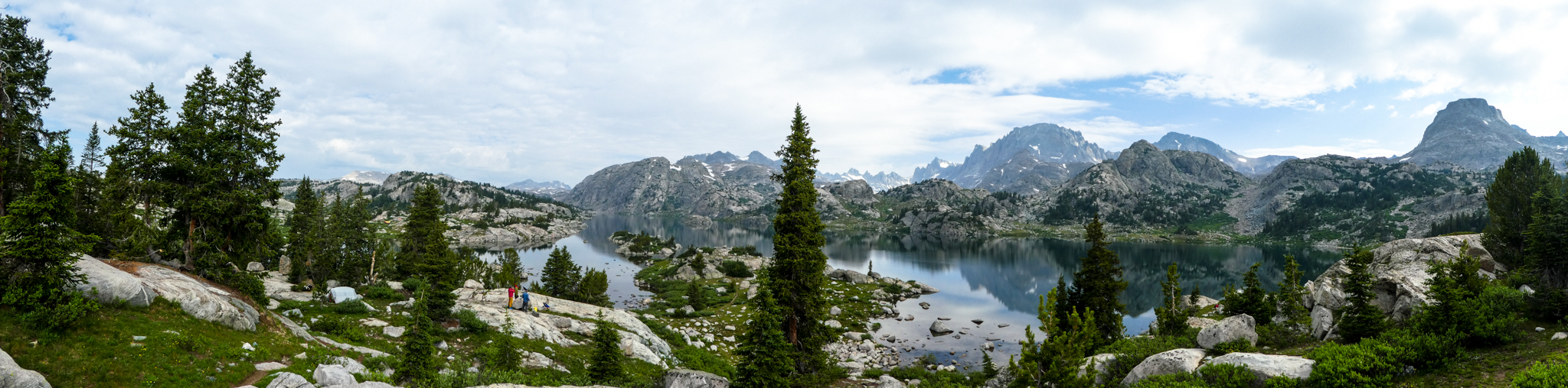
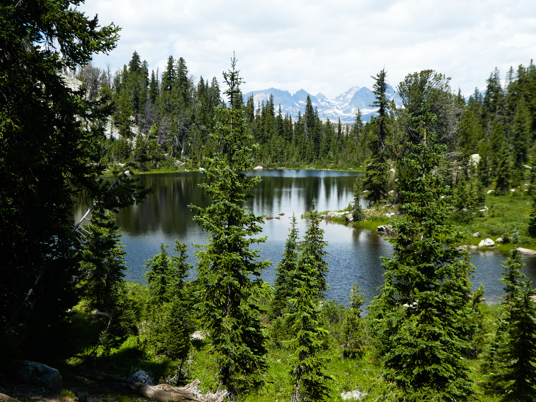
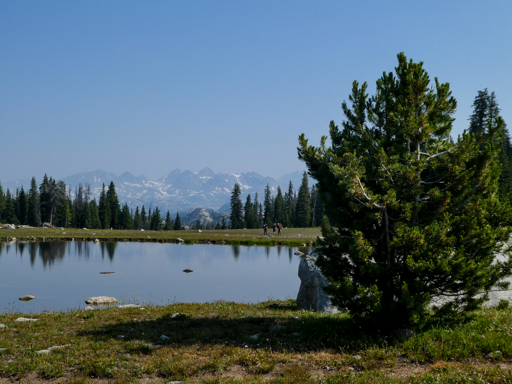
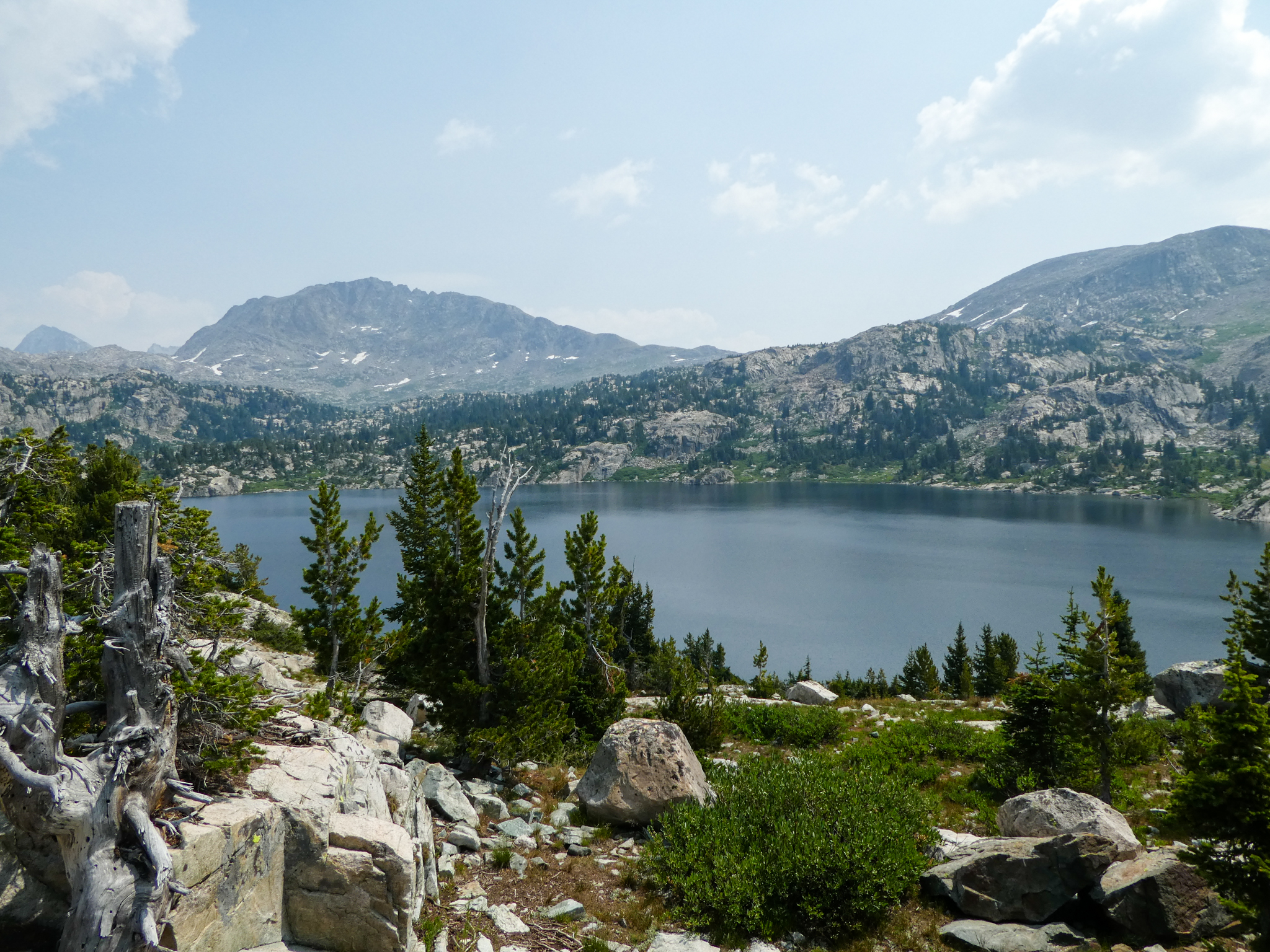
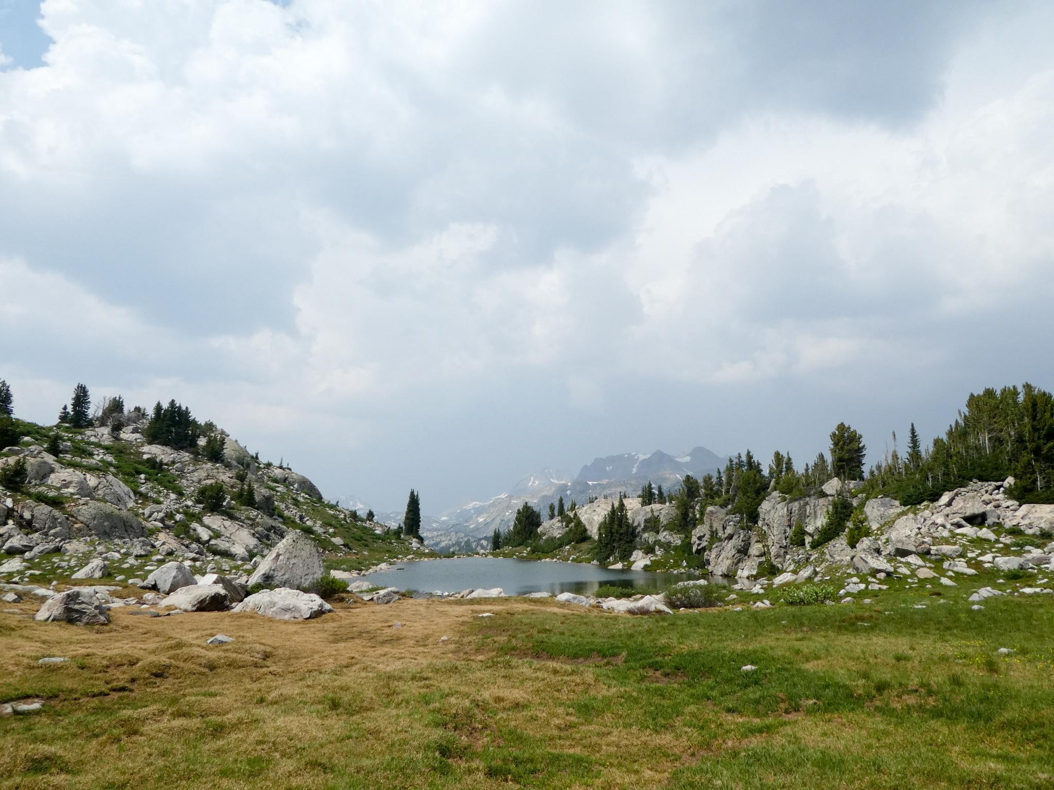
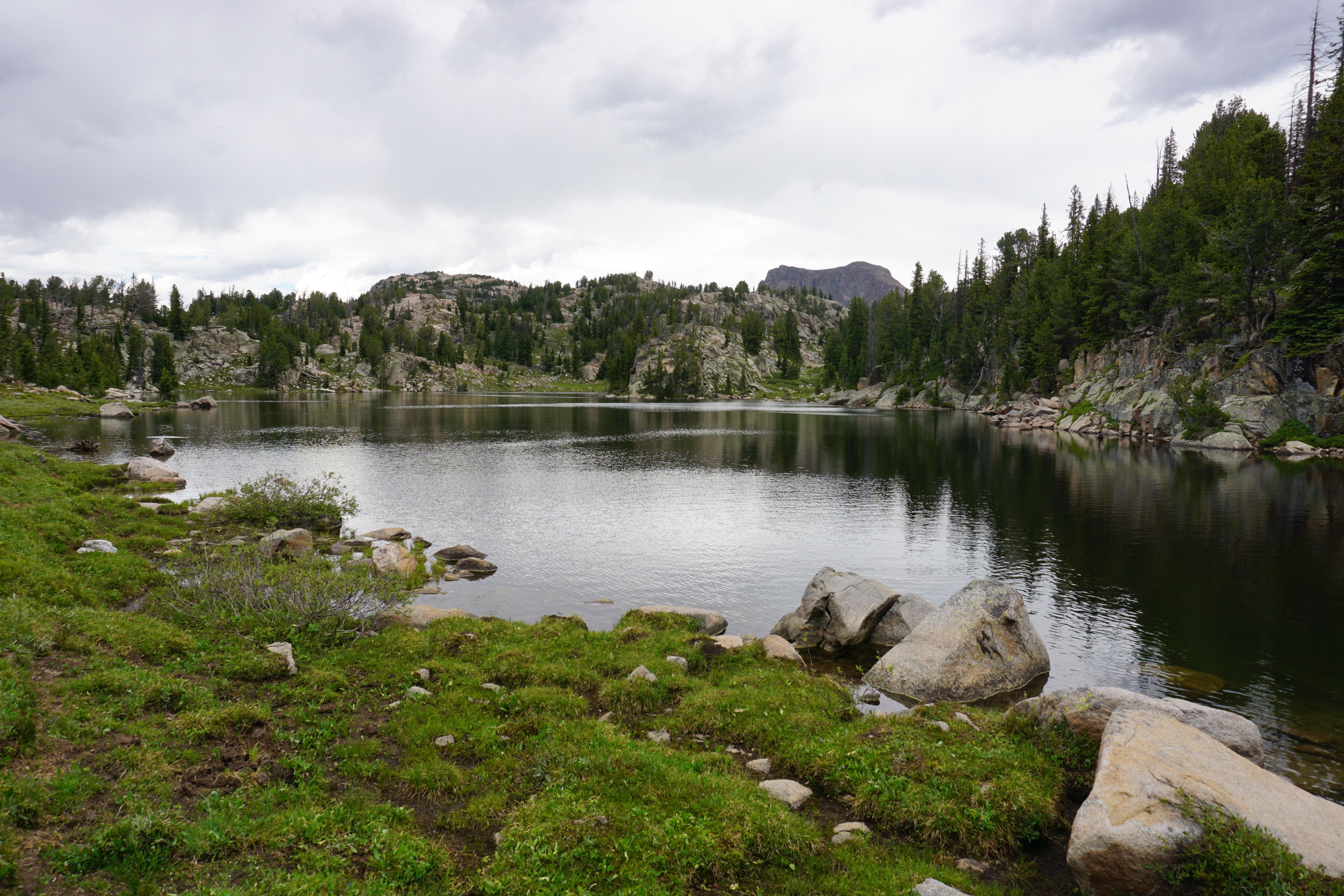
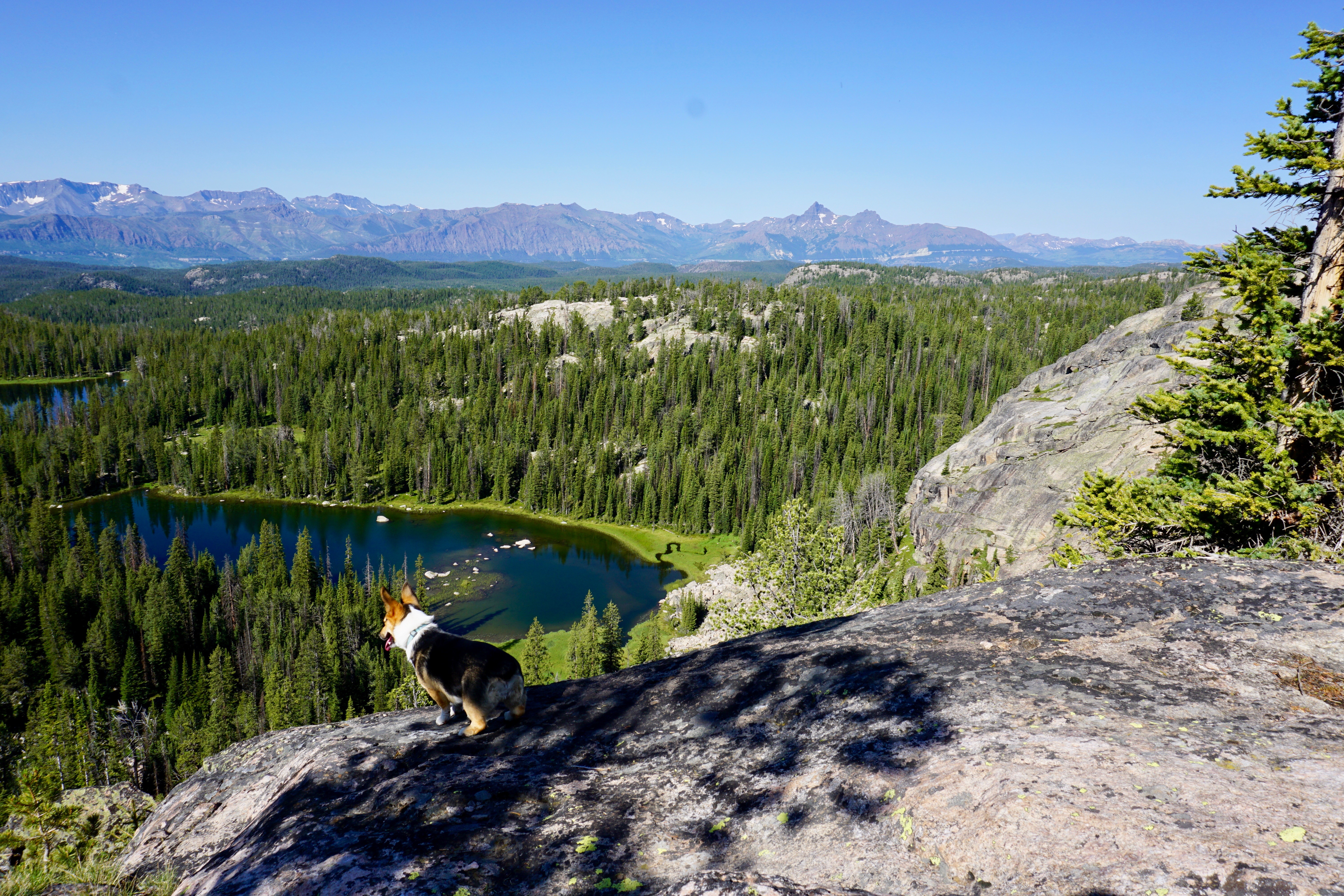
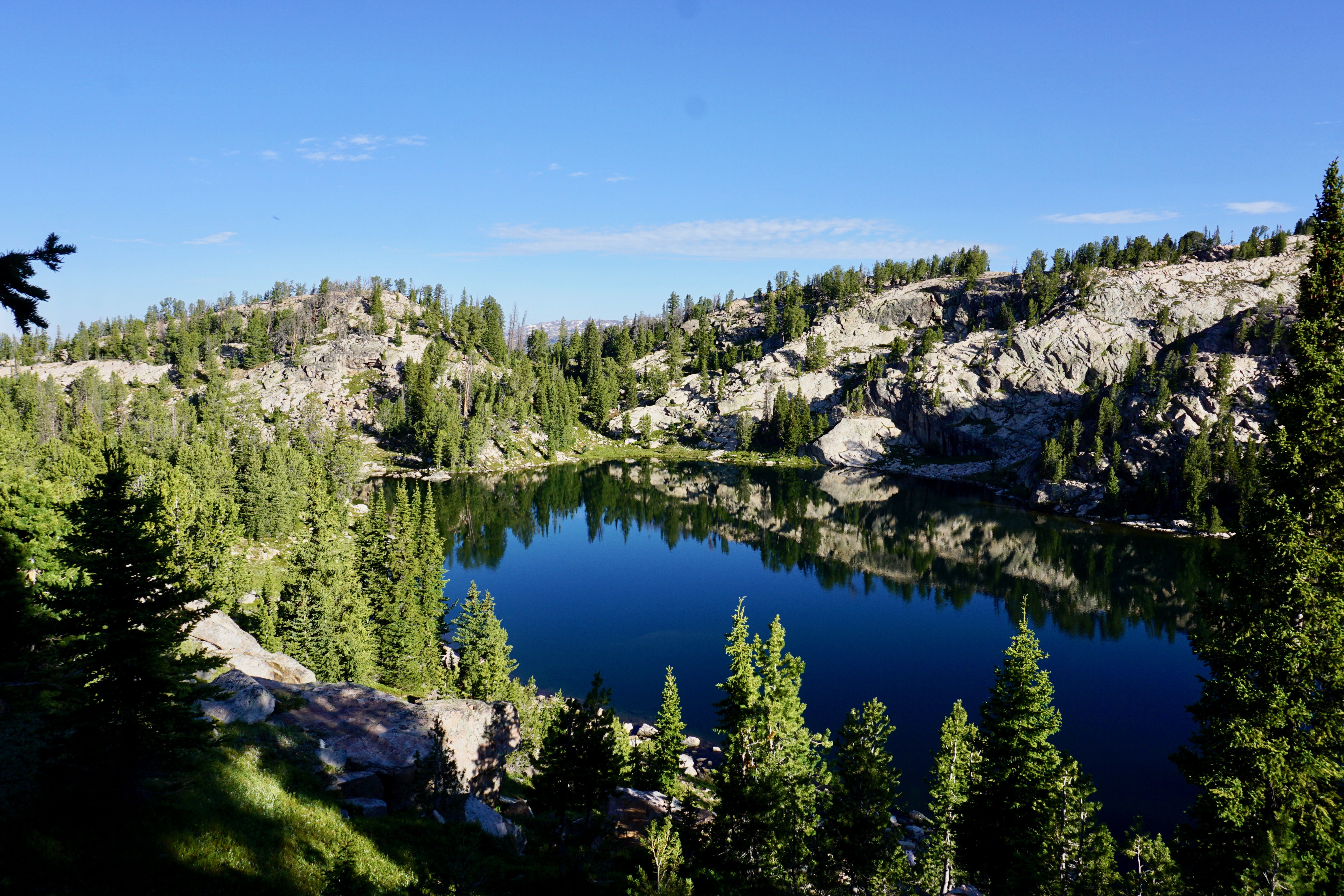
Our campsite (we stayed there all three nights) was in a pretty good area, on top of sort of a long, narrow cliff. Good views in most directions.

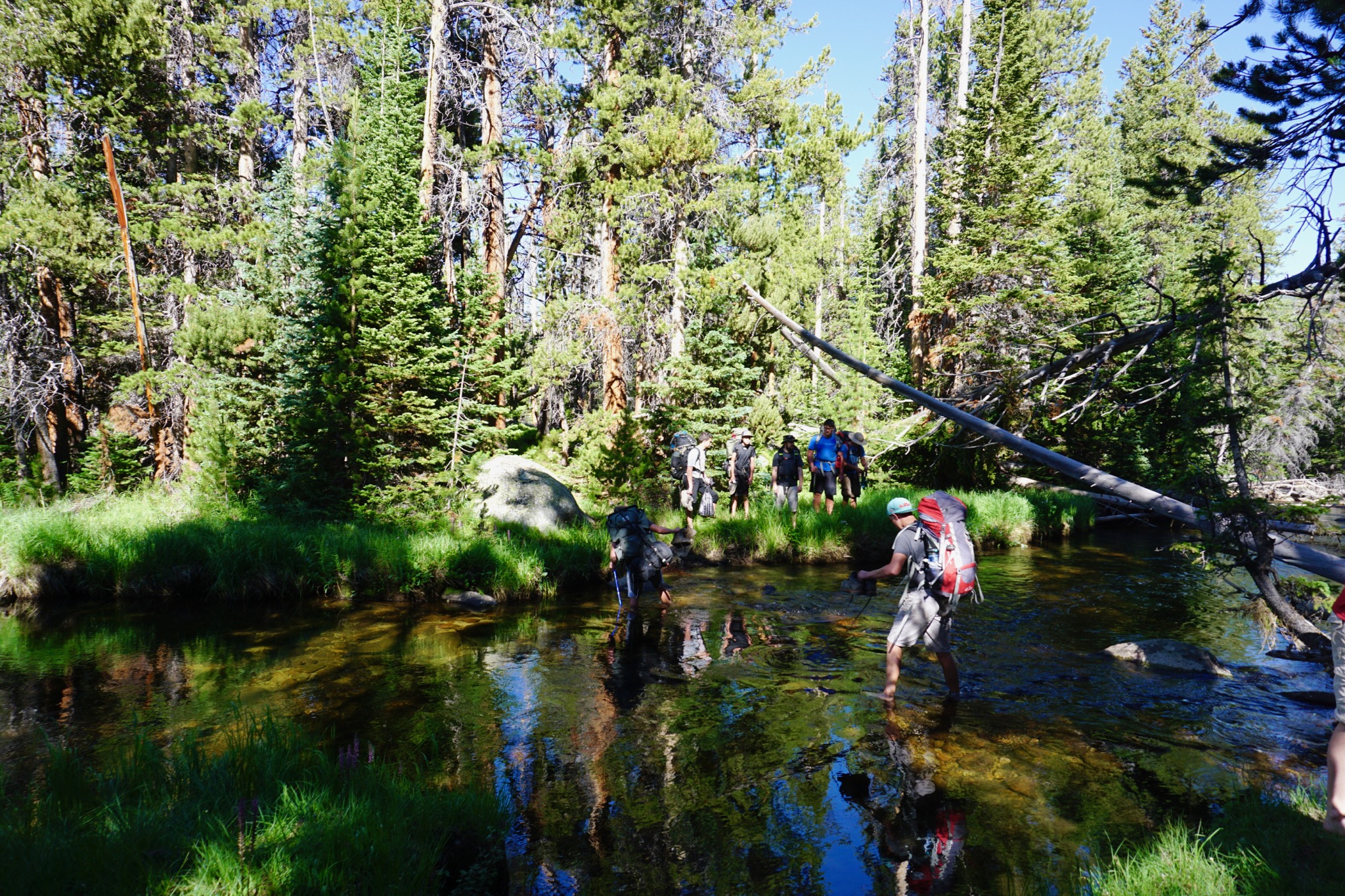
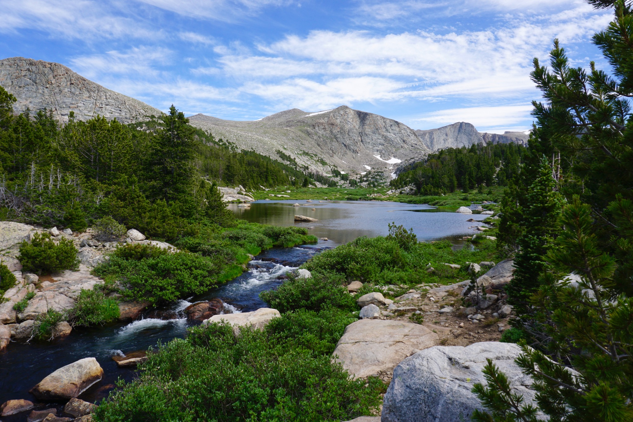
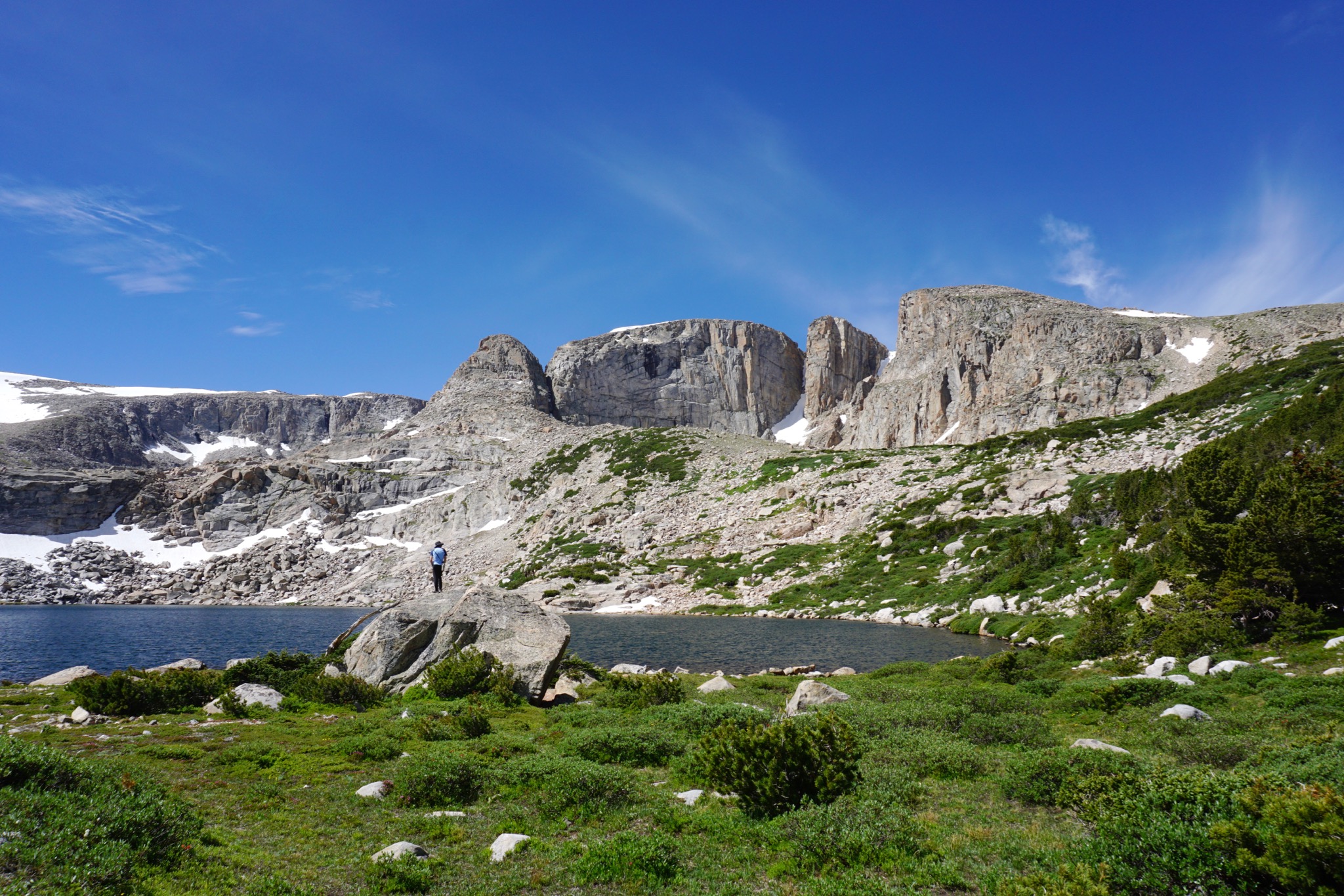
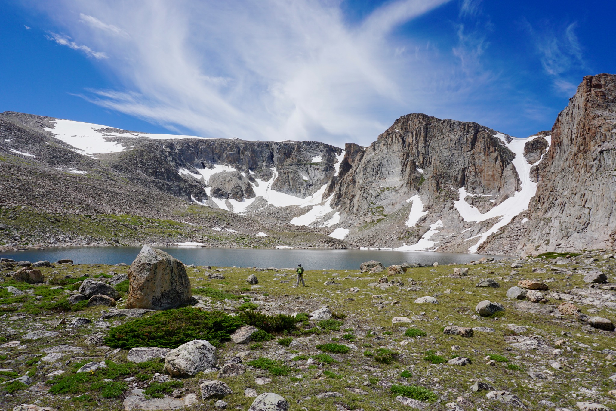
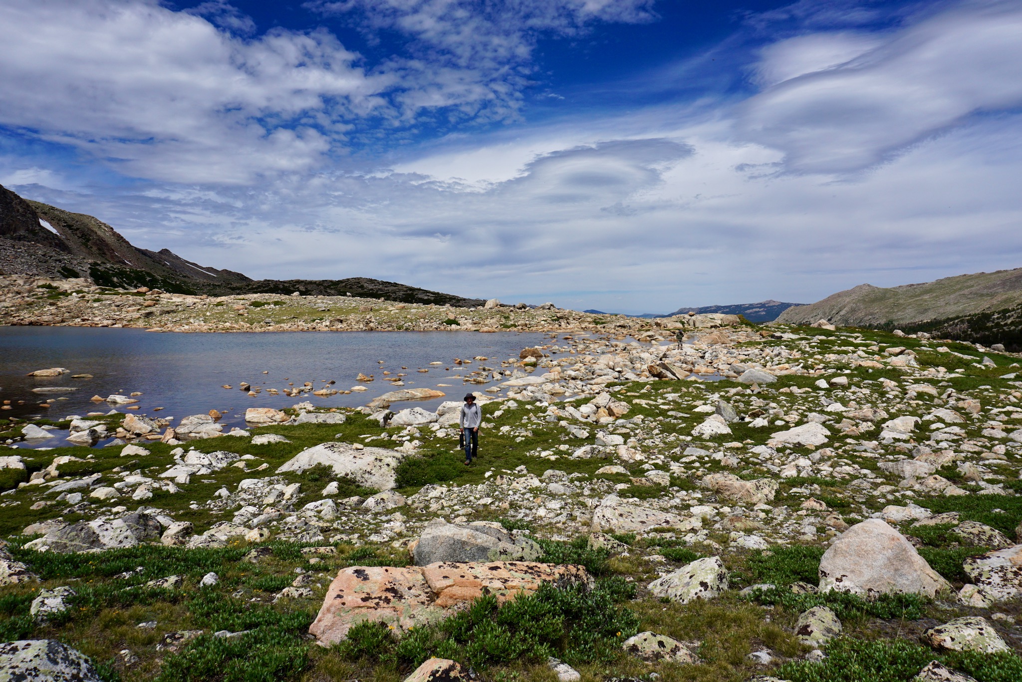
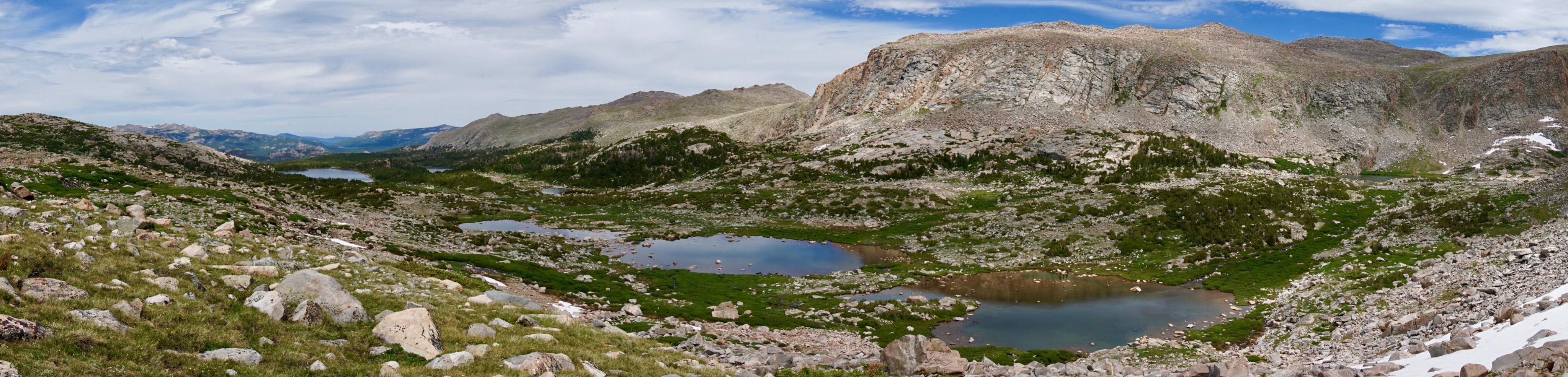
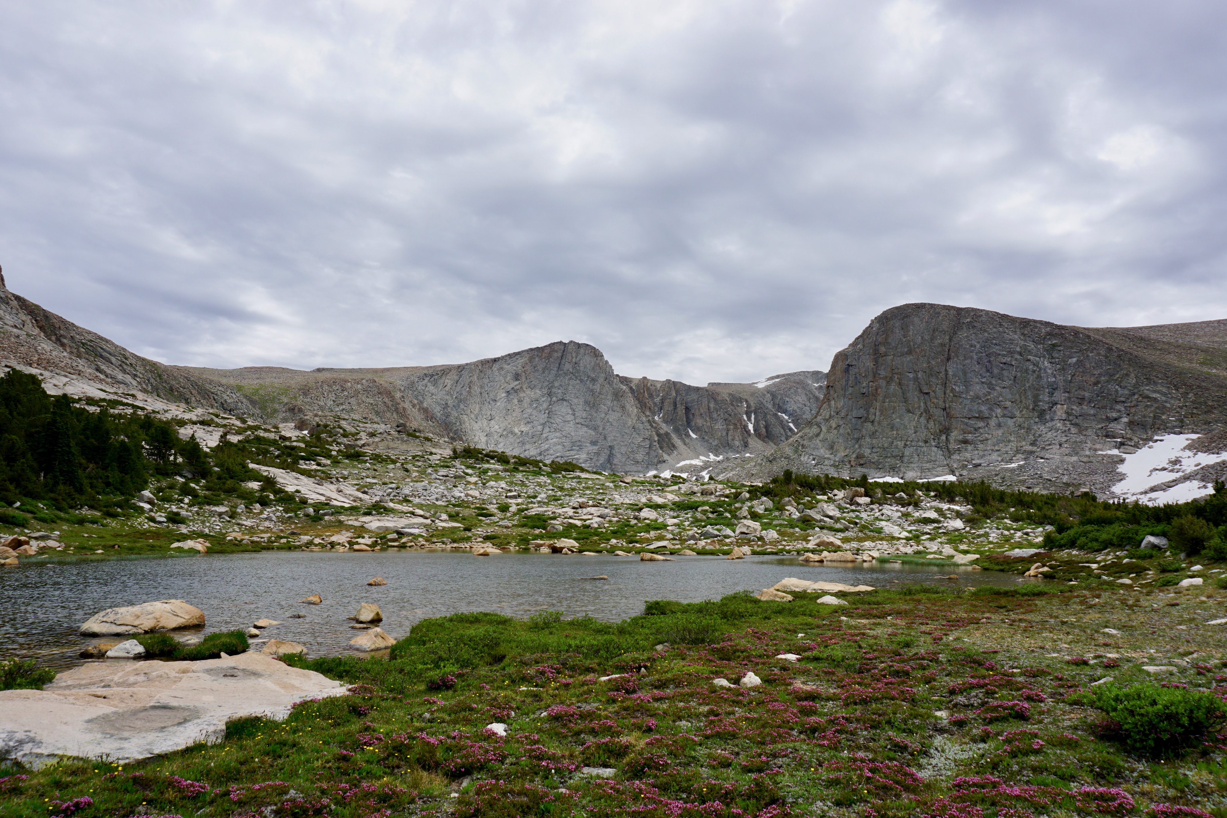
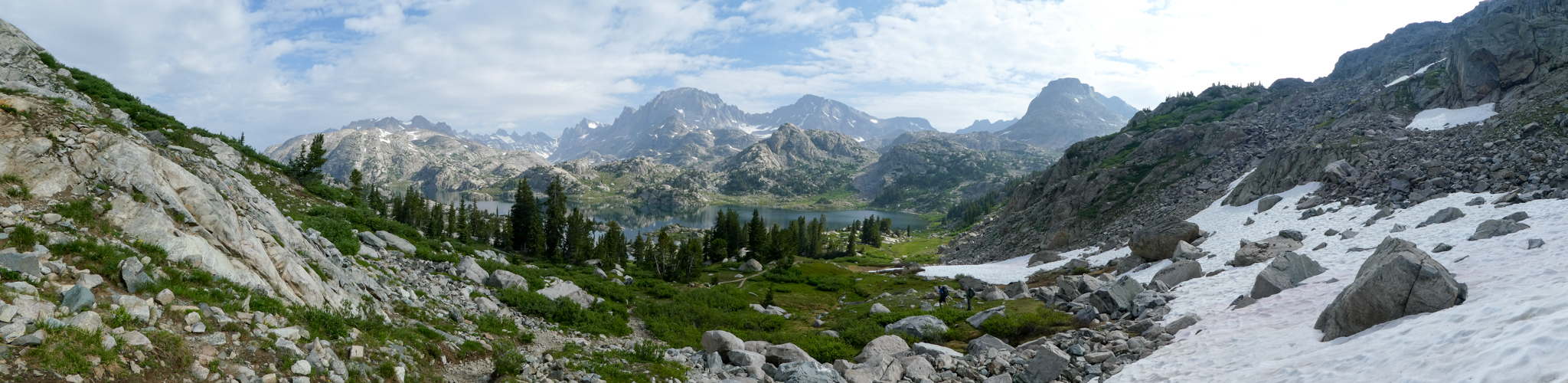
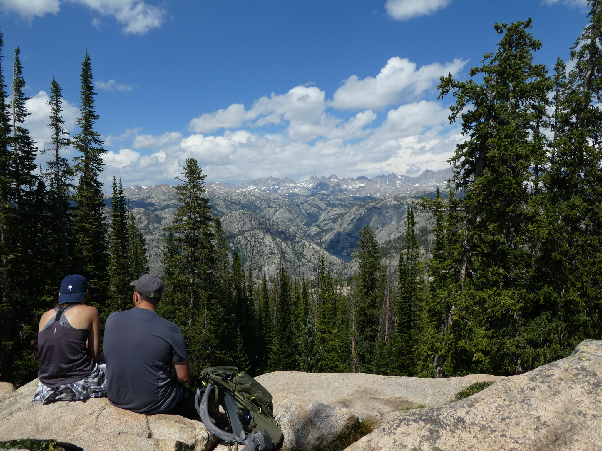
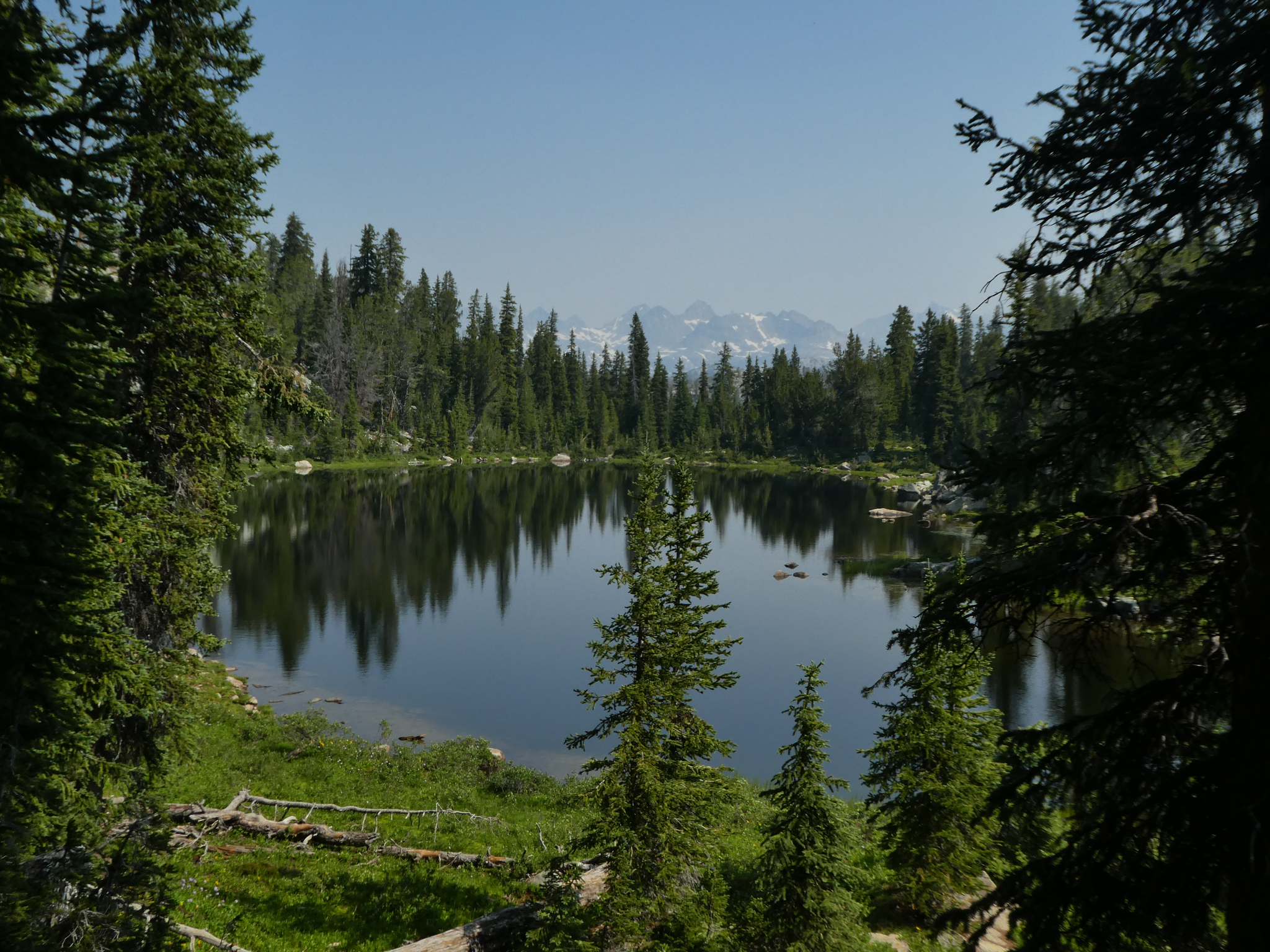
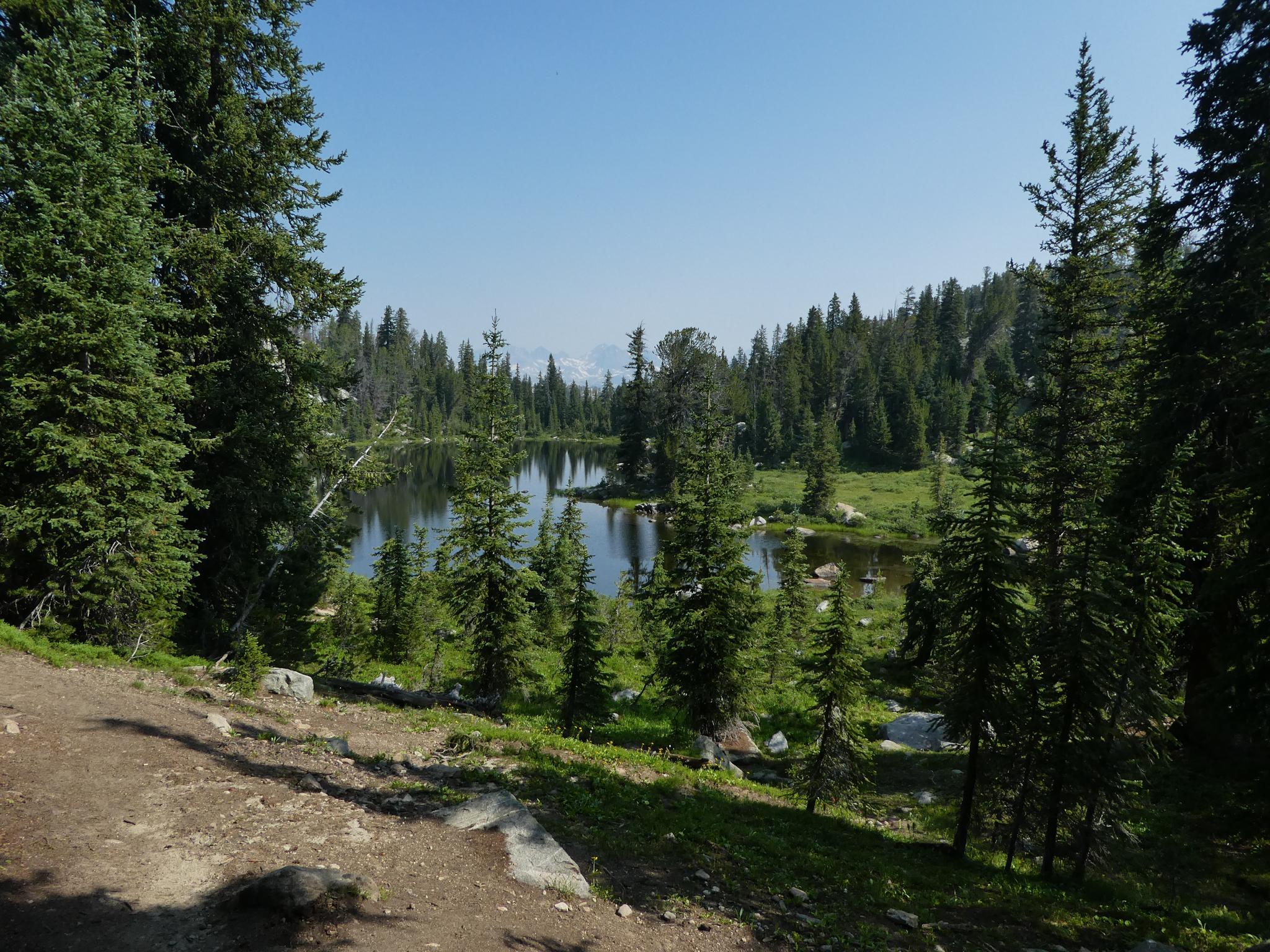
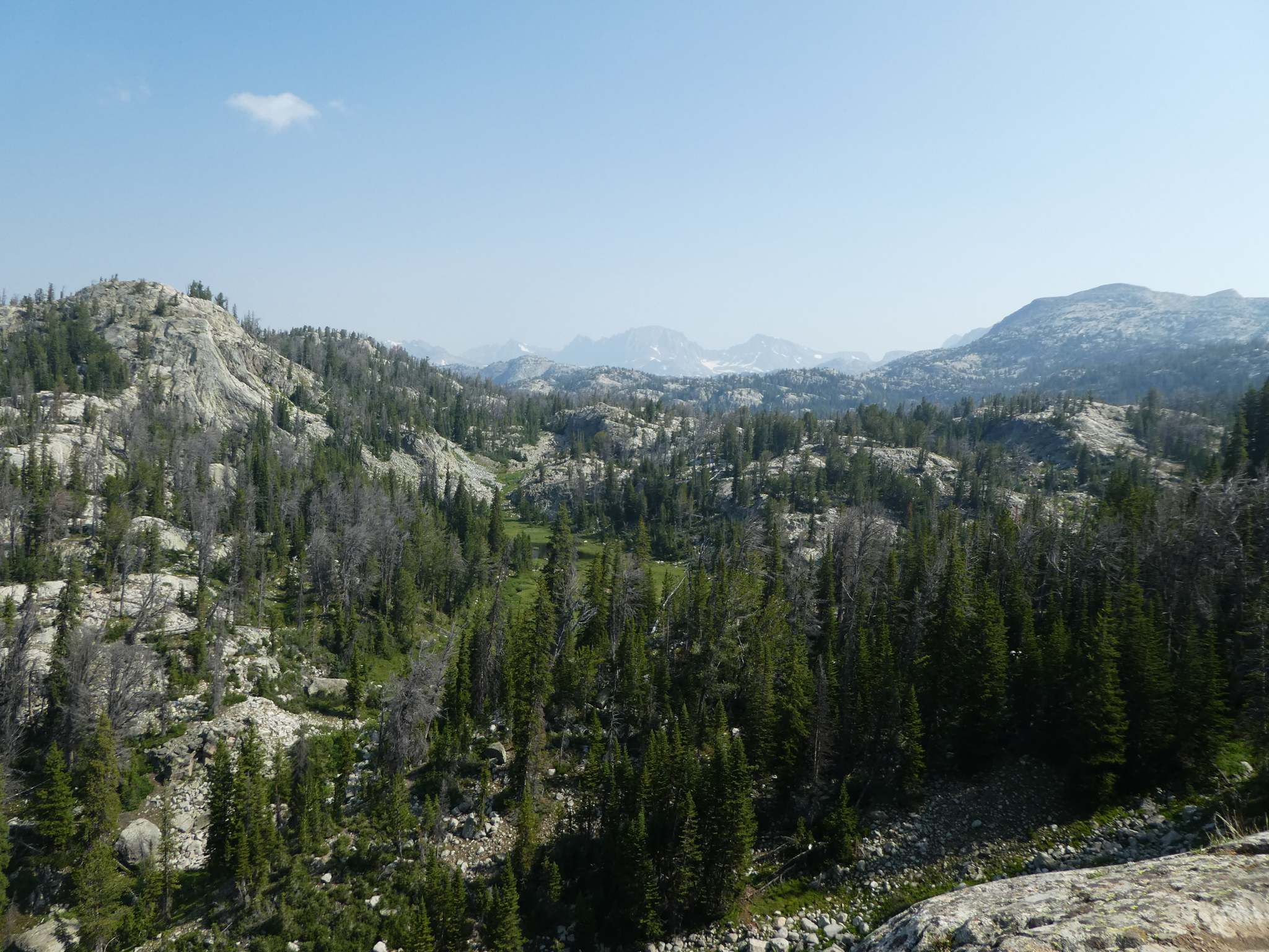
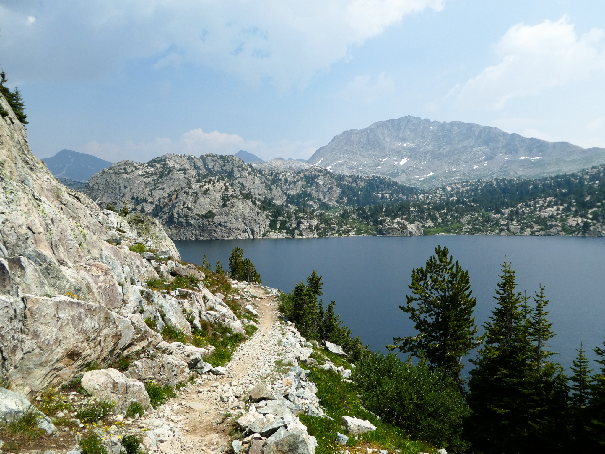
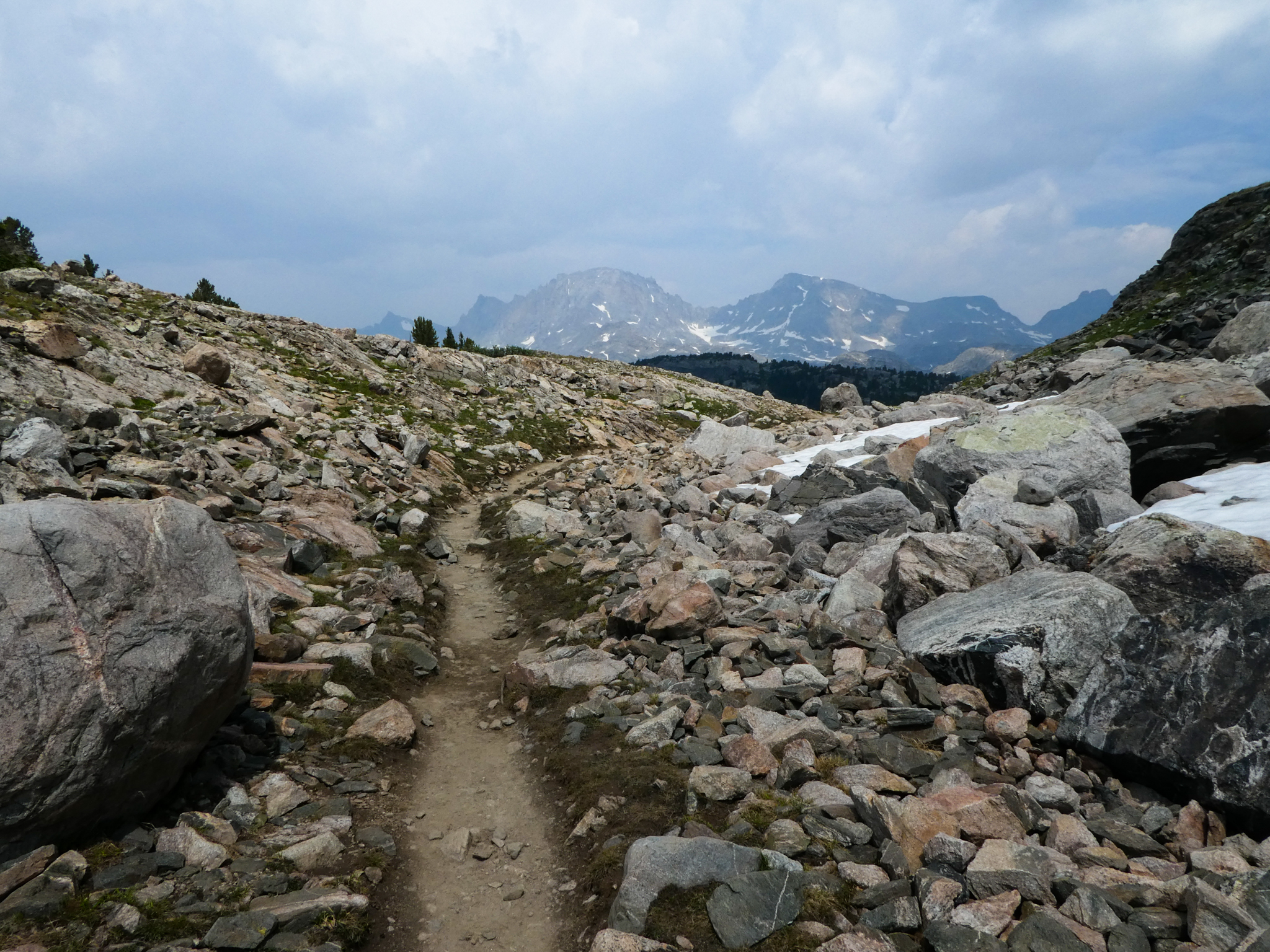
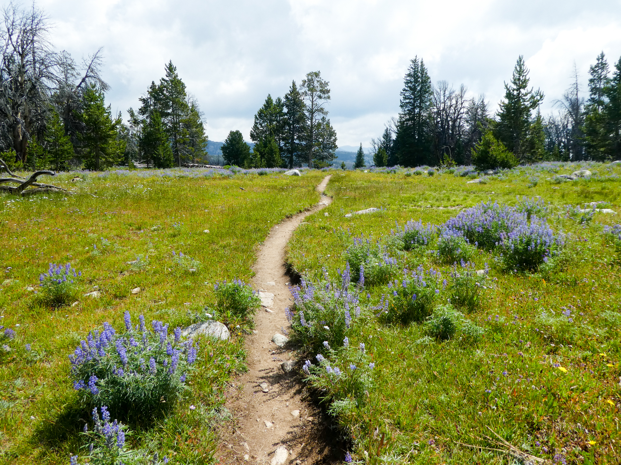
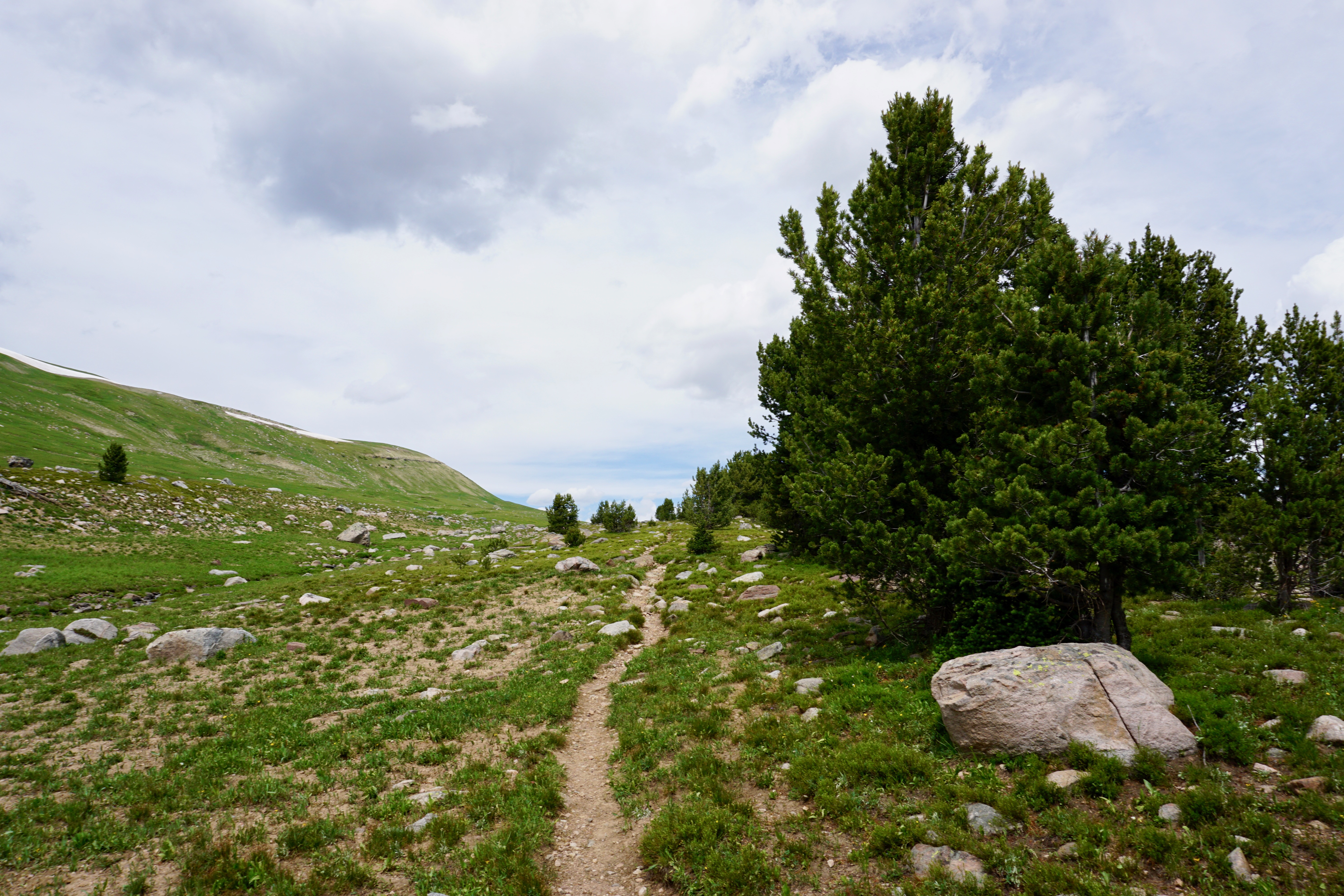
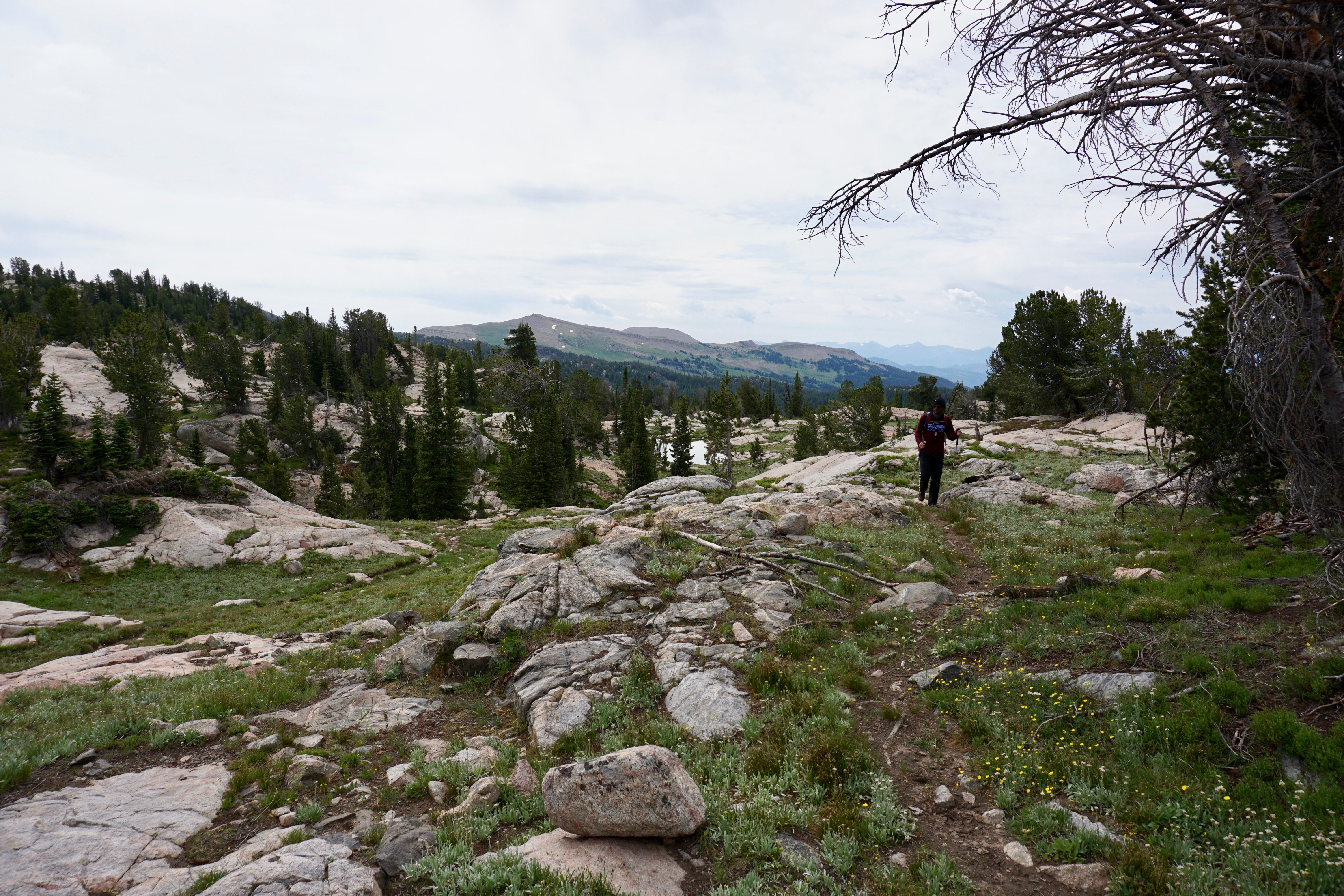
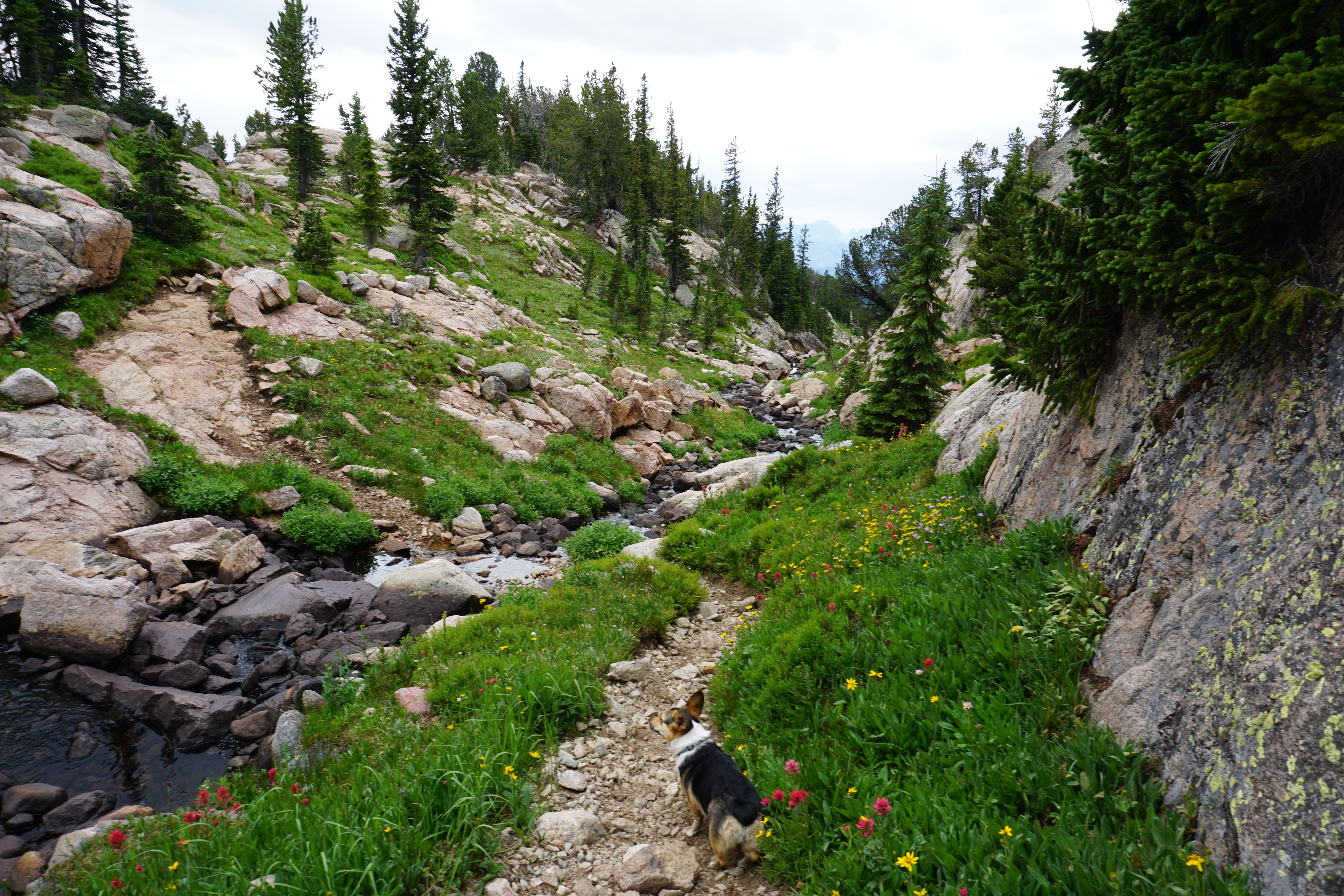
We eventually did our day-hike to Martin Lake, which was pretty steep in spots. It’d be kind of a slog to get there in one day from the trailhead with packs on. Anyway, here’s how all that looked.
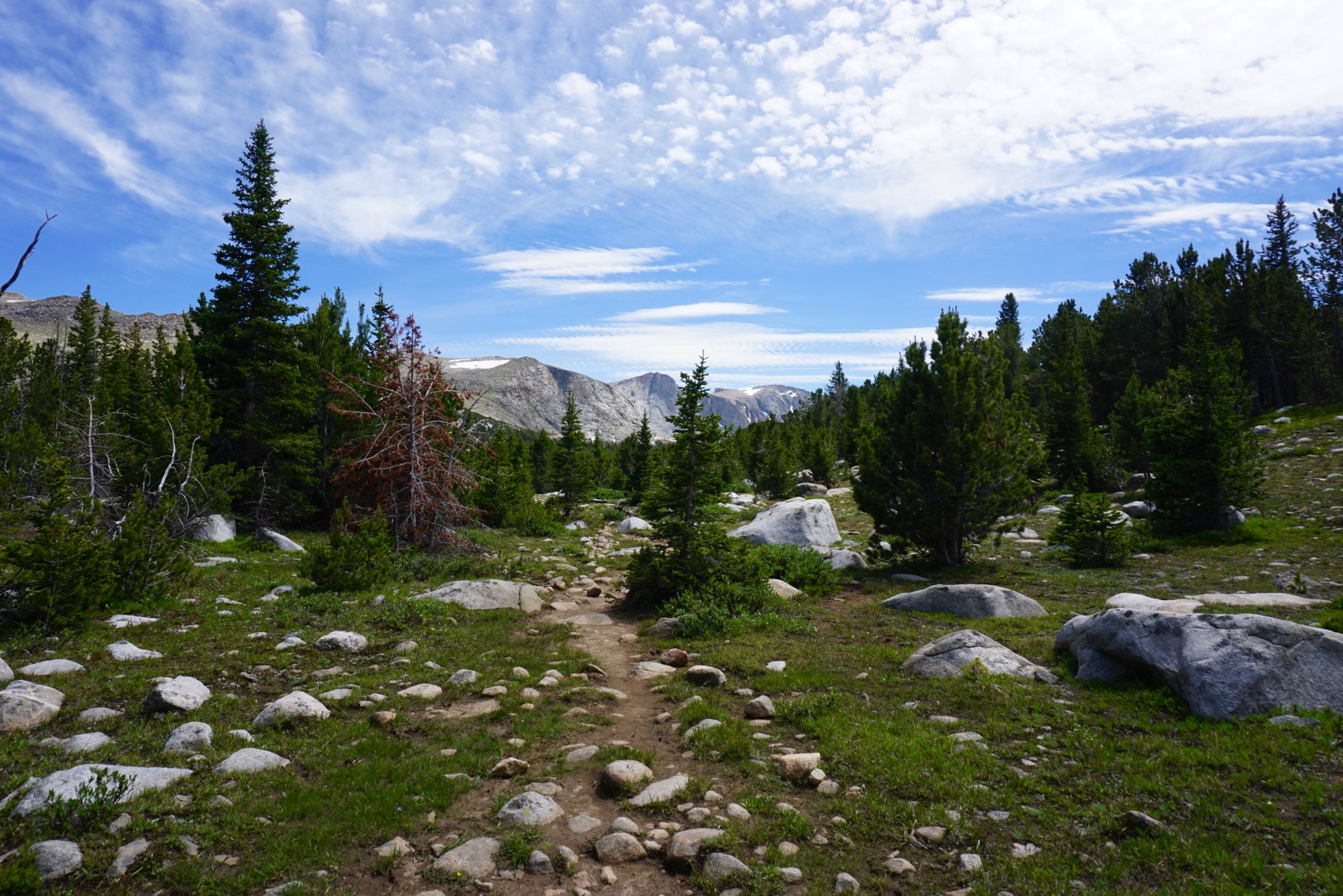
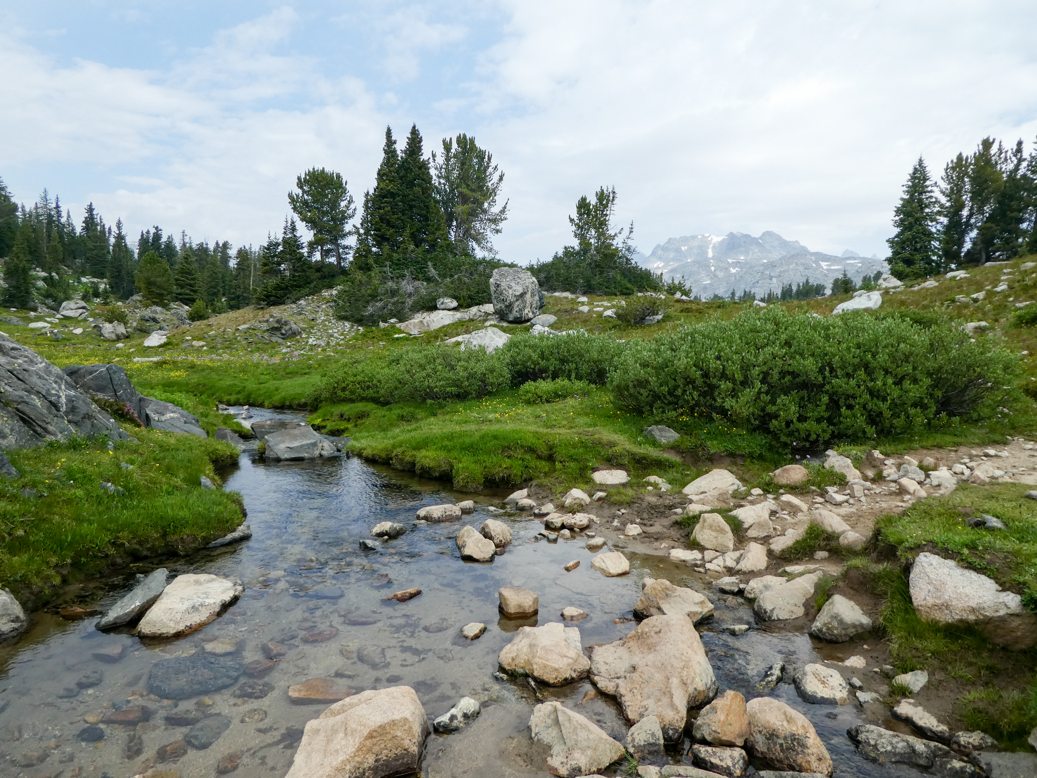
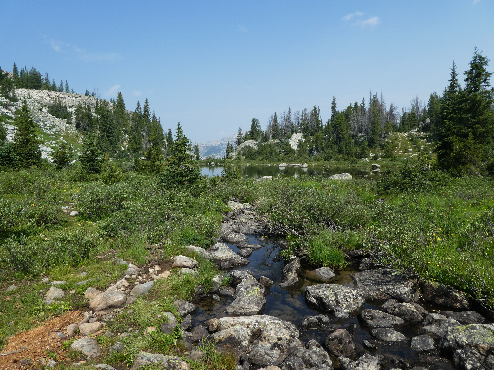
En route:

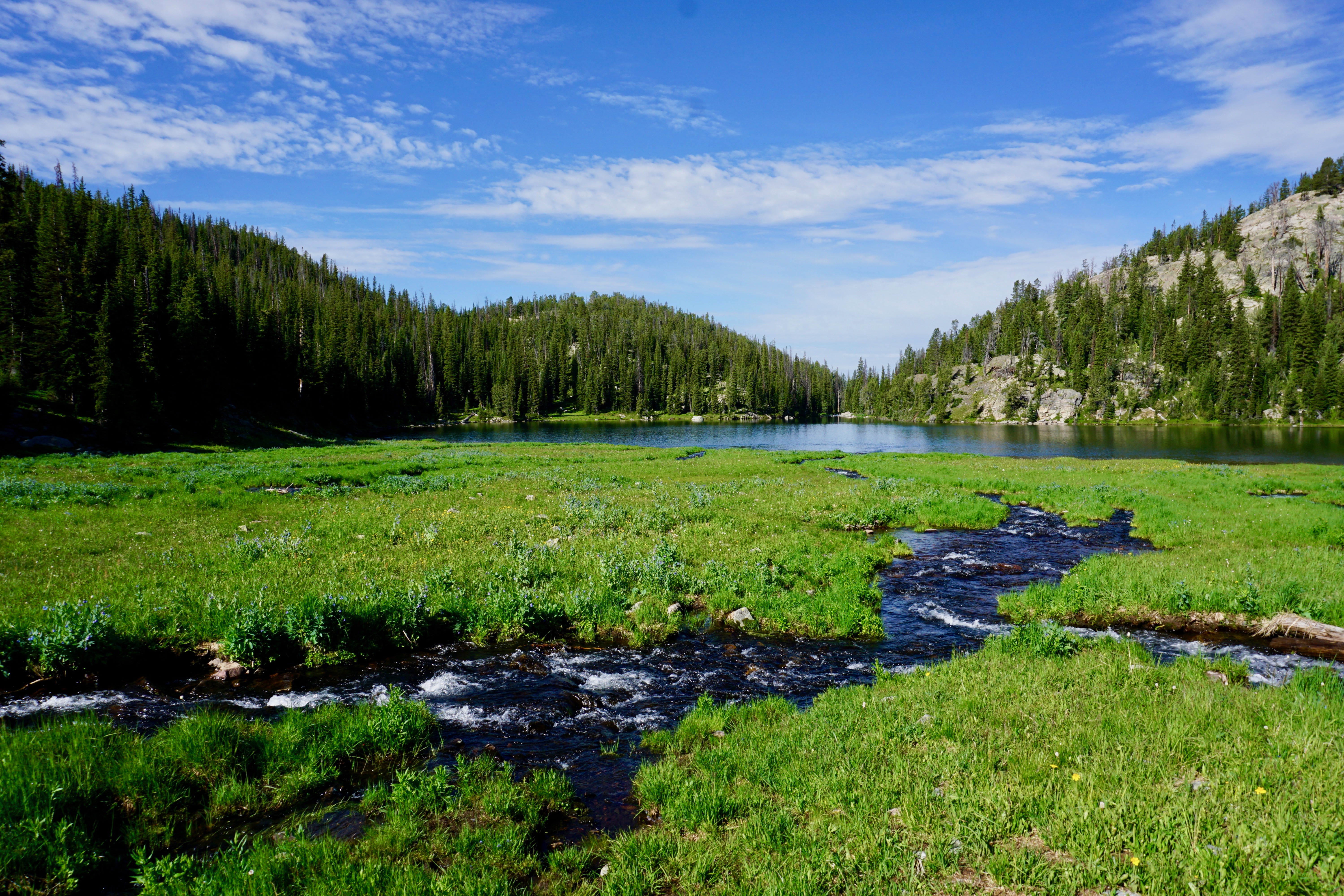
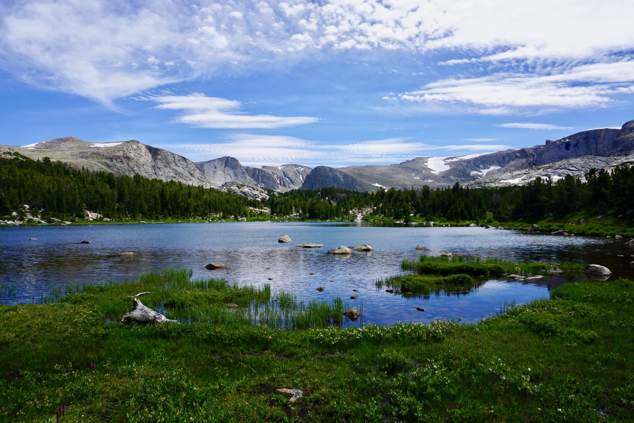
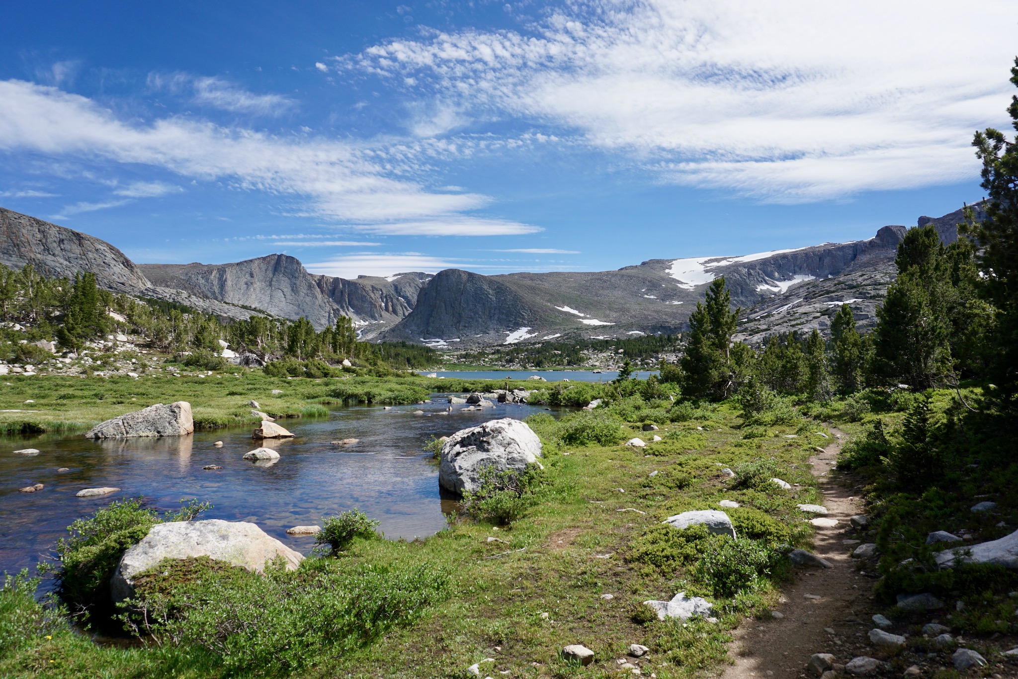
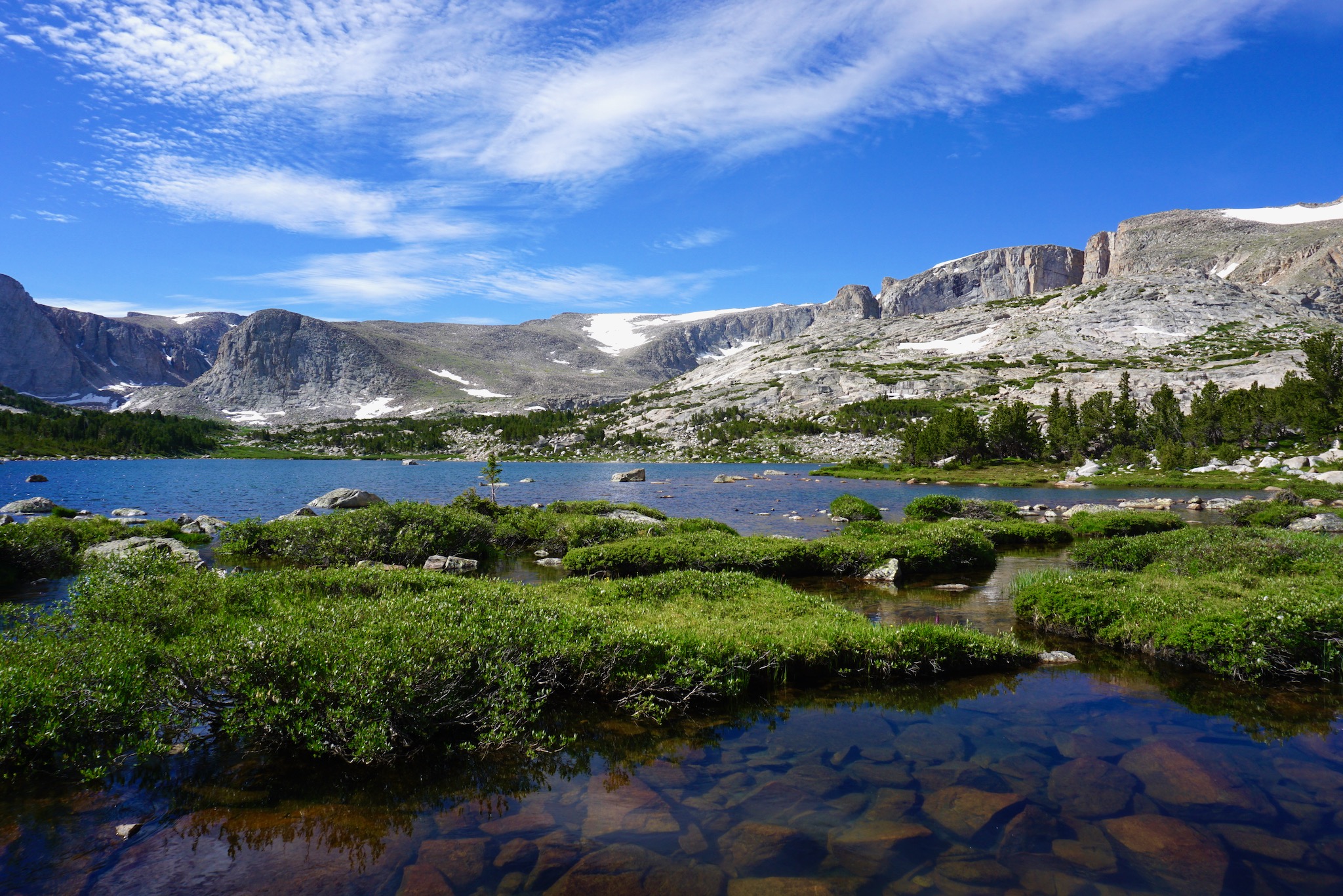
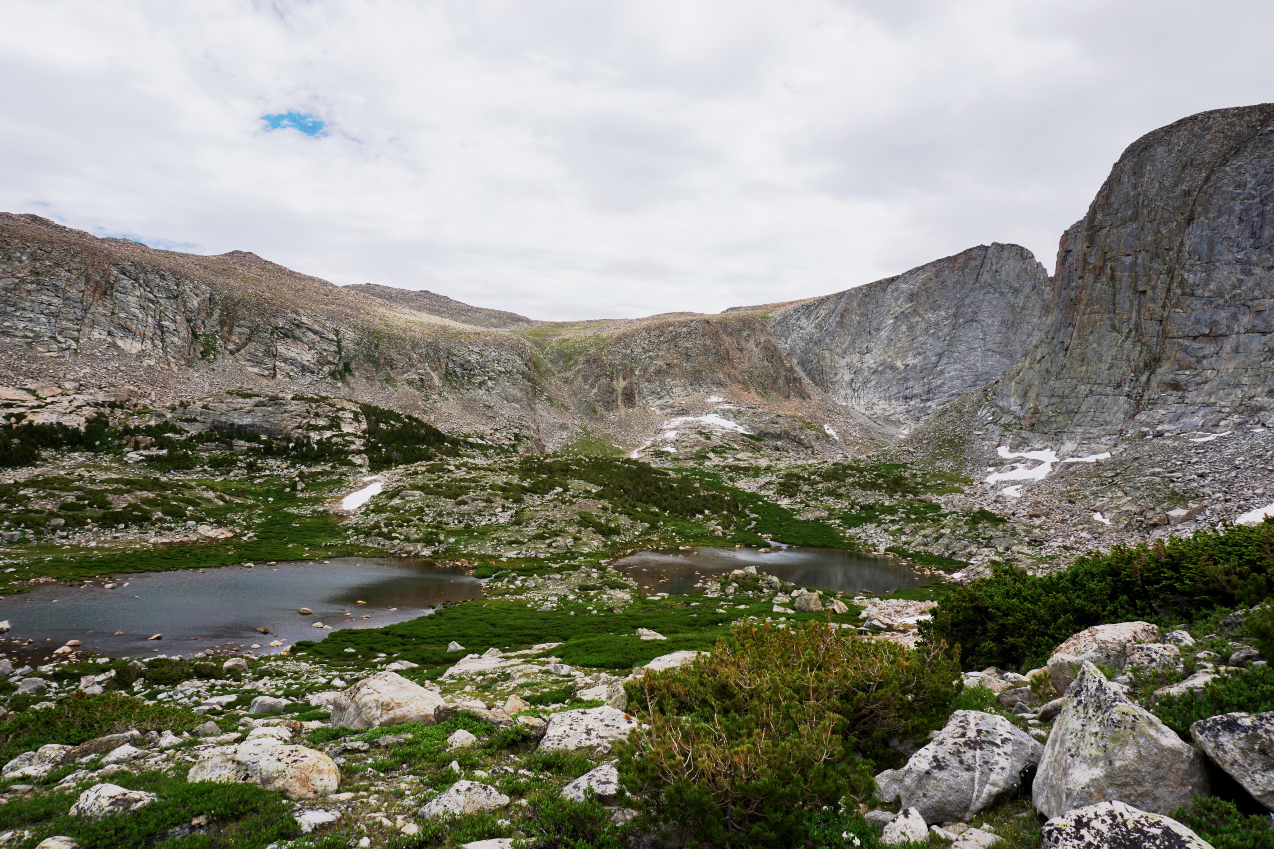
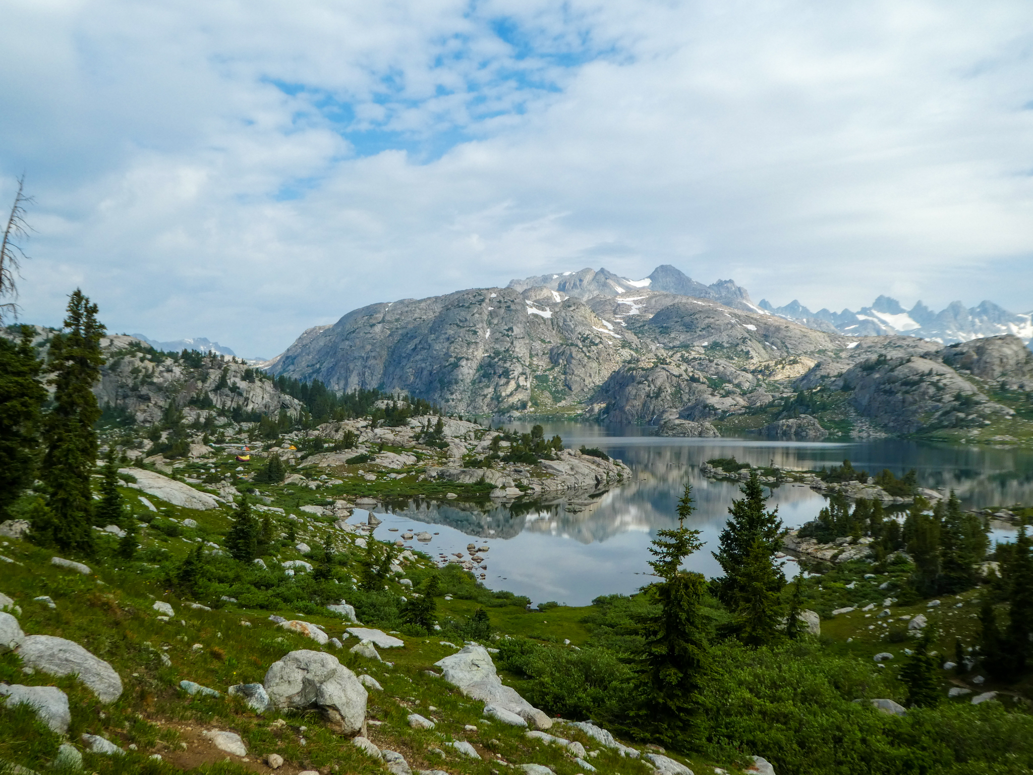
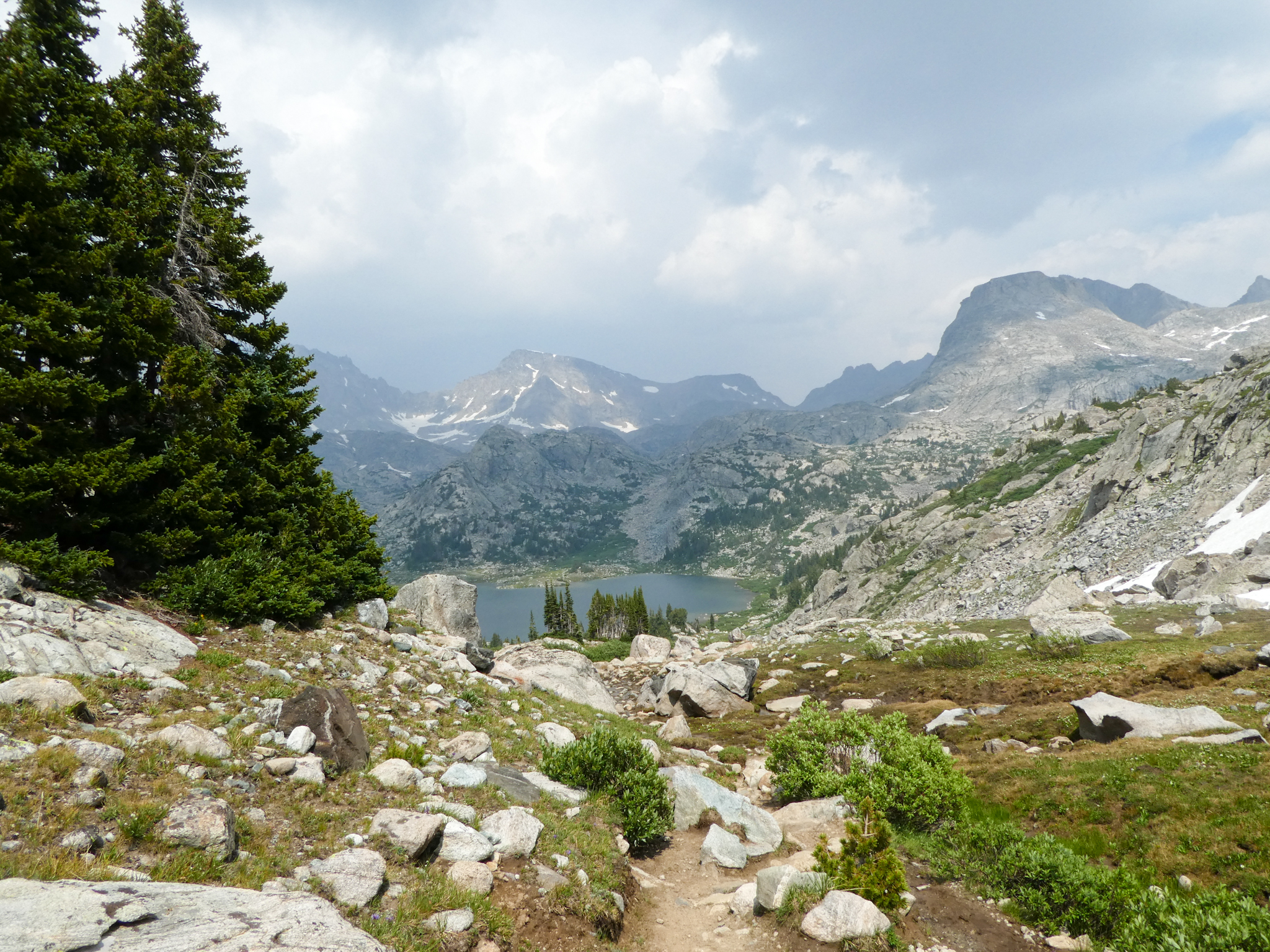
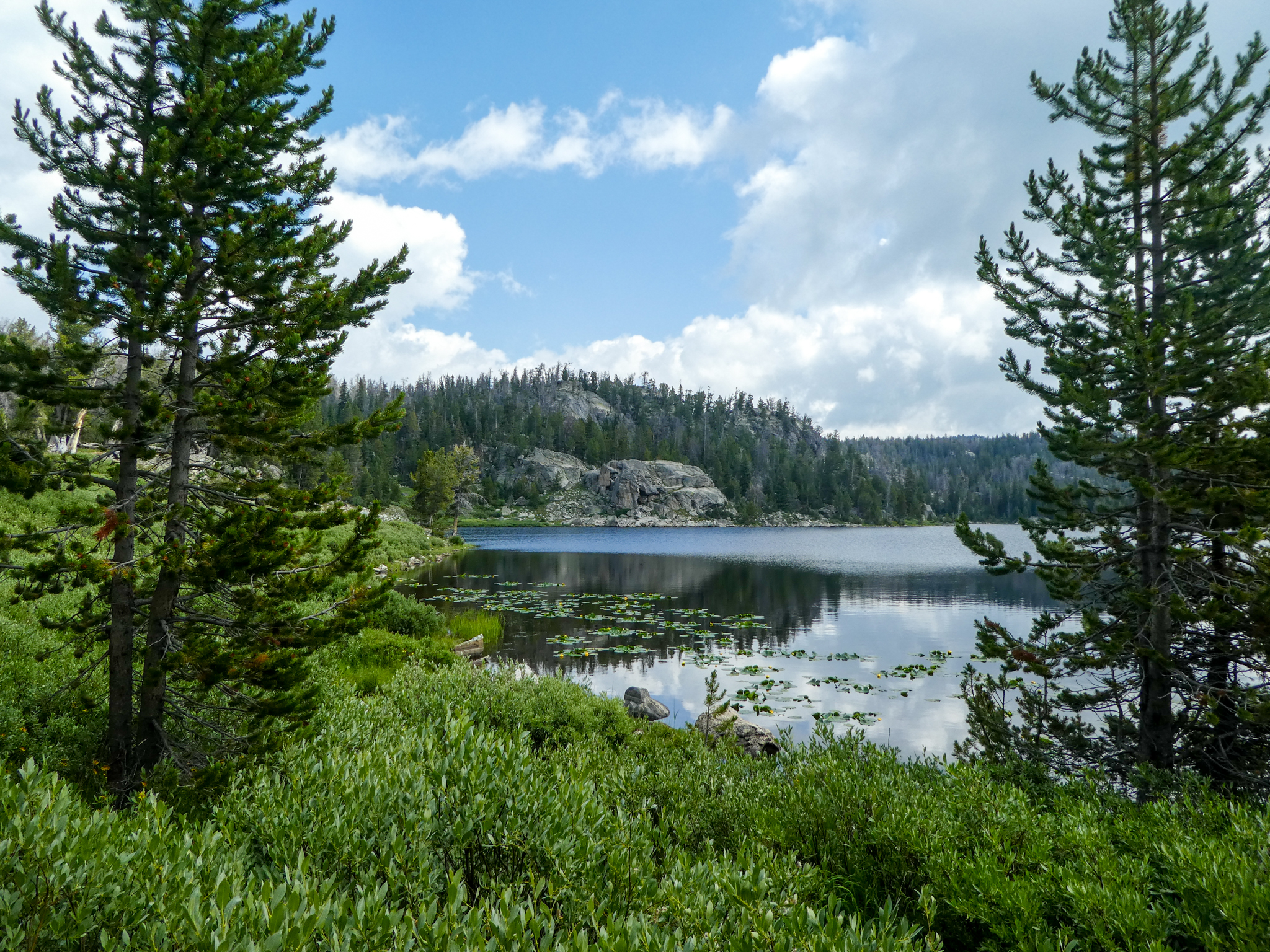
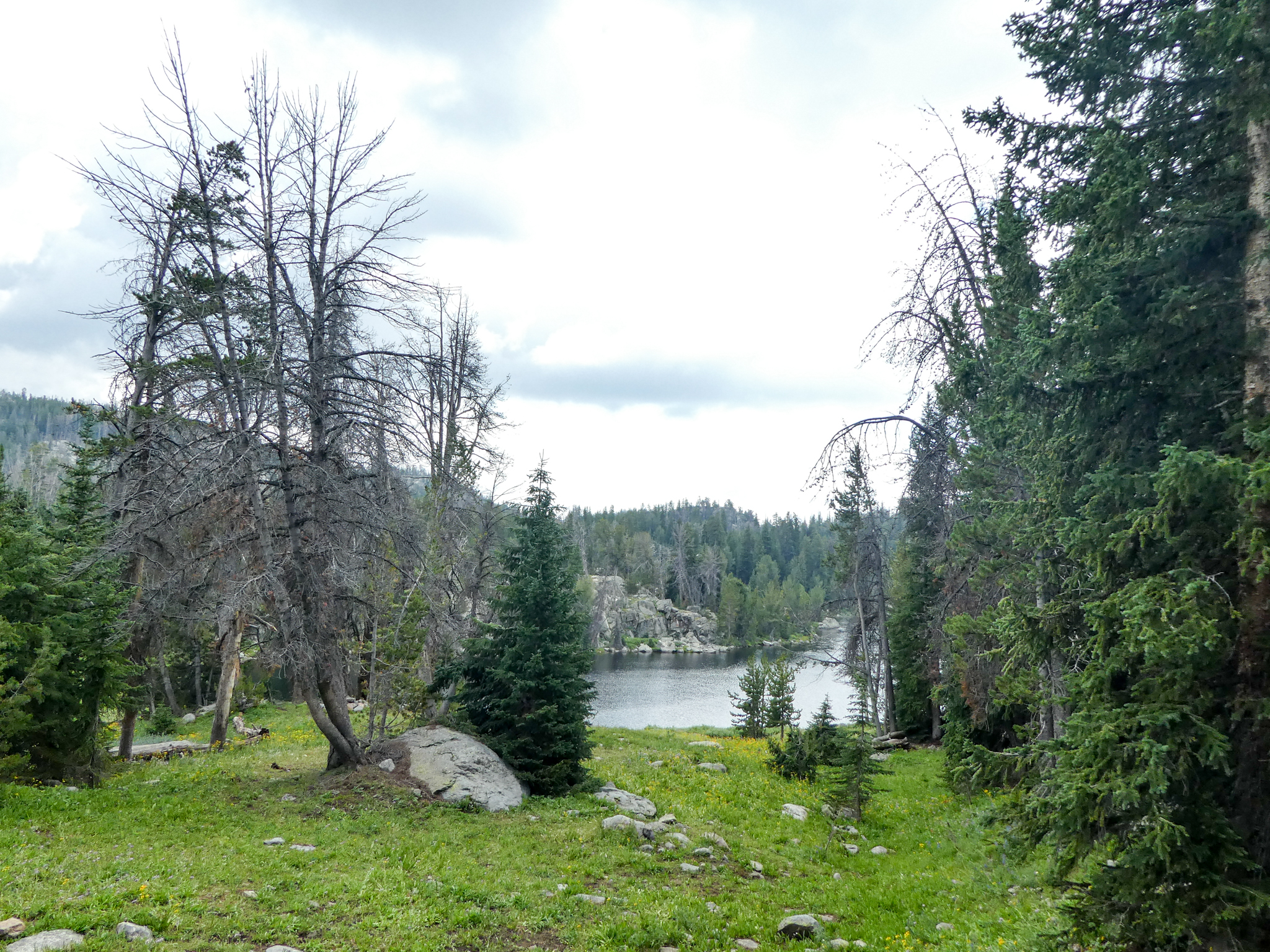
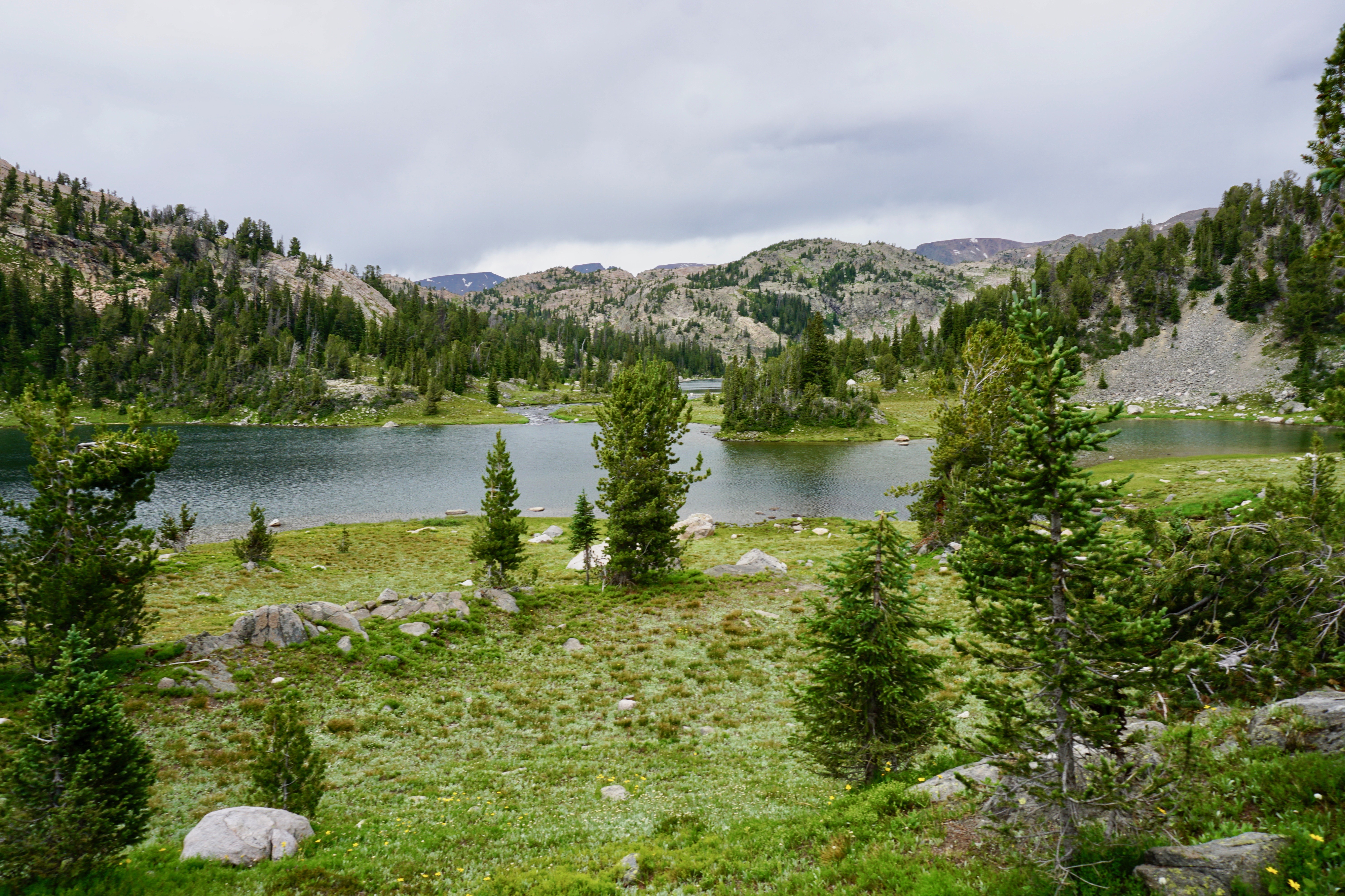
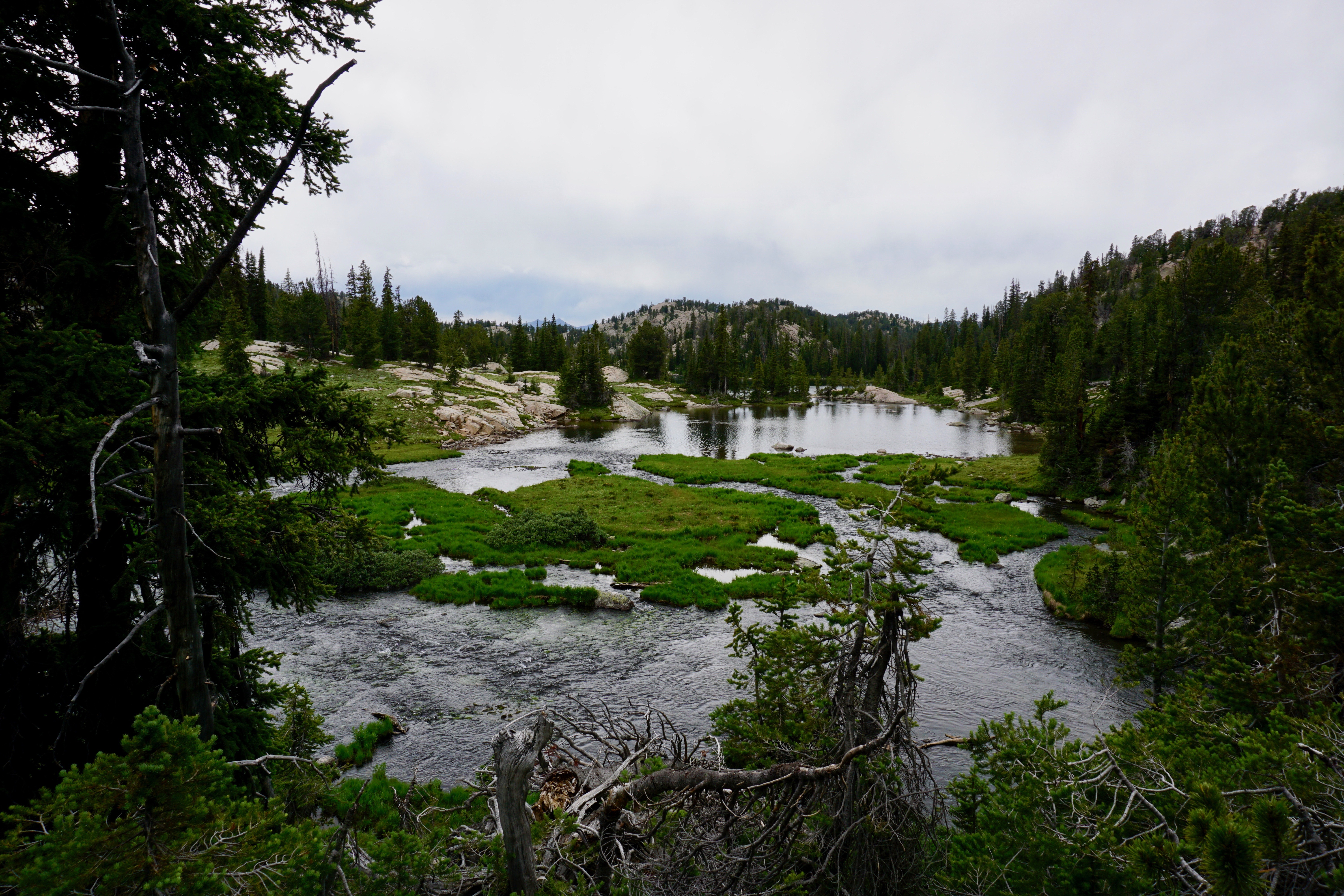
And then into the Martin Lake basin…:

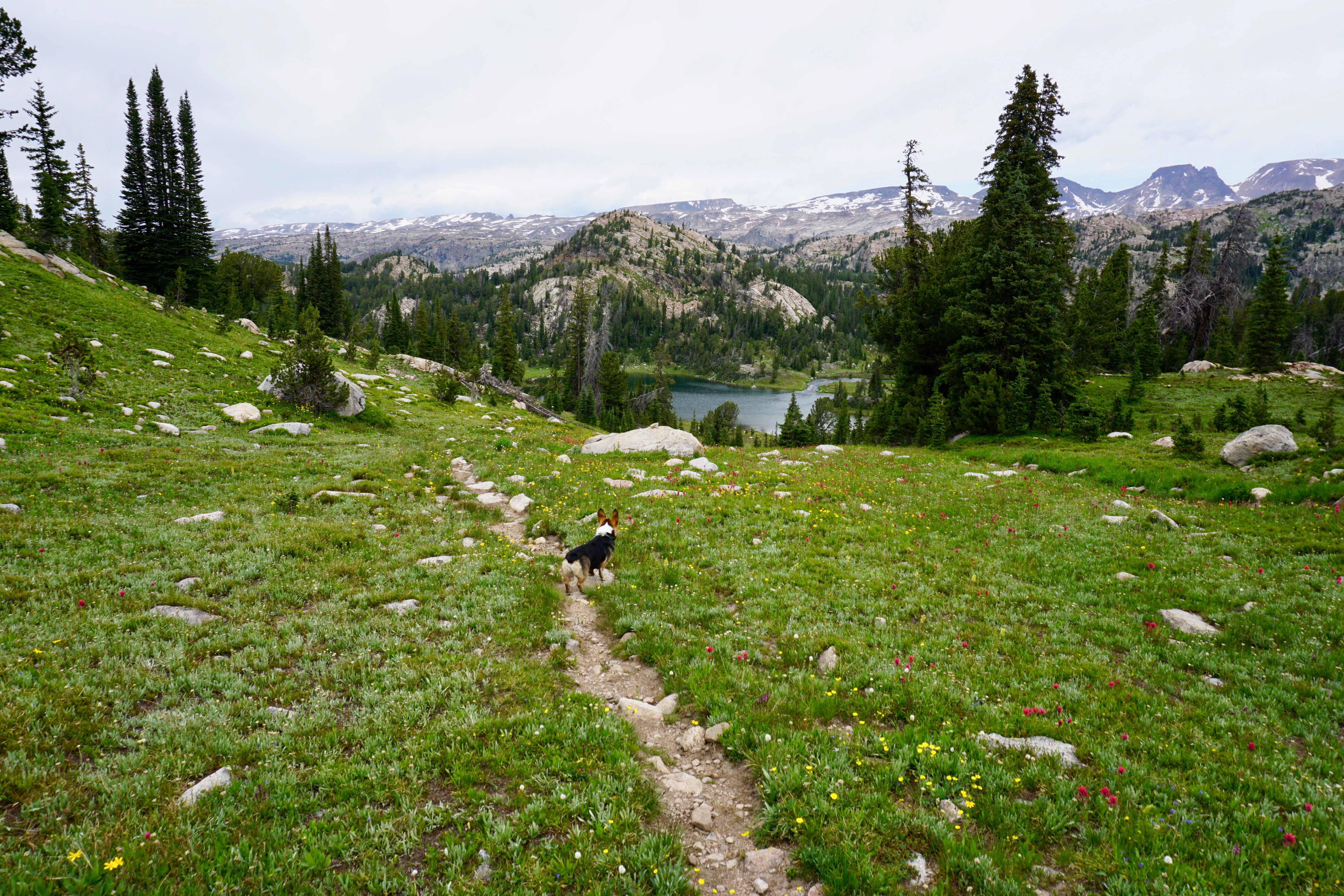
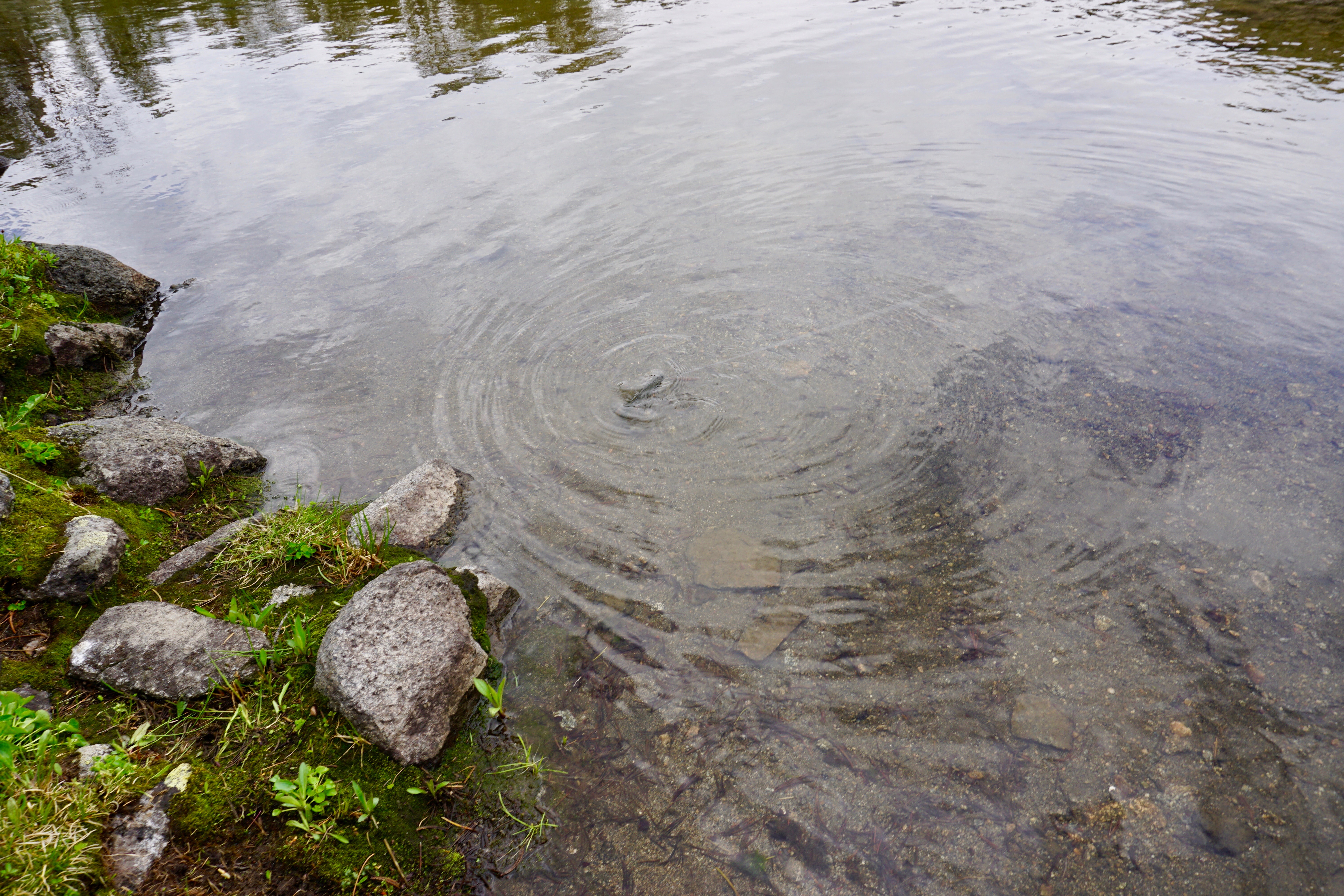
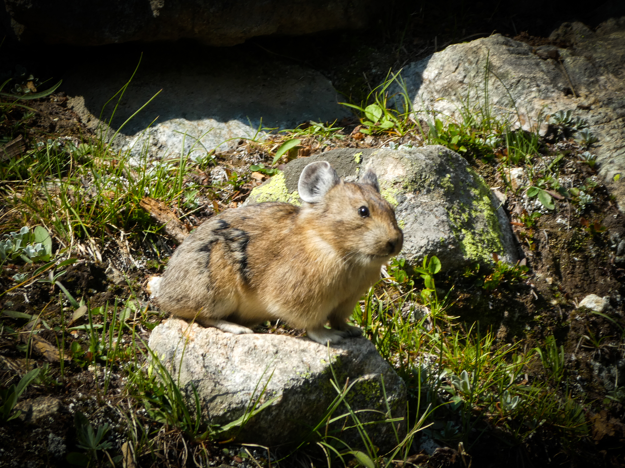
The dog didn’t really enjoy watching me fish (shrug).

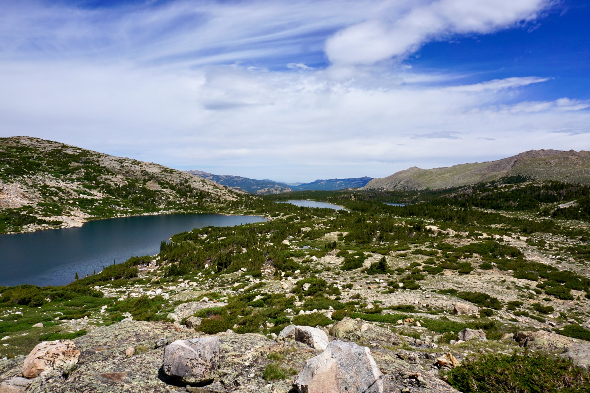
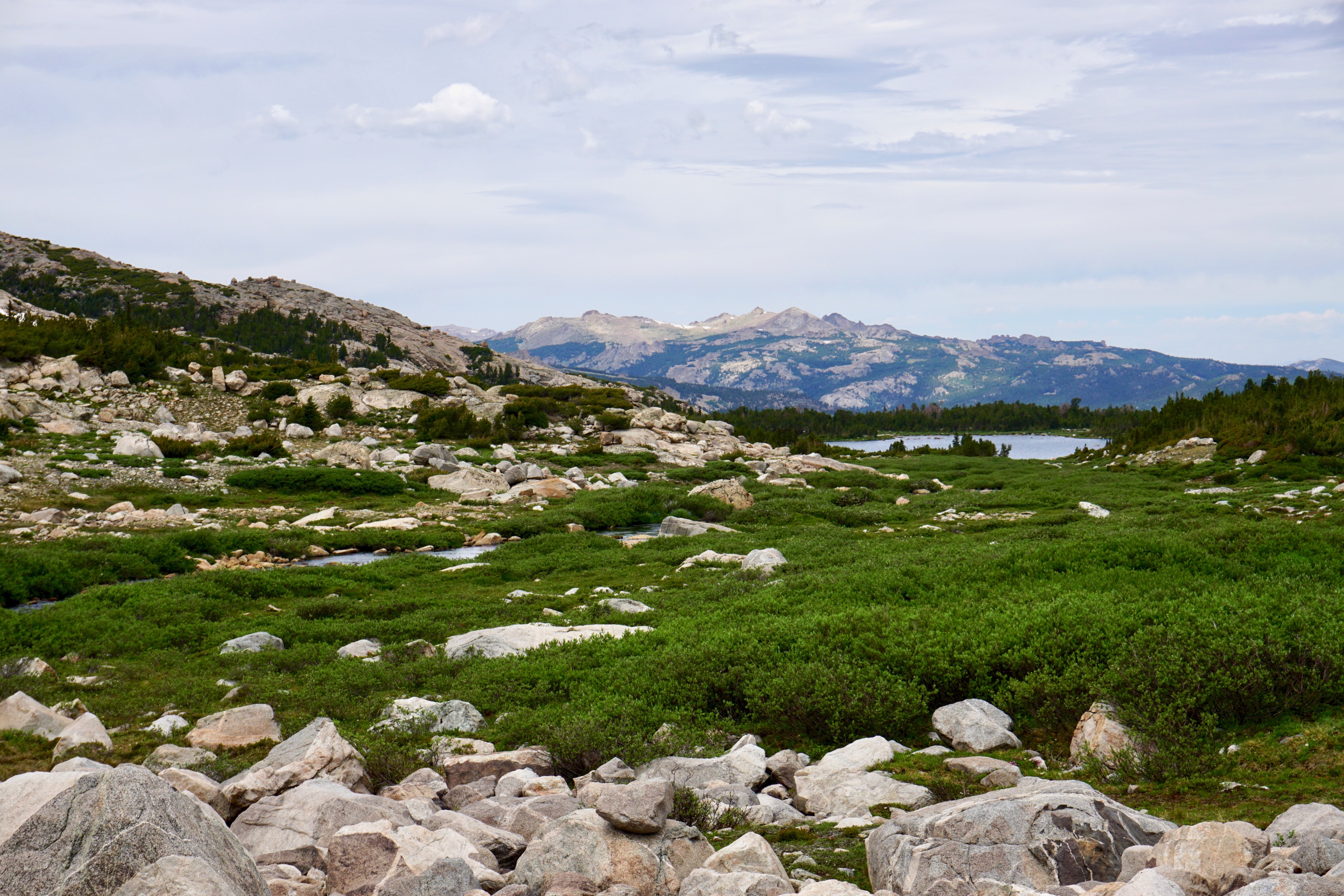
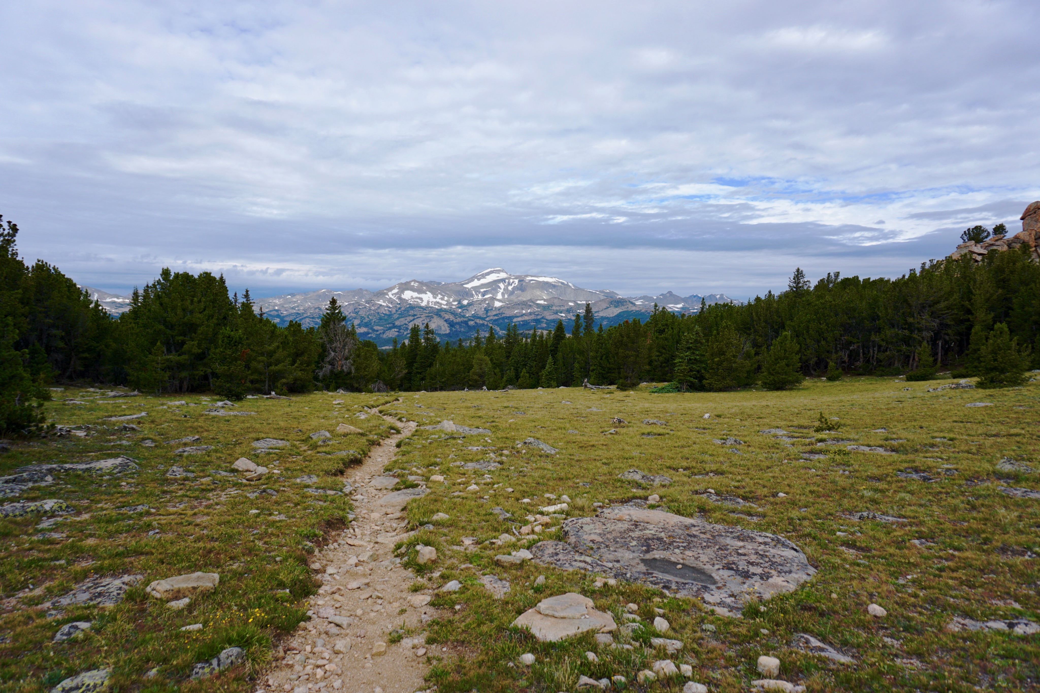
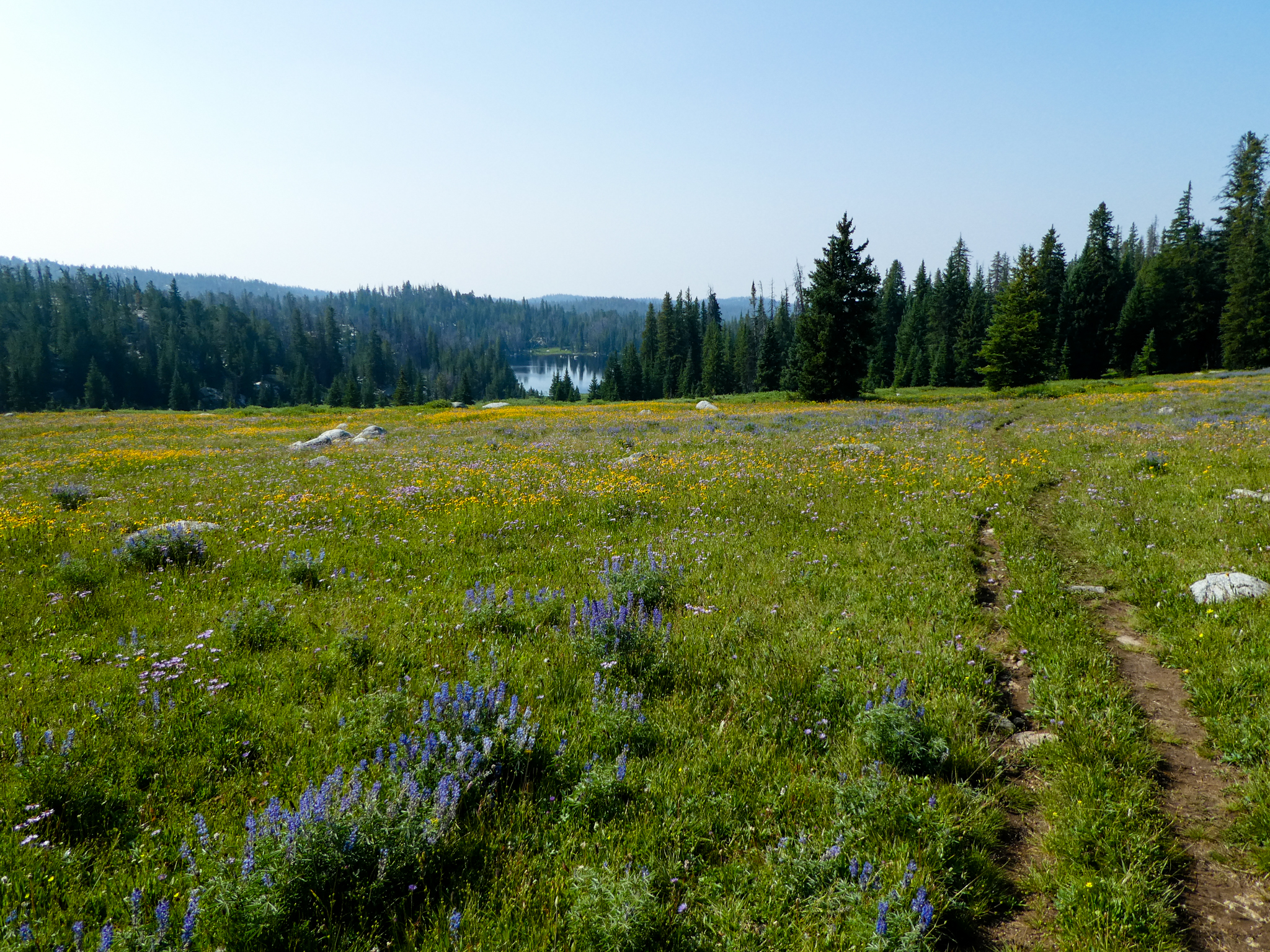
And finally we headed out.

We ended up on the wrong trail around Fossil Lake, so didn’t come back to the right trailhead, which meant a couple of bonus miles hiking on the shoulder of the highway.

And then that was just sort of it.

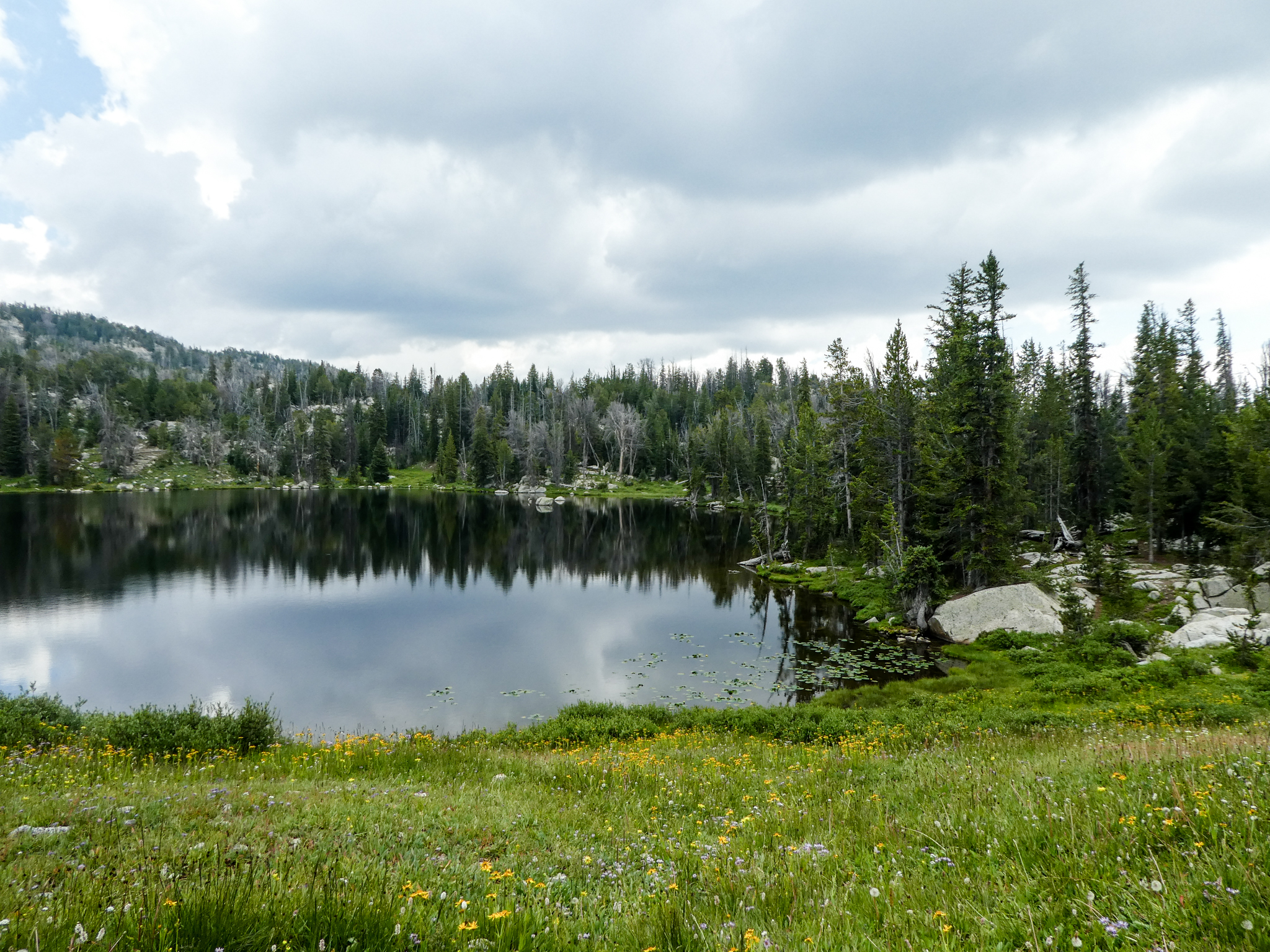
This place is really pretty.

bkd

post image

Stough Creek Basin via Twin Lakes (Wind Rivers)

Did this trip over four days/three nights (July 24-27) as the High Adventure trip for the boys in the ward (these are Utah/LDS terms — can be replaced with “took a bunch of kids from church” as needed). The group and our arrival time in the eastern Winds dictated the route to some degree (it would’ve been more direct — but steeper and a longer first day — to just hike straight in to the basin). Started from Worthen Meadow Reservoir and went counter-clockwise via Twin Lakes to the Stough Creek Basin (Stough Creek Lakes Basin?), then home via the Stough Creek Lakes Trail. Was somewhere around 20 miles total.

Summary

Scenery-to-Effort Ratio: 1.7? The route in to the basin isn’t always stellar, but the basin definitely is.

Elevation Gain: Total for the route, it was probably 800′ the first day (about 500′ up at first, then 500′ down, then another sort of steep 300′), another 1,500′ the second (pretty steady climb with a little more steepness toward the saddle just before Stough Creek Basin), then maybe another 700′ the third (all of which is in the first 2.5 miles). Let’s call it 3,000ish’ then.

Obstacles: Several creek crossings (three or four without bridges/logs), some pretty real elevations (we topped out at 10,500′ on the way to the campsite and explored to 11,000′), and a whole mess of mosquitoes.

Popularity: Pretty low for the Wind Rivers, especially taking this route through Twin Lakes. We crossed paths with two groups the first day, zero the second (! — although we saw a couple groups camping once we were already in the basin), and IIRC three the third. Pretty low. The scenery-to-popularity ratio for this route is extremely high.

Distance: 20ish round trip, depending on what we’re counting. It was about 5 the first day, probably 6 the second, then another 7 on the way out — but then add 5 or 6 for the basin exploration day hike.

Location: East end of the Wind Rivers (near Lander, Wyo.). The trailheads (Sheep Bridge, Roaring Fork) are located at the Worthen Meadow campground situated at Worthen Meadow Reservoir.

Pros

  • Incredible lakes and rugged scenery once you’re in the basin.
  • Amazing solitude and lack of crowds.
  • Hot fishing (for seven-inch brookies).
  • Pretty good wildflowers.

Cons

  • The Wind Rivers are known for their mosquitoes. This was a high mosquito year even for the Wind Rivers. There were a LOT of mosquitoes, especially at the campsites (or, really, any time you stopped moving).
  • Most of the scenery is at the basin — the first and last five miles of the trip consisted mostly of walking through trees.

Details

Day 1: Sheep Bridge Trailhead to Twin Lakes

We weren’t going to be able to get to the trailhead at Worthen Meadow till after noon, and given that our pace was going to be slow and a little stoppy, we opted for this route to the basin that didn’t require a lot of steep uphill. It’s hard to find many people who have hiked the Twin Lakes Trail specifically, but it was a-okay if also a bit of a tree prison at times. Route was easy to find.

Mosquitoes were, relative to the rest of the hike, not bad.

Ended up camping at a site that was just at the end of the Twin Lakes, very near the intersection with the Stough Creek Trail. I never took a photo of either of the Twin Lakes. They were tree-lined and unprepossessing, but probably deserved a photo. >shrug<. The campsite had a ton of good tent sites, you just had to be willing to hike uphill from the trail about 100 yards to get to them.

And then I slept badly, because that’s what I do in the backcountry.

Day 2: Twin Lakes to Stough Creek Basin

Day 2 was designed to be our “hard day” — the one with the most elevation to gain. Fortunately, there wasn’t a lot of up-and-down on the Stough Creek Trail, so we didn’t give up a lot of elevation until we got to the final saddle at about 10,500′ and then descended only another couple-hundred feet into the basin.

The day started out with a fording.

And then a mile or so later, we started getting into the actual Wind Rivers Scenery.

Of course, the further we went, the worse the mosquitoes became. Man, but there were a lot of mosquitoes on this trip.

We forded the creek one more time, then made our final, relatively steep assault to the basin’s saddle.

And then entered the basin.

Stough Creek Basin First Lake

A lot of our group were pretty done-out from the climb up to the saddle, but a few of us went ahead and scouted out campsites, eventually finding one at the far end of the basin’s second lake in. It had some good tent sites, plus good access to moving water.

Stough Creek Basin Second Lake

Day 3: Exploring the Basin

This basin is pretty amazing. At first it seems like there are just a few lakes in there, but the deeper you go into the basin, the more lakes you discover. Every time you head up a ridge, you see a couple new lakes connected by creeks to the lake you just saw. Heading to the back of the basin was outstanding and, visually speaking, the highlight of the trip.

Stough Lakes Basin

Day 4: Stough Creek Basin to Worthen Meadow via the Stough Creek Lakes Trail

Heading out, we completed the loop. The scenery on the way out was more interesting than on the way in.

And then back to the cars, then to Lander for an epic session with Domino’s Pizza. Plus all the kids survived, which was a bonus.

bkd

post image

Ski Spring Break: Big Sky, Jackson, and Grand Targhee

They were all better than Sun Valley.

The Mountain Collective pass I bought for this ski season included both Big Sky and Jackson Hole Mountain Resort (JHMR). And then there was spring break in March, so: northward, ho!

I’d never been to Big Sky before, although I’d driven down that highway from Bozeman to West Yellowstone. Speaking of: the drive up was mostly nice — it’s about five hours plus road-related slow-downs from my house up there. Roads were clear up until somewhere north of Island Park, then stayed a little dodgy till West Yellowstone.

Then they got better.

I’m going to start a pod cast where I do day-to-day evaluations of random roads. No, not really.

I rented a condo in Big Sky that was very expensive, but not very nice. It was a one bedroom condo where someone had separated the one bedroom into two rooms, one of which had a queen-sized bed that didn’t fit in the room and the other of which included bunk beds that didn’t fit in the room. Otherwise fine.

Condo was walking distance-ish from the resort, but there was also a shuttle bus that stopped by every hour. I should’ve taken a photo of the shuttle bus. It was crowded on-board though.

Also, the condo complex’s buildings were all named after European ski resorts and it bothered me that one of the buildings was called Grin del Wald. OTOH, “Smile of the Forest” seems like it’d be a happy place if only it were socially acceptable to mix three languages into one misnamed building.

My condo was in St. Moritz, which is less interesting.

Here’s what skiing at Big Sky looked like.

They hadn’t had any new snow in a while, but it was cold enough and sunny enough that it skied pretty well anyway. A lot of steeps, but plenty of all kinds of terrain, well-served by a large number of lifts. Had a couple of lifts with heated seats and bubbles, one of which was an eight-seater on which, once you put the bar down, you couldn’t get it back up again (until you were at the top station).

The place didn’t remind me of anywhere else, although it’s probably more European than most US resorts in terms of above tree-line and scope.

Since the resort was uphill of the condo, skiing back to the condo worked out well. Here’s a great photo of the ski path back to the condo.

From Big Sky it was, like, four hours or so to Jackson. Drive was nice. All the driving on this trip was pretty scenic.

I think I’d never driven through this area when the grandest Tetons were visible (due to clouds).

And then it turns out this is the only photo I took of Jackson/JHMR:

It is a very nice library (where I killed time after checking out of the one hotel and before I checked into the next one).

Jackson Hole Mountain Resort, on the other hand, is not my favorite. Though, to be fair, I’ve only been there twice and neither were particularly good snow days. On this trip, they hadn’t had snow for a week. Also, the majority of the terrain there is pretty steep, which, given the lack of snow, means:

  • 9 AM – 10:30 AM – Beginners on beginner slopes, intermediates on intermediates, advanced skiers on advanced.
  • 10:30 till Close – Beginners are bored with easy skiing and have moved up to intermediate, intermediates are still on intermediates, and advanced skiers are tired of side-sliding down the icy steeps and are likewise on the intermediates.

And there just aren’t that many intermediate runs there. And the ones that are there are pretty boring — just wide lanes on either side of the chairlift-style boring.

FWIW, I think Big Sky sets up a lot nicer than JHMR. Or, at least, it feels like there are a lot more options and places to explore, even on less-challenging terrain. I dunno. JHMR feels like there are a lot of lifts but not many places to ski, like the base is expansive, but the actual slopes are all too confining. Plus it’s expensive, there are a lot of people there, parking is inconvenient, and the food is not great.

But I like Grand Targhee.

Even though that’s the only picture I took of it. Still, for spring break next year I think I’m just going to go up and spend a couple days at Targhee. It seems like it has the exact virtues that JHMR lacks: a lot of terrain per lift, not all that crowded, not expensive per se, and pretty easy parking. TBF, though, the food is also meh. I think that’s just a Wyoming thing probably.

And then I went home.

bkd

PS, Thanks to Jon and Erin for putting me up at their house. Again.

post image

Skiing Sun Valley

And… it’s 2019.

I had a Mountain Collective pass this year, which included two free days (I mean, free once you buy the pass) at each of Snowbasin, Snowbird, Alta, Jackson Hole, Big Sky, Squaw Valley, Mammoth, Taos maybe?, somewhere in Alberta, probably a couple other places, and Sun Valley.

I’d never been to Sun Valley before. It’s not that far away. I decided to make the trip.

It turns out that Sun Valley is the place to go if you want an east coast skiing experience without having to leave the intermountain west. The snow was fake and hard and good edges were all-important.

They don’t get enough snow there. IMHO. Here’s the artwork that was hanging up in my motel:

In which the place’s lack of snow has been memorialized as if it’s a good thing. The photo shows (a) which runs have snow-making and (b) what runs without snow-making look like. Neat.

Anyway, here are a couple photos, then I’ll complain more.

  • Unlike skiing back east, there’s some actual steep terrain here.
  • Which, given east coast-quality snow, isn’t much of a virtue.
  • They have a lot of chair lifts once you get out of the base area.
  • There were a surprising number of tourists there. Just that: it costs less to fly to Salt Lake or Denver or probably costs the same to get to Big Sky or Whitefish or a lot of places that are way better than this.
  • No one should spend a lot of money to ski at this place. There are way better options that cost less.

The worst part about Sun Valley was the regulars. If you ever want to see what 70-year-old trust-fund kids look like, this is your place. So much plastic surgery there and toupees there. Weird, weird scene. The random lift strangers, the locals at least, have a trust-fund attitude to match. They’re intensely crusty. Cranky, unhappy to meet you, and mad that you’re on their chair lift.

Sun Valley was like Pennsylvania’s snow with Aspen’s regulars (and, to be fair, Montana’s steeps). That’s not really an ideal resort.

Good luck with that ice chunk of a mountain.

bkd

post image

Summiting Mt. Naomi

It’s also called Naomi Peak. It’s the highest peak in the entire Bear River Range (!). You know, if you sub-divide your mountain ranges thoroughly enough, every peak can be the highest peak in something.

So I had this one student last spring whom I saw at the dog park last summer and we talked about, hey, we should take our dogs hiking some time. And then he followed up, and then we ended up taking our dogs hiking up to Mt. Naomi Peak. I don’t know if Peak should be capitalized. Or included.

The hike was fun, a little steep, not much shade, and that’s most of the details. Was good to also have non-canid company on a hike for once.

A lot of the scenery looked like this:

Dog of Danger at the peak:

Pano from peak:

I think we might try to hit Jardine Juniper this summer before he moves back to Arizona. Hopefully the dogs get along okay in the car if so.

bkd

post image

Oregon Tourist Hike II: Green Lakes Hike

Next up on the Bend-area tourist hike agenda was the Green Lakes hike that, somewhat predictably, leads to Green Lakes. This would be the longest hike my dog had ever attempted. Would she make it?

Whatever, here’s a little commentary and some photos from the hike.

Started at the Green Lakes Trailhead (!). The hike follows Creek of Angry Badger Fall Creek and offers good views of Broken Top and South Sister before eventually arriving at a massive backcountry campground (22 sites!) around the Lakes of Froggish Talus Green Lakes.

Right.

Trailhead warning:

FWIW, she was on-leash the one time we passed by a ranger.

That one was of Fall Creek. I think this next one is South Sister.

This is what the trail looked like after we crossed a bridge and the creek was on the left side instead of the right.

I think this is Broken Top. We’ll see if the ol’ blog ever gets enough traffic that someone bothers to correct me.

I think we were basically at the Lakes of Green at this point:

Definitely by this point:

Anyway. We did it as an out-and-back hike. A lot of the trail is exposed, and my dog has a pretty warm coat. About a hundred yards from the trailhead and in view of the parking lot, she found a shady spot, laid down, and refused to go any further. So I got to carry her the last hundred yards.

She was tired when we got back to the AirB&B.

It’s a really pretty hike. As with everything in Bend, it gets crowded though. As with every hike that gets crowded, it was good to have gotten onto the trail by 8 AM so that at least the out-leg offered a little wilderness solitude.

Also, this would be a great place for an easy overnighter/basecamp situation. Some day maybe.

bkd

post image

The Stockhorn Is a Peak in Switzerland with Clouds and Closed Trails

This is back in May.

Went on a two-week trip to Switzerland (to see Thomas and Christine) and Germany (forthcoming). The flight to get there was kind of ricidulous, but I should probably let that sink down the memory hole and instead remember the trip up to the Stockhorn.

So this is what I did the first day I was in Switzerland. This wasn’t too far from Bern, where Thomas and Christine live (for now). We took the train out to… some town. Erlenbach apparently. Then headed up to the tram with the idea that we’d head up to the top of the mountain, then hike down probably to the middle station, then tram it back down. But then it turned out that the guy at the station said that all the upper trails were closed for some reason, even though it was difficult, once we were up there, to see what this immediate danger was (avalanches supposedly). Whatever. I didn’t take photos to capture “the experience” per se. My bad. Was living in the moment.

It was pretty and the clouds broke for a bit, which was — different for Switzerland. I dunno. I’ve been there twice in five years and still am not sure where the mountains actually are what with all the clouds.

There are actually two trams, though. One goes to the middle station, then the other goes from the middle station to the peak. Both were crammed full of people in a way that seems like wouldn’t happen in Europe, but apparently totally does, at least at the higher altitudes. The second tram was particularly high off the ground.

During the journey, Thomas and I had compared our experiences of having a kid and dog respectively. In particular, we’d noted that, when you have your kid/dog around, random people constantly come up to you wanting to share their experiences with their own kid/dog. As I always say, having a dog is exactly the same as having a kid and I reject all comments to the contrary. Anyway — we took the top tram back down to the mid-station after enjoying the partially cloudy (but pretty awesome anyway) views and took a hike around that area. We stopped for lunch somewhere, at which point a Swiss woman, whom I’d noted as having a foreign guest with her, came up to Thomas and said, Oh, I have an American with me too!. The two of them seemed to connect on a deep level.

So: Americans are apparently the kid-dogs of Switzerland. I guess we could do worse.

bkd


post image

Backpacking Back from Island Lake (Day 3)

This post is mostly to provide closure and post more pictures that were taken on the third day of this trip. I got my best pics of Island Lake on Day 3. I mean, fwiw.

And then it was time to bid sad farewell to this magical place where I mostly just felt sick and out-of-breath. One last pano on the way out:

I decided I’d go back to Eklund Lake and see if I wanted to spend the night there or just head on out of the wilderness. Spoiler: I chose the latter. Before that decision was finally made, though, the way back looked much like it had the day before except from the other direction.

Right, then Eklund Lake, decided to finish the whole thing out. This return trip was (IIRC) a little over 11 miles coming back. Net downhill, but with a lot of up and down still, and 11 miles is a long ways for me with a backpack on. Anyway.

On the route back, went via Photographer’s Point, which…

Shrug?

But anyway. And then I drove home.

Some generals:

  • Man, but this area is crowded. They have a short season with the trails snow-covered well into July and then snows starting up again usually mid-September, which probably helps explain it (plus amazing scenery), but still: the Uintas on a weekend were less crowded.
  • It’s not even close to anywhere (well, maybe an hour-and-a-half from Jackson, but that’s not a huge population center is it?).
  • And it’s not really a super-easy hike. Still: crowded!!
  • And most people camp in “illegal” sites that are too close to the lakes, yet the NFS doesn’t do much to prevent it from happening aside from sending some rando rangers out to tell people “don’t camp next to the lake” while they’re hiking along the trail.
  • Yeah, sure, I’ll avoid all the developed campsites next to the lake so that I can… what? Anyway.
  • Was my first trip with all my ultra-light gear. Was geared up for 5 days, 4 nights and kept it down to (IIRC) 23 lbs. total.
  • This is purported to be a great trout fishing area, but no one I talked to who was using flies caught anything on the lakes I visited. I sure didn’t catch anything there. Apparently lures are the way to go, except that I don’t especially get excited about fishing with lures. Flies? Sure, raw passion.

I am done writing about this trip now.

bkd

post image

Backpacking to Island Lake: Day 2

And then I woke up. Because it was the next day.

Here’s probably my favorite photo of Upper Sweeney Lake. I took it on the way out on Day 2. Better lakes would come, but, hey, meadow, etc.

From there, you’re hiking out of the lake basin. This second day was just a series of hiking out of a basin, then hiking back in to the next one. The net altitude gain from the trailhead to Island Lake is minimal (ca. 1,000′), but the actual vertical feet hiked over that span is maximal (don’t recall except for being ready to just concede and die of exposure by the side of the trail on several occasions on Day 2).

On that happy note, just as you’re exiting the Upper Sweeney basin, you get your next view of the Winds:

Always taunting.

And then, not much further, another meadow with a tarn in it and some people that I didn’t meet ever.

Next lake on the agenda is Eklund, but hopefully I got a better photo of it on the way back, because my in-route photos aren’t very compelling. And then after climbing out of that basin, you climb quickly back into the next one with some lake that’s small and the name of which I’ve forgotten and can’t find anywhere.

This is sort of a high point of the hike. Scenic lake, mountains in the background, enough up-and-down to feel like you’ve done something, not so much that you’re writing the letter in your head informing the forest service that they should probably just go ahead and start using dynamite to form some tunnels. Anyway:

Seems like it might have had a woman’s name. The lake, I mean.

Then it’s on to Hobbs Lake, which is a little more strenuous a trail — but not entirely without upsides.

And then ol’ Hobbs itself:

There weren’t many obvious campsites on Hobbs, but from a distance perspective, this would probably be my lake of recommendation for first-night camping. It’s the last good location before the big slog up to Seneca Lake.

This photo, not much past Hobbs, makes the slog look better than it was:

As does this pretty little unnamed (?) tarn:

But then that last mile hiking up to Seneca was pretty awful. Steep and kind of ugly.

The mud wasn’t actually a big factor, but I didn’t take pictures of the true awfulness. Steep tree prison with nothing to look at. Slog.

But then you get to the top of the slog and get to take in Seneca Lake. You’re pretty much above the timberline and Island Lake is at about the same elevation. You actually have quite a ways to go to get to Island Lake, of course, none of which is anywhere near flat, but whatever: here you are.

Just the walk around the lake has a ton of elevation change (Dear Forest Service: Go ahead and start blasting out some tunnels in the Wind Rivers. Thank you, bkd). There are campsites here, but none of them looked very cozy or inviting. It’s the biggest lake on the hike though. I think.

Then you leave it.

You pass by Little Seneca Lake next, which is just like Seneca Lake only smaller. Then you start getting into the talus slopes.

After the talus, you still have a little ways to go. Here’s yet another tarn.

And then the final descent into Island Lake basin:

Finally, to where I camped, this is close-ish:

Not pictured are the literally dozens of tents scattered across this slope heading down into the lake. So crowded. I was also pretty dehydrated by the time I got here because I am stupid. I set up camp, took a nap (!), ate dinner, read that Chichester book about flying airplanes to New Zealand for not good reason, then, because it was night-time, slept.

bkd

post image

Backpacking to Island Lake: Three Days in the Wind Rivers (Day 1)

It was supposed to be five days, but then I got bored, lonely, and dehydrated. Plus the fish weren’t biting on flies and it was super-crowded. Nice place, though!

At one point, I had the perfect recommendations in mind for how everyone should do this hike. Now? We’ll see.

Here’s the prime payoff pano of Island Lake. I worked two whole days for this.

I did this hike back in August. Was supposed to be heading into Titcomb Basin, spending a couple nights at Island Lake. Again, didn’t end up in Titcomb Basin, turned around at Island Lake. OTOH, someone wrote once that Island Lake was the most scenic part of all that anyway, inclusive of Titcomb Basin. Just, you know.

First night I hiked to Upper Sweeney Lake, which was about a five-mile walk from the Elkhart Park trailhead.

The first couple miles of the hike are talked about in un-glowing terms (e.g., “tedious”). I can see what they were getting at, it’s sort of a tree-prison, but it’s a gently-sloped tree prison where the trees aren’t entirely right on top of you and that opens up into meadows often enough. In other words, it’s a tree prison you can live with (with which you can live, sorry).

Eventually the trail breaks into a large meadow (possibly “Elkhart Park”), from which you can see the jagged Wind Rivers in the distance. This is the point where the trail branches (it’ll reconvene later): photographer’s point to the north, or the Sweeney lakes to the east. I went east.

The trail then drops into a basin, where I encountered my first lake of the trip: Miller Lake. This hike is eventually all about lakes, and this is arguably the least photogenic. I mean:

Right?

I skirted Miller Lake and kept going till I hit Middle Sweeney Lake.

So: most of the good lakes were on the second day. Just above Middle Sweeney, then, I hit Upper Sweeney, which was my objective for the day. The problem with this trip, to some extent, is that most of the good camping locations between the trailhead and Island Lake are either only 4-6 miles away, or are Seneca Lake, which doesn’t actually have great sites and is 10 eventually pretty steep (a lot of up-and-down) miles from the parking lot.

Campsite, Upper Sweeney Lake

And then I made a campfire (!). I rarely make campfires, but there was a (not-literal) ton of wood around. It had been sprinkling (rain) off and on, so the wood was a little wet, which added to the challenge as well as the sweetness of the victory.

About two hours later I went to sleep.

bkd